Category: Canada

  • A FOREST OF SIGNS

    Signpost Forest is a (free) roadside attraction in the town of Watson Lake BC.  In 1942, when the Alaska Highway was being built, the US Army Engineers put up a directional post at their camp at this location.  The signs pointed to camp facilities and the nearest communities.    A homesick private named Carl Lindley added a sign pointing to his home town of Danville Illinois.  That started a tradition that is now known as the World Famous Signpost Forest.


    P1020661


     According to Watson Lake's website there are now over 72,000 signs.  Anyone can add one — and  obviously many tourists do.


     P1020659


     The tradition is to bring your own home-town sign,  but a few other kinds of signs seem to have snuck in there as well.


    P1020658


    We stayed in Watson Lake on our way back to the lower 48.  And (only partly) because we'd never heard of this tradition we didn't add a sign — we just took the ones that were already there (pictures only).  

    So if  you visit Watson Lake, don't forget your sign.  


    Linking to SIGNS SIGNS (obviously) and GOOD FENCES (stretching a bit, but the meme is about gates too and the top pictures does show the gateway into the Forest.)


    Thank you to Lesley for Signs and Theresa (TexWis Girl) at the RunAroundRanch for Good Fences.  Visit and link up!!


  • WE DID IT … BACKWARDS

    The Alaska Highway (formerly known as the AlCan) was built during WWII to connect the United States to its (then) territory of Alaska through Canada.   It opened to the public in 1948, when much of the route was still rough and unpaved.  Quite a few  tourists who braved it bought the bumper sticker that  said "We survived the Alcan." 

    P1020749-001


     Now paved over its entire length, it's fairly smooth driving.    Not the worst road we've ever driven by far.  Not even the worst one in Alaska.  But we honored the history of those who went before by taking the obligatory picture of  the start of the highway — at Dawson Creek BC.    (Only, for us, Dawson Creek was the end rather than the beginning of the road.)


    P1020320-001


    Like just about everywhere in Alaska, the drive-by scenery along the Highway was stupendous.   


    P1020297-001


    But also like everywhere else in the State, there are only two seasons:  Winter and Road Construction.  One time, we followed this pilot car for over 15 miles.   Road crews keep very busy repairing frost heaves and other weather damage.


    P1020321-001


    Of course, the scenery was even better when we could get out of the car to explore and we felt fortunate to be able to do that.


     From the Alaska Milepost guidebook:

    "The Alaska Highway begins (or ends) at Mile 0 in Dawson Creek, BC. The first 613 miles/987 km of the Alaska Highway are in British Columbia, where it is designated BC Highway 97 North.  

    The highway travels in a northwesterly direction to the Yukon  border near Watson Lake, YT (Historical Mile 635). From there it continues as Yukon Highway 1, crossing 577 miles/929 km of Yukon to Port Alcan on the Alaska border.

    The Alaska Highway crosses into Alaska at Historical Mile 1221.8, where it becomes Alaska Route 2. From this international border, it is 200 miles/322 km to Delta Junction, AK (Historical Mile 1422), the official end of the Alaska Highway. " 


    We drove all of it.  Not in one fell swoop  –   parts of it at a time with side jaunts here and there.     We stayed overnight in Delta Junction (the end/beginning of the Highway) on August 2 and we got the other end at Dawson Creek on the 5th of September.  Even covering all those miles, that gave us  some time to explore.

      P1020313-001


    So we  survived the Alcan Highway — even though we did it backwards.  (There might be a metaphor for our life in there somewhere!)


    LINKING with the wonderful sharing opportunity provided by the host team of OUR WORLD on TUESDAY.  Thank you Lady Fi, Sylvia, Sandy, Gattina, Arija, and Jenn.

  • Learning GOLD RUSH HISTORY from the train

    This is Part 2 of our White Pass-Yukon Route train ride.  Here is Part One if you misssed it.


    P1020458This is the White Pass Summit, about 20 miles into our railroad trip.  At 2,865 feet above sea level it is the official border between the United States and Canada.   (I showed this photo in Part One, but didn't talk about the history of this spot:)

    During the Klondike Gold Rush (1897 – 1899), there was a contingent of Royal Canadian Mounted Police stationed here to ensure every man, woman and child had a year’s worth of supplies before they continued on their arduous journeys.  Quite a few US citizens weren't able to get that much together before starting their hope-to-get-rich trek, so they took an even more arduous route from Valdez in order to by-pass Canada completely (many of them died trying and few got rich even if they made it).

      P1020480-001

    About 20 miles past our stop at Canadian customs, we reached the town of Bennett BC, our lunch stop for this journey.   As we neared it, we could see beautiful Bennett Lake from our train window.  


      Skagway rail trip6

     The town  of Bennett was built  during the Gold Rush — it is  located at the end of the White Pass and the Chilkoot  Trail.  Gold prospectors would pack their supplies over this mountain trail from the port cities of Skagway and Dyea.  

    For a while after the White Pass and Yukon Route Railroad was completed, wealthy tourists also took the train to Bennett and beyond.  But the gold rush ended and interest in the town faded.  By the early 1900s, the town was deserted.  It is still an abandoned town today except during the summer season when the rail line has renovated Bennett Station House in order to provide a  hot meal to modern rail-riding travelers.  


    Skagway rail trip7
     

    After our delicious lunch (and a chance to visit with people from other cars on the train),  we had a couple of hours on our own to walk on part of the Chilkoot Trail  (a very small part) and explore some of the abandoned buildings in Bennett.   

      Carcross

    The train than continued to the town of Carcross, Yukon Territory.  Once a hunting and fishing camp for the First Nation Tlingit and Tagish peoples,  the town became a key stopover and supply center during the Gold Rush.  From there they would build or buy rafts to take them down the Yukon River to the gold fields near Dawson City.    (The name of the town is a shortened version of Caribou Crossing — it is near a major migration route for these animals.)

    Tourism is the major part of the Carcross economy today.  Some of the passengers on the train spent the night there to return by rail the next day.   Others were from one of the cruiseships in port in Skagway and their Cruise Lines had a bus waiting for them.

       P1020522


    We had, of course, made our reservations directly with the railroad and they had arranged a van for our return trip.   The sixty-seven-plus mile journey went a lot faster by van than it had by railroad.     The scenery seemed to go by in a blur and we didn't learn as much.  But we were glad to be "home" (back to our camper van) for the night.  


    SHARING WITH:  OUR WORLD ON TUESDAY.  Thank you to Lady Fi and the rest of the OW team:  Arija, Gattina, Sylvia, Sandy and Jen.


  • BRITISH COLUMBIA SURPRISES

    Checking in quickly from our RV Park home for the night — in Chetwynd British Columbia.      (We are slowly wending our way back to the USA …   this is the first time in days that we've had  WiFi access.)  

      P1020688

    Who knew there were American Bison in British Columbia?  We do now — after seeing three large herds of them earlier this week, plus a few stragglers here and there along the way.

    We saw all of these amazing animals a couple of days ago —   traveling the 200 miles between Watson Lake and the Toad River RV Park somewhere along the Alaska Highway (the part of it in Canada).   


    P1020677

    Of course there was a sudden downpour just as we saw this Mom and her baby — they were loving that clover and didn't let the rain dampen their enjoyment.  (But it sure played havoc with my camera.)

    Our Alaska summer ended with stays at Haines and Skagway  – both of which we enjoyed for very different reasons and both of which I will eventually blog about — along with  a few (hundred) other wonderful Alaska places that I haven't yet posted.    


    P1020717
    A family of Stone Sheep.   There was a whole herd enjoying the minerals in the soil in this particular spot.


    Although Alaska is behind us,  our camping adventure continues as we head south.  So many places, so much to see!  BC is beautiful.


    P1020743-001

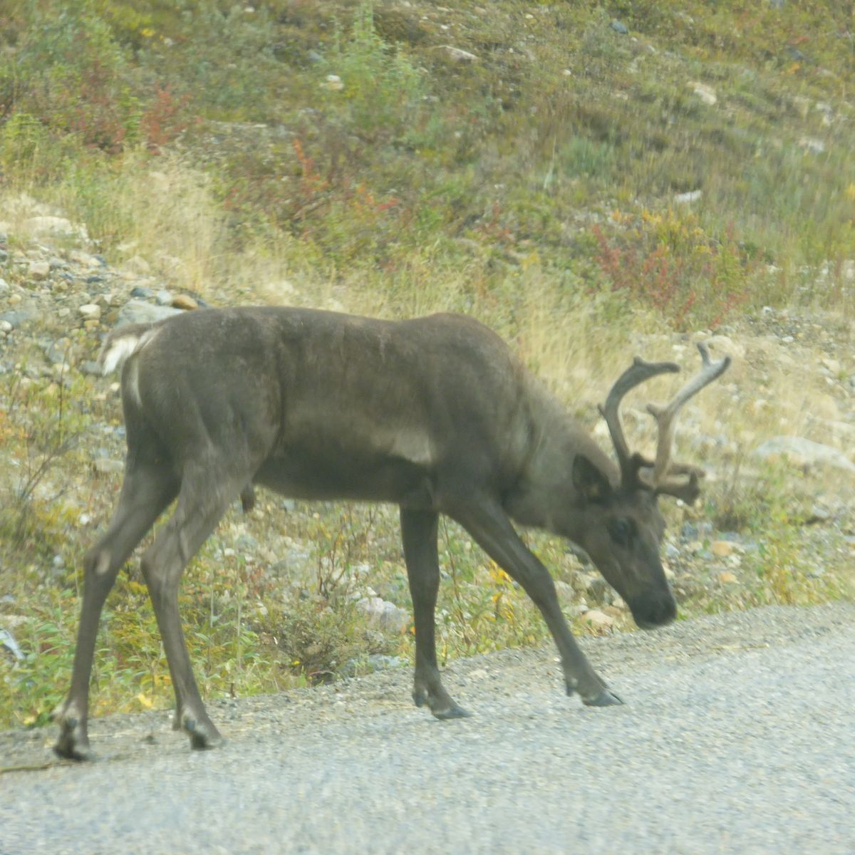
    Caribou


    We still have quite a few miles to go before we cross Canada's southern   border…   and if we have many more amazing photo-op days like this one was, it could take a while!  


    P1020656

    Moose enjoying a late dinner


     Linking to Eileen's SATURDAY CRITTERS and (if I am able) next week's OUR WORLD on TUESDAY.  (Thanks to all of the hosts.)