Category: South America, Central America, Mexico, Caribbean

  • Never Bored on Board


    This is the final wrap-up of our January Ocean-to-Ocean trip around Cape Horn.  We traveled on the Viking Ship Jupiter for two plus weeks.  I have posted about  each of the ports we visited and about one especially scenic day while aboard ship (here).  Because of the distance traveled, this cruise included seven days completely on Board (interspersed with amazing shore excursion days).     On most of the at sea days,  the ocean view didn't change much at all. 


    IMG_6754-001

    But I can't imagine anyone could  be "bored on board" because there was plenty to do on the ship.  Viking says its trips are a journey that will nourish and expand your mind  (Torstein Hagen, founder and chairman) and it also advertises itself for what it does not have.  (There are no children on board and no casinos. )  There are enrichment opportunities on-board.  This cruise had three guest lecturers  and  an on-board historian.  There was a planetarium.  There are port talks the evening before each excursion day with information about the places we could see.   Below are a few pictures of the ship.  I didn't take many. 


    B Viking aboard Ship2-003

     Top: Our stateroom in the evening — curtain on sliding door opens to balcony;  Hallway on our deck; one of the five restaurants on board (outdoor walking deck can be seen through the window)

    Bottom row: One of the reading nooks near the lounge area;  the theater when we got there early one time; Atrium  (more quiet seating on upper balcony, piano and cocktail lounge below)

    There was live piano and violin musicians  in the living room/lounge  area each afternoon and evening — (more often on the days the ship was at sea).    There are on-board musicians and singers and on some nights   guest entertainers, so you could see a different show in the theater every night. There is also a spa and pool and late-night dance music which we passed on because we  are getting old by that time we were exhausted from all the earlier activity.

    The large scale black and white  photograph (top center) in the collage above is one of many photographs displayed along all of the ship corridors.  Fin Serck-Hansonn, a Norwegian photographer  has traveled for Viking to many of the line's destinations.  His pictures show architecture, people, landmarks and natural surroundings — these displays turn each long corridor into an art gallery (and  travel dream list).  The landmark pictured is, however, of a place we've been lucky enough to visit in person.

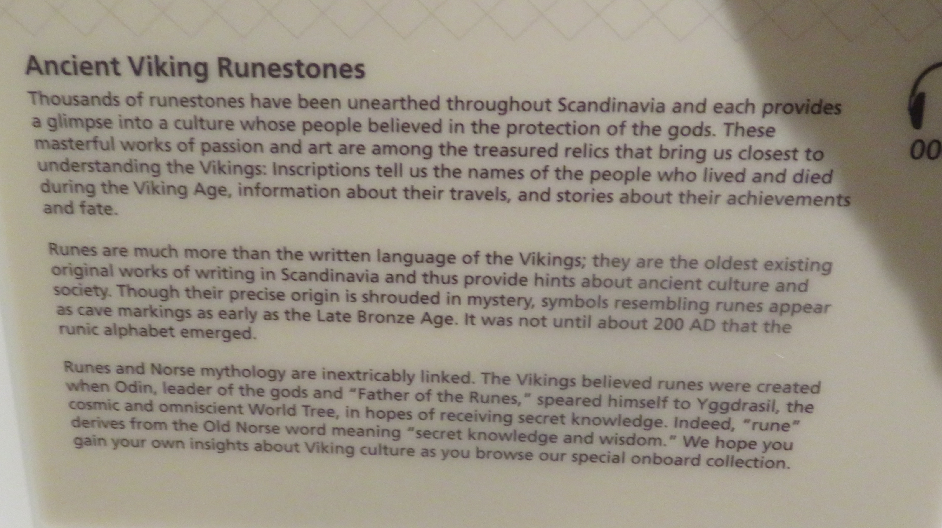
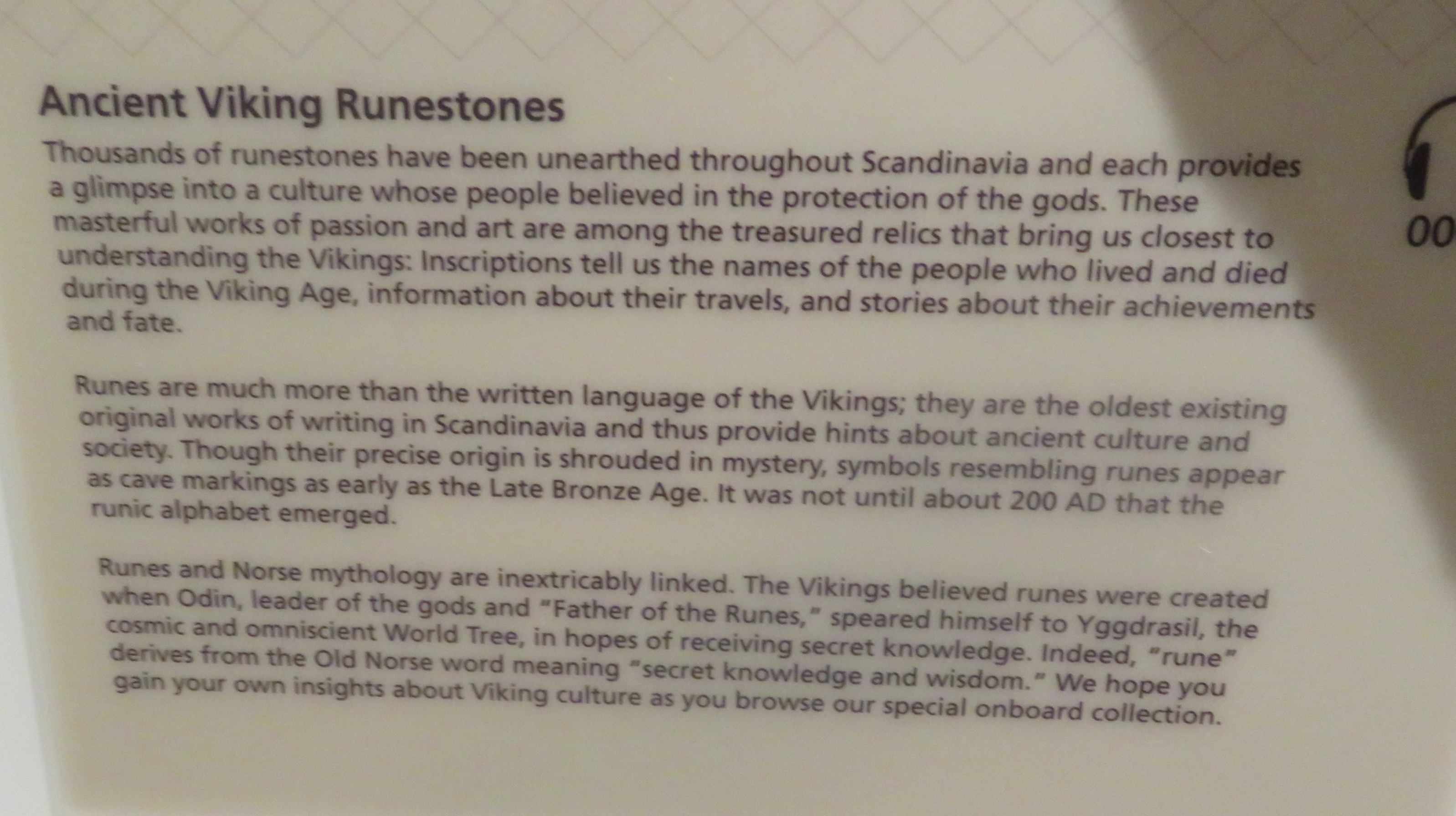
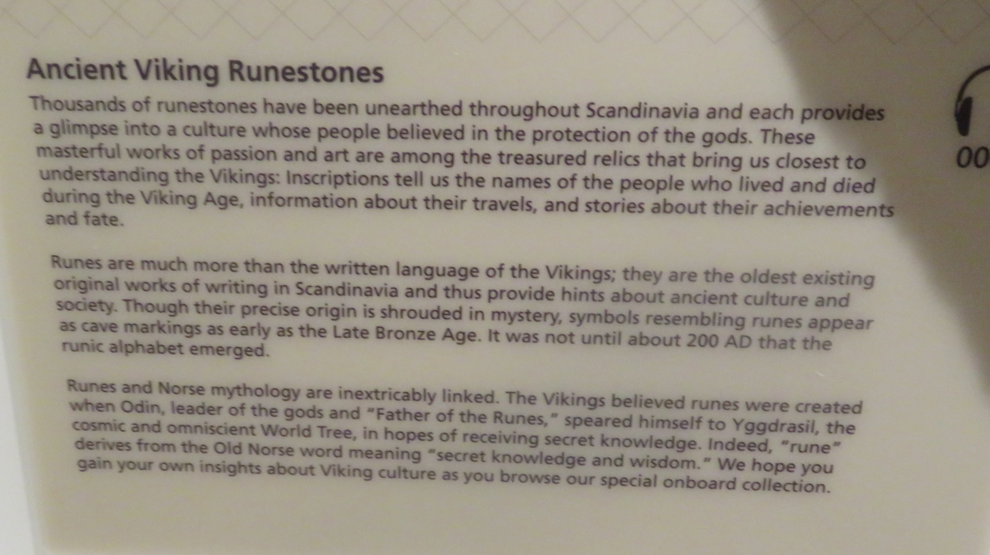
    Viking is a Norwegian line and most of the art and historic replicas  around the ship are related to that country, most especially to the Viking age.  Each of the elevator landings display reproductions of ancient runestones.  

    B - 2 Rune art

    I found these especially interesting because we have seen original petroglyphs and pictographs in a few places in both North and Central America and the similarities are always so amazing.  Please click on the photo of the sign below for some of the history.  As you may notice on the poster, you can also listen to a brief talk about each display with earphones which are provided in your stateroom.


    IMG_6694

    click to enlarge

    Both the up and down stair landings on all six floors of the ship displayed large embroidered reproductions of the Bayeaux Tapestry.  While fascinating and beautifully done, these had me wondering why  reproductions from a museum in France were featured when we were on a Norwegian ship traveling in South America.  But there is a Viking link.   

    I learned that the Battle of Hastings which is a major part of the tapestry was perceived as a Viking victory for William the Conquerer who was a Norman King and at that time Normandy was Viking territory.   (This is one reason why there is a historian on board the ship.  And if I mis-interpreted anything  it is my fault, not the ship's.)


    IMG_6678


    The original tapestry, a cloth about 230 feet long, 20 inches wide, was embroidered 945 years ago.   It still exists, mostly intact,  in the town of Bayeux, France (Normandy).


    IMG_6739

    There was also an animated version of the Tapestry with explanations on a small screen in one section of the ship's living room.


    IMG_6722


    All of the lectures given on the ship were taped and could be watched later on your in-room TV screen.   Some   shore excursions lasted quite late and lectures would be given before some passengers were back on board.  We watched both ways.    The enrichment team of three experts included a resident astronomer who was on loan from NASA; a professor of Geography and Archeology with a specialty in Latin America;  and a lawyer/professor of international constitutional law.     

    I should also mention here that we enjoyed just relaxing in one of the many little book-lined nooks in the public areas of the boat (often with our own e-books) and of course eating and drinking in the living room/lounge/restaurants.  I never remember to take pictures of our food, but we were happy with our choices. 

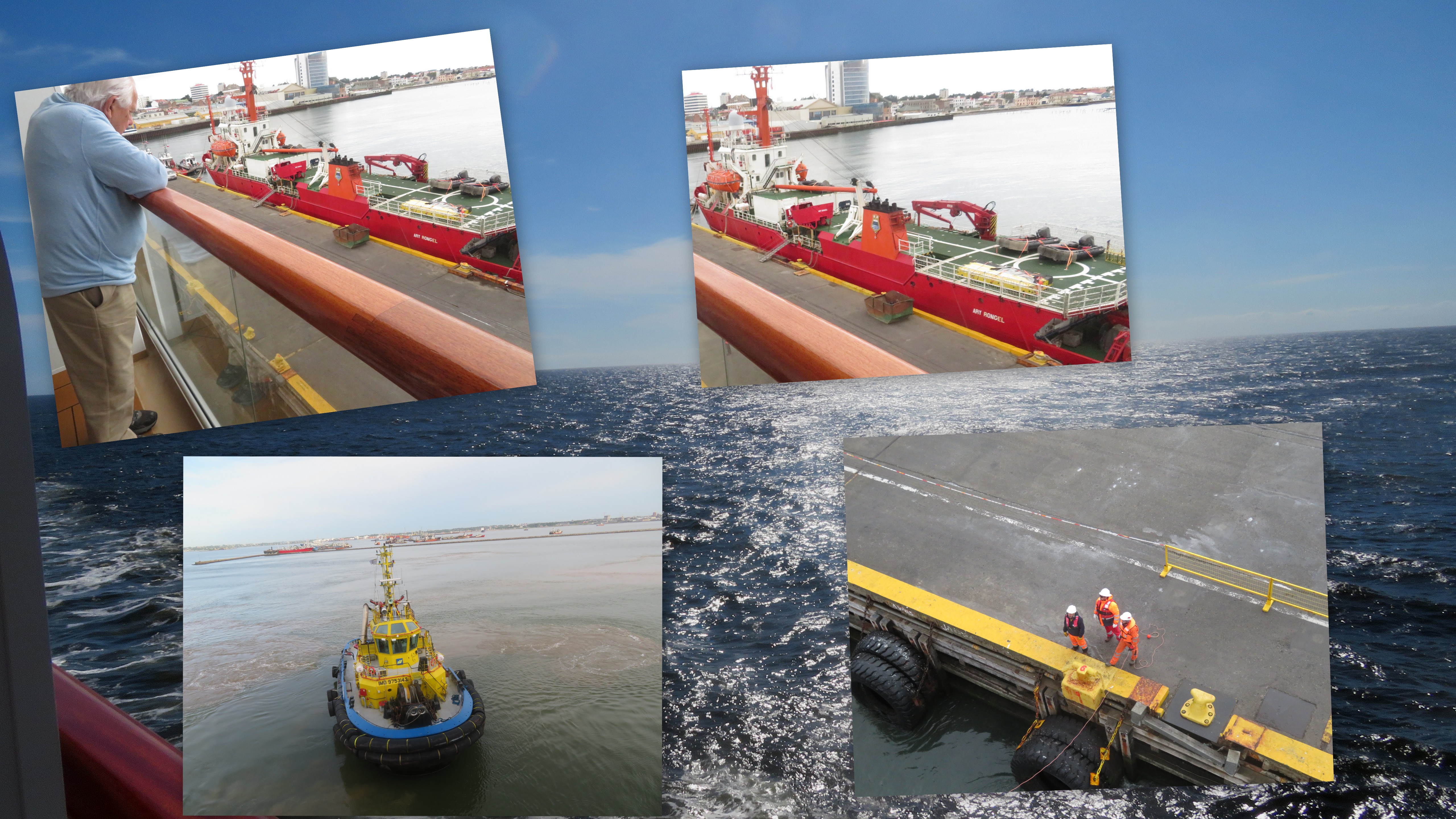
    We always tried to be awake and at a window on days when the ship was coming in to port and docking.   It is interesting to watch experts at work.  Below are some of those pictures.

    B Viking aboard Ship1-001


    There is so much work involved in keeping the ship running smoothly  and we appreciated the hard work of the staff — chefs, cooks, waiters, room stewards, as well as pilots, mechanics , dock hands and so many more behind the scenes doing a good job.  Everyone we dealt with seemed without fail to enjoy their jobs and did a great job as far as we were concerned.

    On this cruise we visited and learned something about three new-to-us countries and  unexpectedly a fourth one when our return trip took us from Buenos Aires Argentina to Sao Paulo Brazil on our way to Miami.  

    IMG_6993


    But sadly, the only thing I can legitimately claim to have learned about Brazil is that the Sao Paulo Airport is very busy and very confusing.     Running around an extremely busy airport definitely shouldn't count at all as a visit, but it was (to say the least) quite an interesting day at the almost end of our trip and I didn't want to forget it, so the picture above is of our only souvenir of Brazil.   

    IMG_6424Sunset after a day at sea 


    I am forever grateful that we were able to see all we did on this cruise.   It was an amazing journey and we loved it, but the air travel to and from was long and kind of difficult. We understand that this was partly due to the fact that we had to arrange the journey to start in one place (Oregon) and end at another (Florida), but also partly due to the fact that air travel is just not a whole lot of fun anymore.   We probably  won't do anything as complicated as this again.  But it was so worth it this time.   


    LINKING:  Thank you to the hosts.

    MOSAIC MONDAY;  THROUGH MY LENS;  TUESDAY TREASURES;  SIGNS SIGNS;  MY CORNER OF THE WORLD;   THANKFUL THURSDAY; and SKYWATCH FRIDAY;   


  • Buenos Aires, our last port of call

    The  final port of call on our  South America and Chilean Fjords Cruise was Buenos Aires, the capital of Argentina.   


    IMG_6815First view of the City from our balcony

    Three million plus people reside within the city limits, with millions more in the Greater BA area.  It's an interesting Big City to explore.    Located on the beautiful Rio de la Plata, there's a lot of port and river activity.  The downtown area is a mix of European-looking 19th Century buildings along with reminders of the fishing and port origins.    And so much history.                                                                                                                                                                             

    IMG_6892

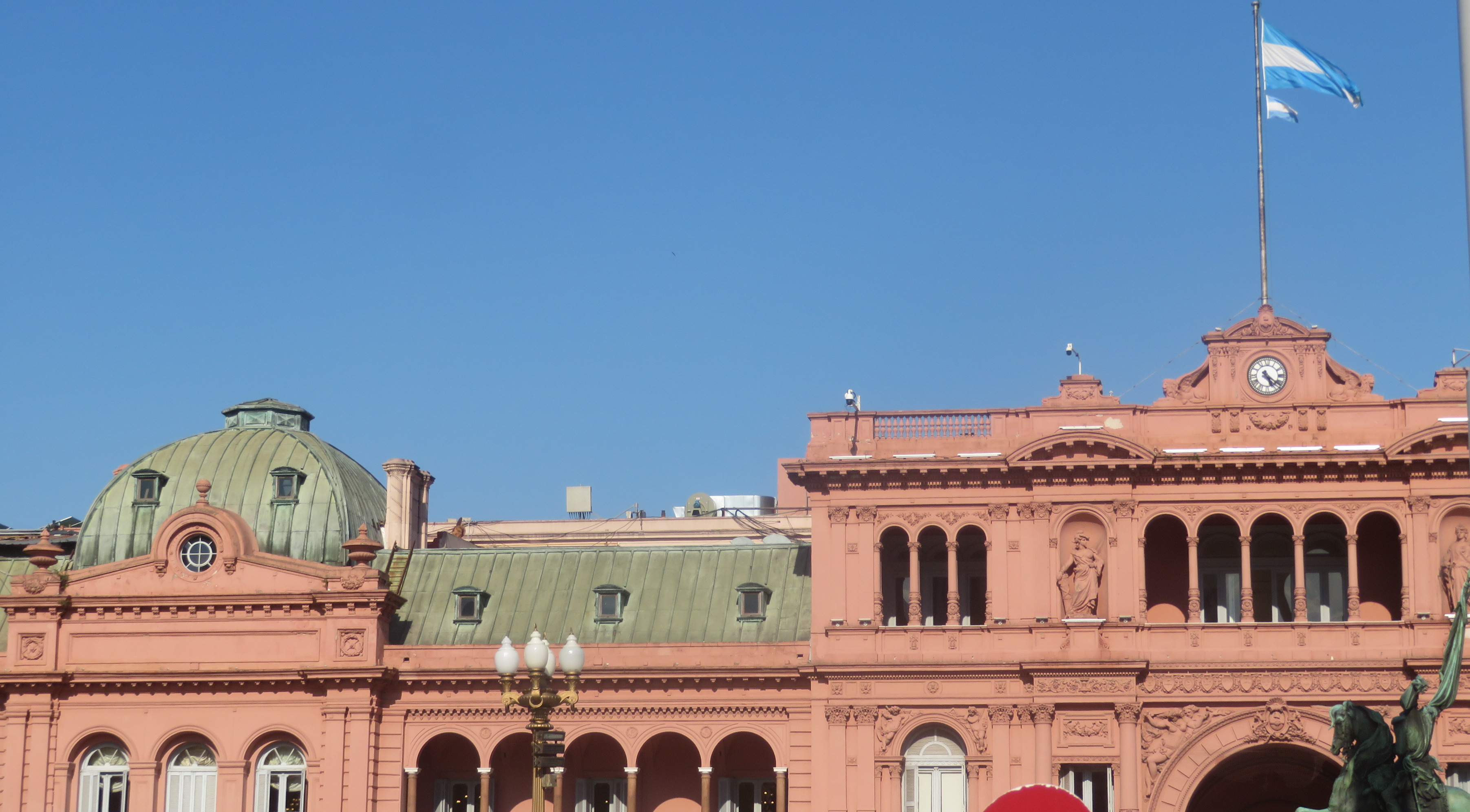
    This is Casa Rosada (the Pink Palace)  which houses the offices of the President (not the presidential residence) and the focal point of  Plaza de Mayo, the City's gathering place.


    N  Buenos Aires Argentina


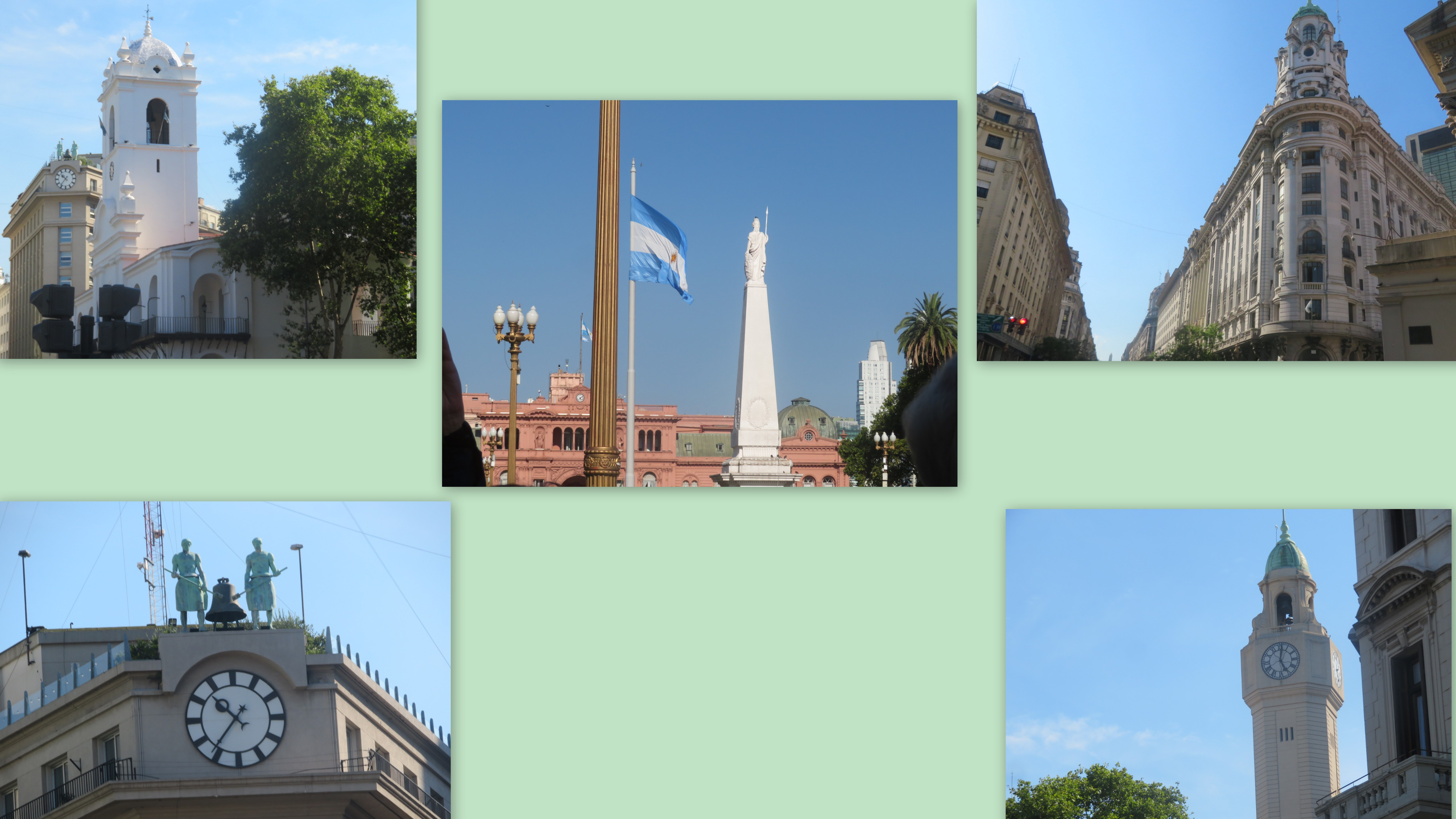
    Plaza de Mayo had been the center of Buenos Aires political life since the city was founded in 1580.  It was renamed for the May 1810 revolution when the country gained its independence from Spain. The monument in   the center picture was placed in 1811 to celebrate the first anniversary of the revolution.  The collage above also shows some of the buildings surrounding the Plaza including the City Legislature building, the National Museum,  and a former commercial building with the statue of two giants ringing a bell.  Their mechanical hammers  are connected to the clock.  

    The Plaza is perhaps best known here in the US as the place where huge throngs gathered to hear Eva Peron's passionate addresses from the balcony.   As an unofficial political leader during her husband's presidency (in the 1960s),  she helped to bring about economic reforms as well as the passage of women's suffrage legislation.  

    But the Plaza had  been (and remains) the site of huge gatherings and protests since its origin.     Below is an example of a more recent action by citizens:


    Buenos aires-002

    Each stone on the steps surrounding the statue  (and the picture doesn't show anywhere near all of them) was placed to honor someone who died during the Covid pandemic.  Many include names and dates.    People wanted to remember and honor those who died, especially because they were almost always unable to be with their loved ones during their final hours or to hold a service.   Later, the City government planned to gather the memorial stones and display them in a building, but people protested that they should be left in the original spot.   

    Tiles such as the one pictured below are reminders of a courageous public protest from a slightly earlier time (but well within memory):

    IMG_6889

    This symbol  on the Plaza's floor tiles marks the path taken on weekly walks by the Mother's Group.  They began marches of resistance during the  in the 1970s  when over 30,000  people disappeared during what was called the National Reorganization Process.  Mostly teenagers and young adults, they were hunted down and killed because they were known to have opposed the right wing military junta that had gained power.  These brave mothers wore white head scarves when they began to march in resistance to the dictatorship and to petition for the return of their Disappeared children.   They continue the marches in their memory and as a constant reminder.

    Democracy was re-established in 1983, but the Mothers Group continues their political action work and members hold a ceremonial march on the Plaza once every week.  


    N  Buenos Aires Argentina1 

    The top row pictures are from the Riverfront neighborhood of the city, while the lower row are of the Municipal Cathedral.  This is the Church where Pope Francis served  before being elected Pope.   (It was really crowded, pictures were practically impossible ) 

    The pictures below are from the La Boca neighborhood — a colorful, eccentric, and joyful area:   

    N  Buenos Aires Argentina2

    This is La Boca, where local artists celebrate and preserve the origins of the neighborhood which was once  a tenement district where port workers and fishermen lived with their families.  The shacks are mostly reproductions of the original homes which were made from shipbuilding scraps.  Local artists added the bright colors.  The neighborhood is full of small cafes and food carts,  art galleries, odd little shops, and street entertainment (tango dancers, dog shows to name a few).  And many winding hallways and alleys, where it was way too easy to get  turned around.  


    IMG_6819

     Our time in this beautiful lively city with all its important history, interesting neighborhoods, and busy port district made an incredible last day for what had been an amazing trip.  We're immensely grateful for all we saw and learned.    


    IMG_6898

    This pedestrian bridge is in Puerto Madero, the newest neighborhood in Buenos Aires.  It rotates to allow ships access to the river.   Viking transported disembarking passengers to a hotel in this area, where we had breakfast and snacks while waiting in groups for our airport transportation.    (The ship's crew would prepare to board a new group who would take the same cruise in the opposite direction beginning the next day).  The last day of vacation is never fun, but it was made about as painless as possible and we walked around this new scenic neighborhood while we waited to begin the long trip home.  

    At least a couple of people have asked for further information about our days at sea and I do plan to post one more blog about "life aboard ship."    Meanwhile, we have been alive and well and doing a few blog-worthy things at home and around the Canal Cottage, and it's great to be just about caught up here in blogland.     

    LINKING to the following sharing opportunities this week:  

    MOSAIC MONDAY;  THROUGH MY LENS; TUESDAY TREASURES;  MY CORNER OF THE WORLD;   THANKFUL THURSDAY; and  SKYWATCH FRIDAY;    

  • Small town, big city, and two countries

    We were away for 18 days on this trip.  Seven of those were sailing days — spent entirely on the boat.  At-sea days are what you make of them and it's easy to find things to do — more activities than we needed actually.  For us, there were no bad days on board — and some of them were spectacular.   

    We can say the same thing about shore excursion days as well.   Or any days at all  for that matter.   Every day can't be spectacular.  But on this trip, almost every day  came fairly close.  Every shore visit was to a new place, often one we'd never heard of before booking the voyage.  And every day brought a learning experience.    We count our blessings.


    IMG_6639


     Our next port-of-call was the one day we were slightly disappointed with.  But it wasn't a bad day either.  We were in a new place and it gave us the opportunity to  learn more about the Patagonian region of Argentina.  Puerto Madryn is a fishing port, settled in the mid-19th century when the Argentine government, like Chile's, encouraged European immigration to this remote region.    The first settlers to arrive were  Welsh immigrants.  Settlers from Spain and Italy soon followed, but the heritage of the original Welsh settlers lives on.  

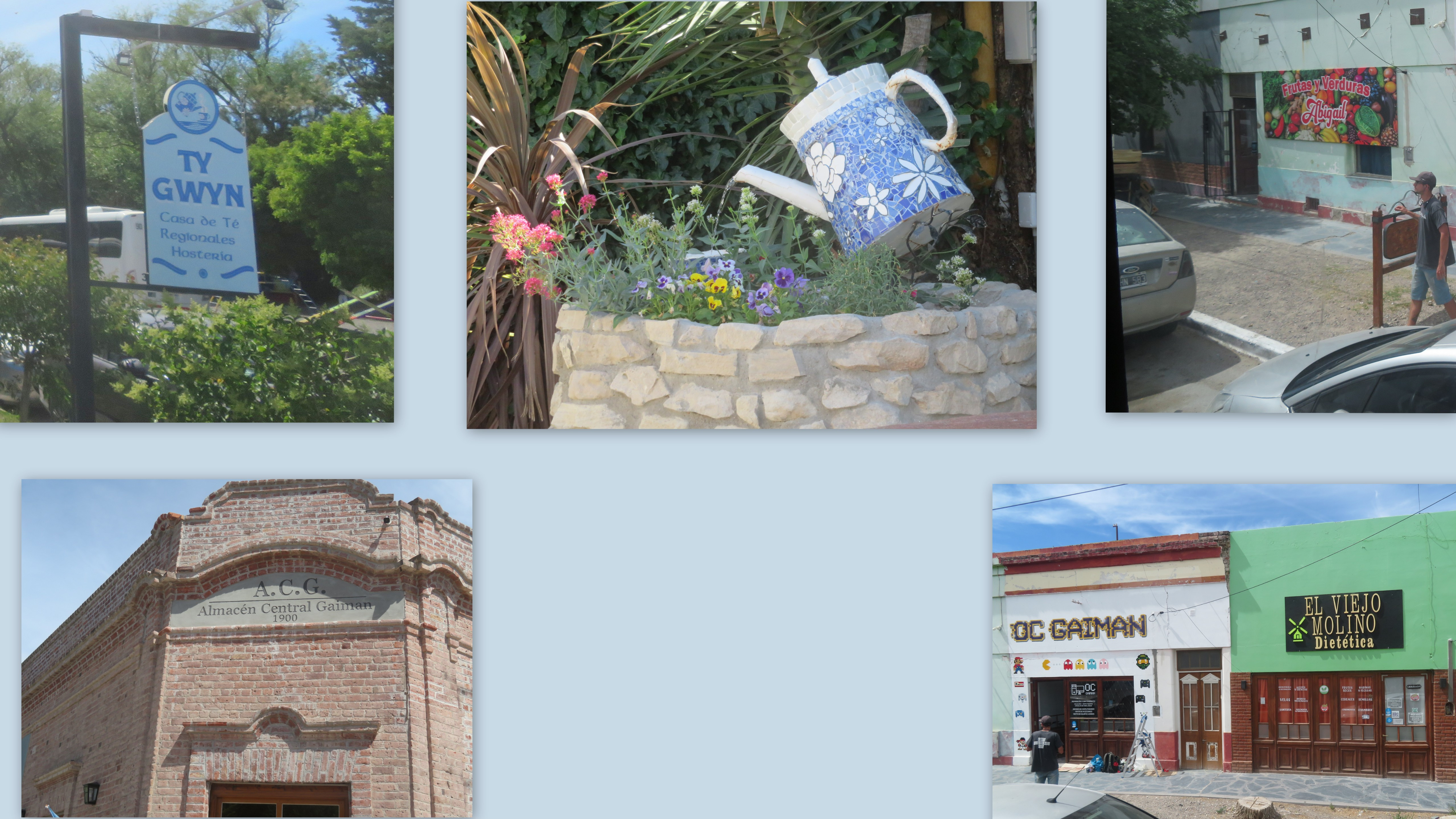
    Our shore excursion was a drive-through tour of Puerto Madryn and then on to  the village of Gaiman, where descendants  of the original Welsh families still keep their traditions alive.  It was a hot day for a bus ride along  a not-very-scenic road.


    L Puerto Madryn Argentina Jan 4-001 

    We had tea and biscuits (sweets) in Gaiman and listened to Welsh folk music.  We were sorry not to have more time in the village as we had time for only a very short  guided walk around the town.   A lot of this excursion was taken up by the bus ride to and from the village.

    IMG_6669


    In the afternoon, we took a shuttle bus from the dock into the town of Puerto Madryn where we braved the heat and did a little walking around on our own.    This is the Jupiter at the dock shown in the first picture, taken from the  bus stop across the beach.  It was pleasant to watch local families  enjoying the warm summer day at the beach and it had me wishing to dip my toes into the water as well.   In retrospect, we  should have foregone the bus tour and chosen to spend more time on our own.   

    A couple of at-sea days later, we  woke up to an entirely new country  at a very  interesting port of call.

    Uruguay_mapa

    We  were docked at Montevideo, Uruguay.  This, the Capital City of the country, is situated on the north shore of the Río de la Plata, the arm of the Atlantic Ocean that separates the south coast of Uruguay from the north coast of Argentina.   

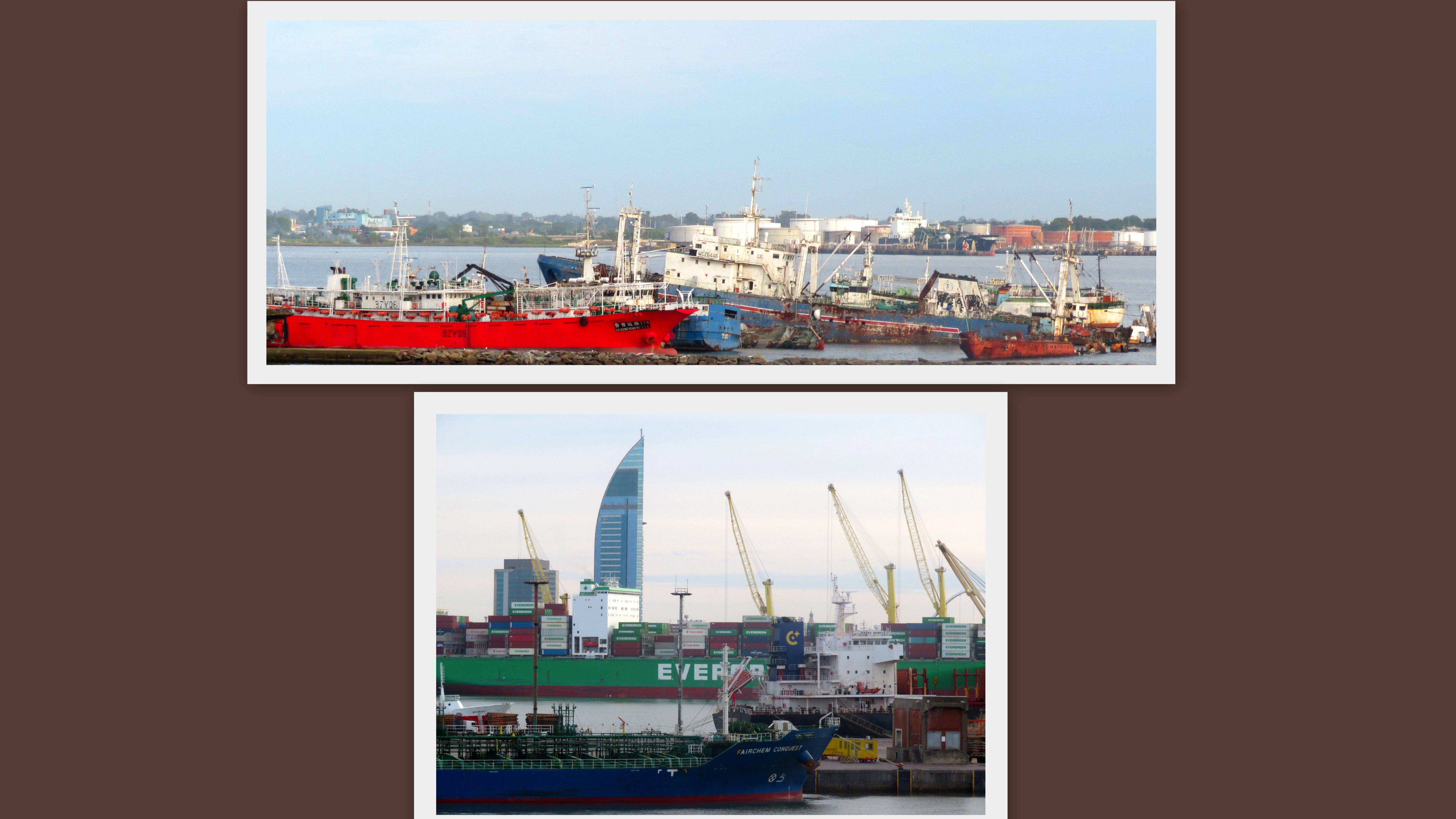
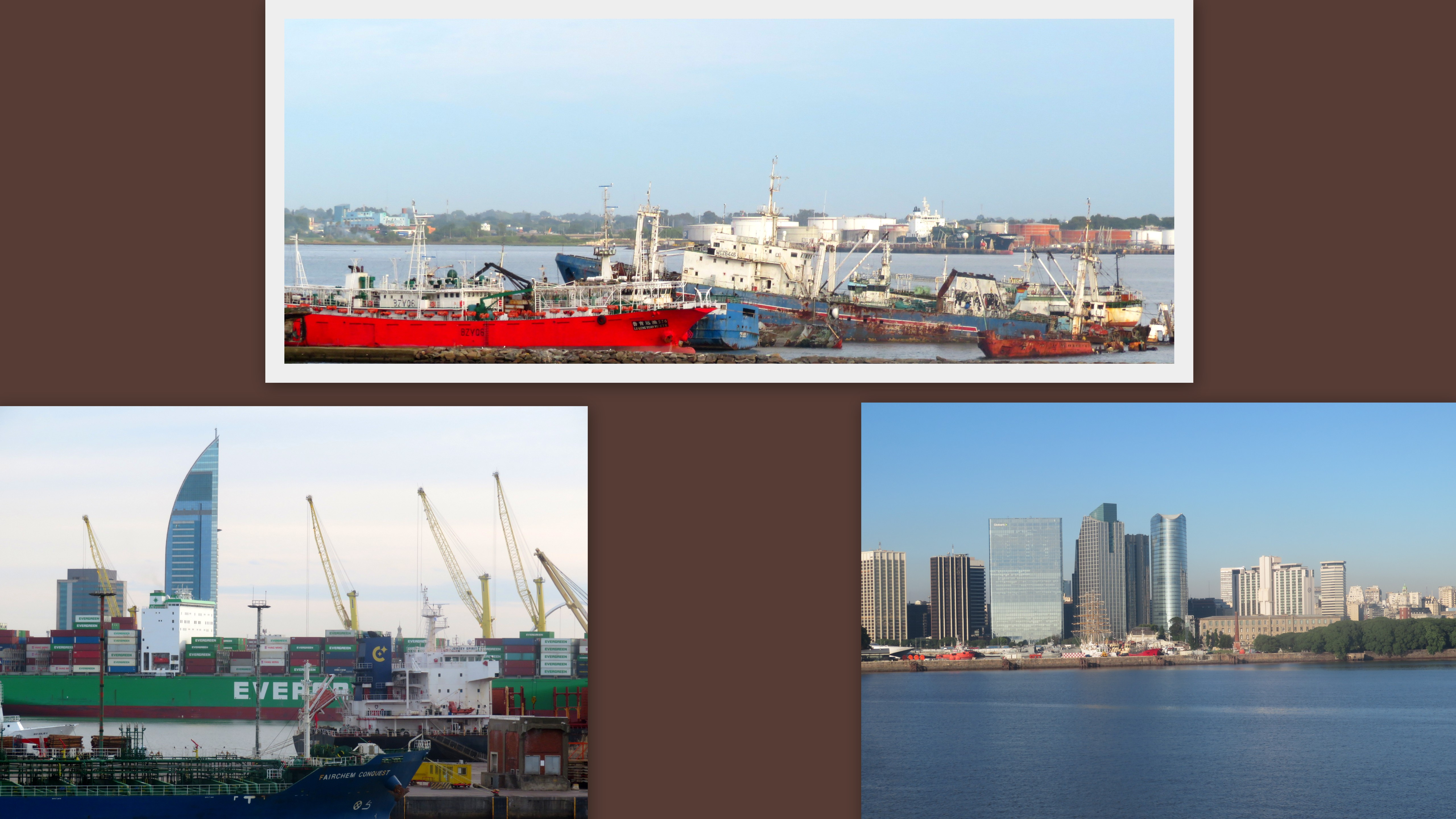
    Looking out our window in the morning as the ship came in to the dock, we could see what looked like a ship graveyard as well as a thriving commercial port and then the skyscrapers of the city.   

    M  Montevideo Uruguay Jan 7-001
    Though we never did find out about the abandoned ships, we did quickly realize just how big the city is.  The Capital of Uruguay, Montevideo has a population of  over a million — one-third of the country's population resides within its city limits.   Montevideo is said to have one of the highest qualities of life of any Latin American city and it felt to us like a thriving city.  If anything from the brief time we spent there, it seemed more European than anything else.  
     

    IMG_6793


    We were comfortable exploring City streets on our own.   Modern skyscrapers co-exist with  historic art deco and neo-classical architecture.  Remnants of the old walled city still exist in some places.


    M  Montevideo Uruguay Jan 71


    There was a street art exhibit going on in the old part of downtown, along with some probably unauthorized graffiti.   We window shopped and even sampled a little of the local cuisine.  

    IMG_6802


    Teatro Solis is the country's major theater.  Opened in 1865, the building was designed by Italian architect Carlos Zucchi and named after the first European explorer to land in what is now Uruguay.   It served as a hub for society in those days.  According to Wikipedia:

    The motivation behind constructing a theatre was to have a worthy place where one could be seen socializing and flaunt one's social and political influence. The necessity behind constructing a theatre in Montevideo was the need to elevate one's social and political status through civil associations that had a cultural, scientific, and commercial nature. Therefore, the new theatre would offer a platform for socializing among the societal elite.

    A renovation project was completed in 2004.    I wish we could have attended a performance in this historic theater! 


    IMG_6812


    We would have two more sea days following our time in Uruguay and then we'd be back in Argentina for the last two days of our trip.  We appreciated the chance to see another country  –   one we did not expect to visit when we decided on this itinerary.   It was also, for me at least, a good geography lesson. Before this,  I honestly wouldn't have been able to place Uruguay on a map.  (I'd at least be able to get close now!)


    Linking this week to the following sharing opportunities.

    Thank you to the hosts.

    MOSAIC MONDAY;   THROUGH MY LENS; TUESDAY TREASURES;  MY CORNER OF THE WORLD;   THANKFUL THURSDAY; and  SKYWATCH FRIDAY;    


  • Port Stanley Falkland Islands

    After a couple of days on the ocean (the first of which was sailing around Cape Horn), the  Juniper  anchored off shore.

    Tender Port Stanley


      Tenders transferred passengers from the ship to Port Stanley, Falkland Islands.


    IMG_6624


    Geographically, it's Argentina, but it felt like England.  (Albeit, a very nice spring-like day for January in England)>


    J  Port Stanley Falkland Islands Jan 2-001


    Of course, The Falkland Islands is (still) a British Territory and it feels like one.  Top row is Christ Church Anglican Cathedral built in the 1800s, the British Flag at the Port,  and the iconic red phone booth.  In the lower row, the flag flies near a government building, one of the many English gardens we passed on a walk around town, and the Royal Post Office.    We also passed several typical British pubs and tea shops  (no pictures of the last two)

    But first …

    Before we walked around town, we boarded a local tour bus near the port.  It took us to Gypsy Cove, a scenic park on Pembroke Peninsula, about  4 miles from the Port.  This beautiful coastal park is home to several colonies of Penguins.


    Gc sky


    It was a beautiful day to be outdoors.  I spotted  penguins  on the beach, but too far from the top of a hill.  This beach was off limits for walking (as it should be for the penguins safety).    A few had waddled up closer to the path.  Here are some of my favorites:

    IMG_6575


    IMG_6574


    G cove

    IMG_6554

    After our morning at Gypsy Cove, the bus transported us back to the Port.  We spent the afternoon walking around on the town of Stanley on a self-guided tour.  


    IMG_6518

    A military plane flying over the Port is a reminder of the 1982 Falklands War  — and why the Island is still a British Territory.   The Royal Air Force Base is on the other side of the island.  Some of our fellow passengers on the ship opted to take a tour  focused on the history of the war, instead of focusing on nature and wildlife.      We have long ago come to terms with not being able to do everything of interest, no matter where we go on a tour.   Or when traveling on our own for that matter.  We are grateful to see and learn what we can.  


    IMG_6594

    This arch, made from the jawbones of two blue whales, was built in 1933 to commemorate a century of continuous British administration of the Islands.    It is one entrance to the grounds of the Anglican Cathedral.


    IMG_6612


    Our walk took us to the National Museum of the Falkland Islands, which had well-done rooms showing early history of the Island and British Isles settlement (many descendants of early settlers still make it their home).  There are displays dedicated to the Falklands War and more.   We could easily have spent much more time there, but it was time to walk back to the port as we didn't want to miss the last tender trip back to the ship.


    IMG_6562

    It was a great day.   Besides all that we saw — and more Penguins! — we talked to friendly locals and learned a little bit about what it was like to live on this somewhat remote Island.   The Falkland Islands was never a place I dreamed of seeing, certainly wasn't on my travel wish list, but as often happens it was one of the most interesting places we've visited.   I'd recommend it to anyone.


    Linking this week to the following:  Thanks to the hosts.

    MOSAIC MONDAY;   NATURE NOTES;  THROUGH MY LENS; TUESDAY TREASURES ;  MY CORNER OF THE WORLD; WILD BIRD WEDNESDAY;  THANKFUL THURSDAY;  SIGNS SIGNS; SKYWATCH FRIDAY; and SATURDAY CRITTERS 

  • End of the Earth — and Beyond

    We had arrived at the end of the earth… Ushuaia Argentina the southernmost city in the world.  Surrounded by Andes mountain slopes and located on the Beagle Channel, it is the closest city to the South Pole and as such the departing place for most Antarctic expeditions.  We saw many expedition vehicles and supply stores around the town.      On the day we were there, a cold strong wind was blowing –  it definitely had the feeling of a remote outpost.   I was in awe of the explorers preparing to experience even harsher conditions.


    IMG_6415

    The above picture is NOT where our ship was — that dock was the City Pier in Ushuaia.  Sadly, I neglected to take pictures of anything in the town or at the city dock.  This picture and the collage below are  from Tierra del Fuego National Park, where we spent most of the day.   

    The Park is located on  Tierra del Fuego (the Land of Fire) island, part of a region composed of  many  islands in both Chile and Argentina as well as Andean Mountain peaks, plains, forests, lakes and glaciers. 

    H Tierra del Fuego NP Ushuaia Argentina dec 30-002

    We got a taste of the beauty of the area as we walked around the Lake with views of the surrounding mountains and took a short hike on a sheltered woodsy path.  The bottom panel of the entrance sign points out how far South we were.

    We were "at-sea" again the following day, but once again it was one that gave us scenic views and interesting history:   

    Cape horn-001

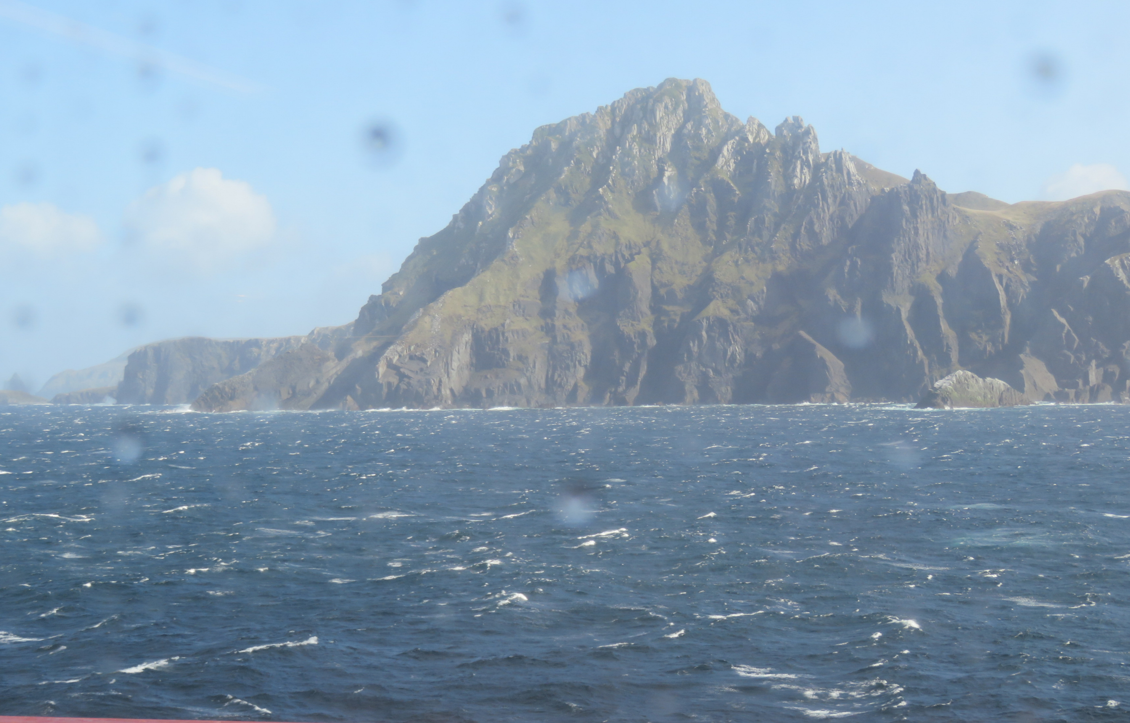
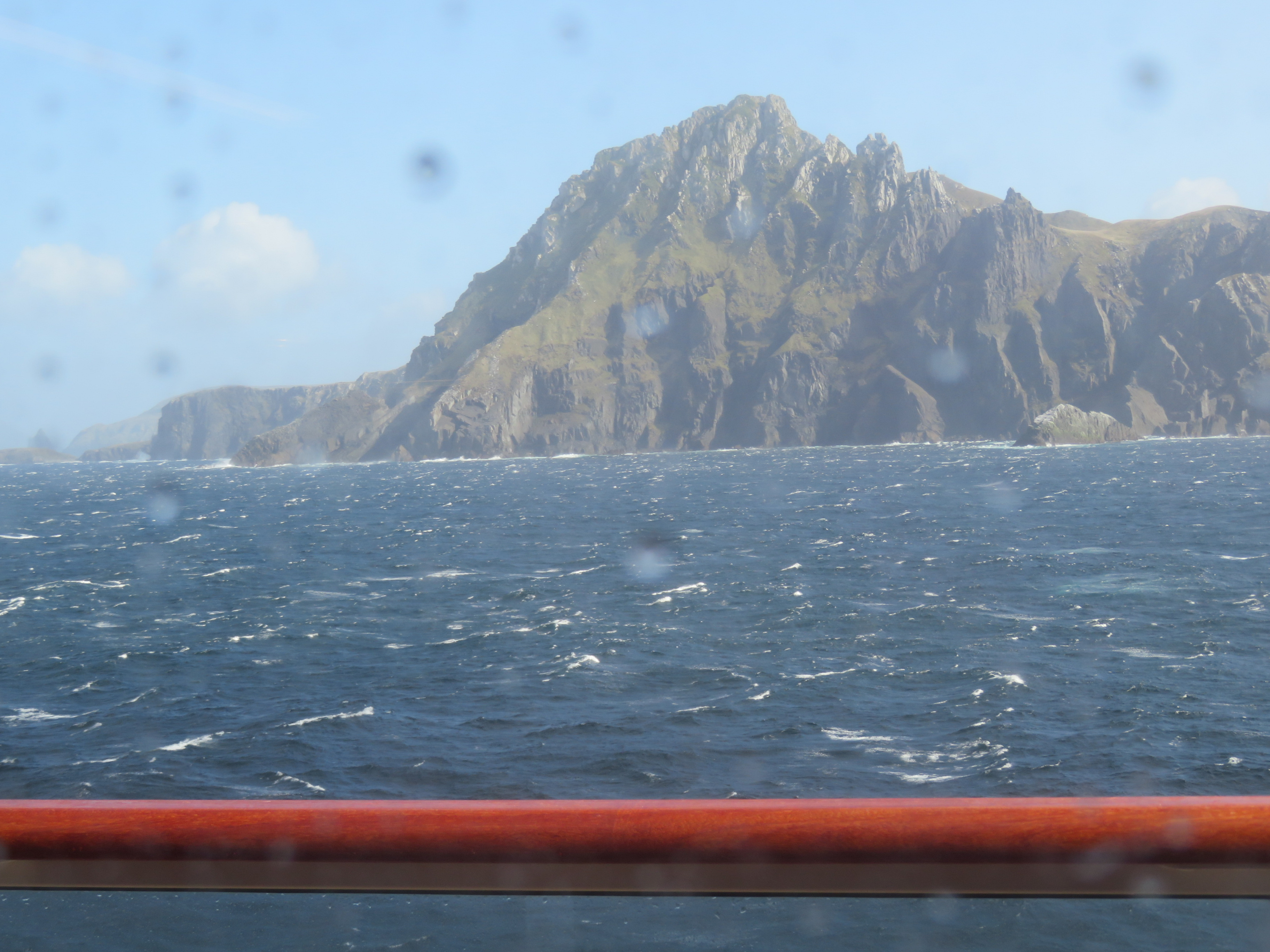
    We sailed around Cape Horn.     

    Cape Horn is a rocky headland on Hornos Island, part of the Tierra del Fuego archipelago that belongs to Chile.   The Pacific and Atlantic Oceans meet here on the southern tip of South America.    The northern boundary of the Drake Passage, it was a major milestone  on the route where sailing ships carried trade around the world.  


    IMG_6463

    It was a hazardous passage back then, owing to strong winds, large waves, strong currents and icebergs.  These hazards can and do still exist and it was a rainy stormy day out there. While we kept a hand out for support just in case, we didn't feel any real turbulence.     I was happy to view the scenery through our window as we listened to commentary from the ship's Captain.  In retrospect, of course I wish there'd been a little better light for these souvenir photographs.    

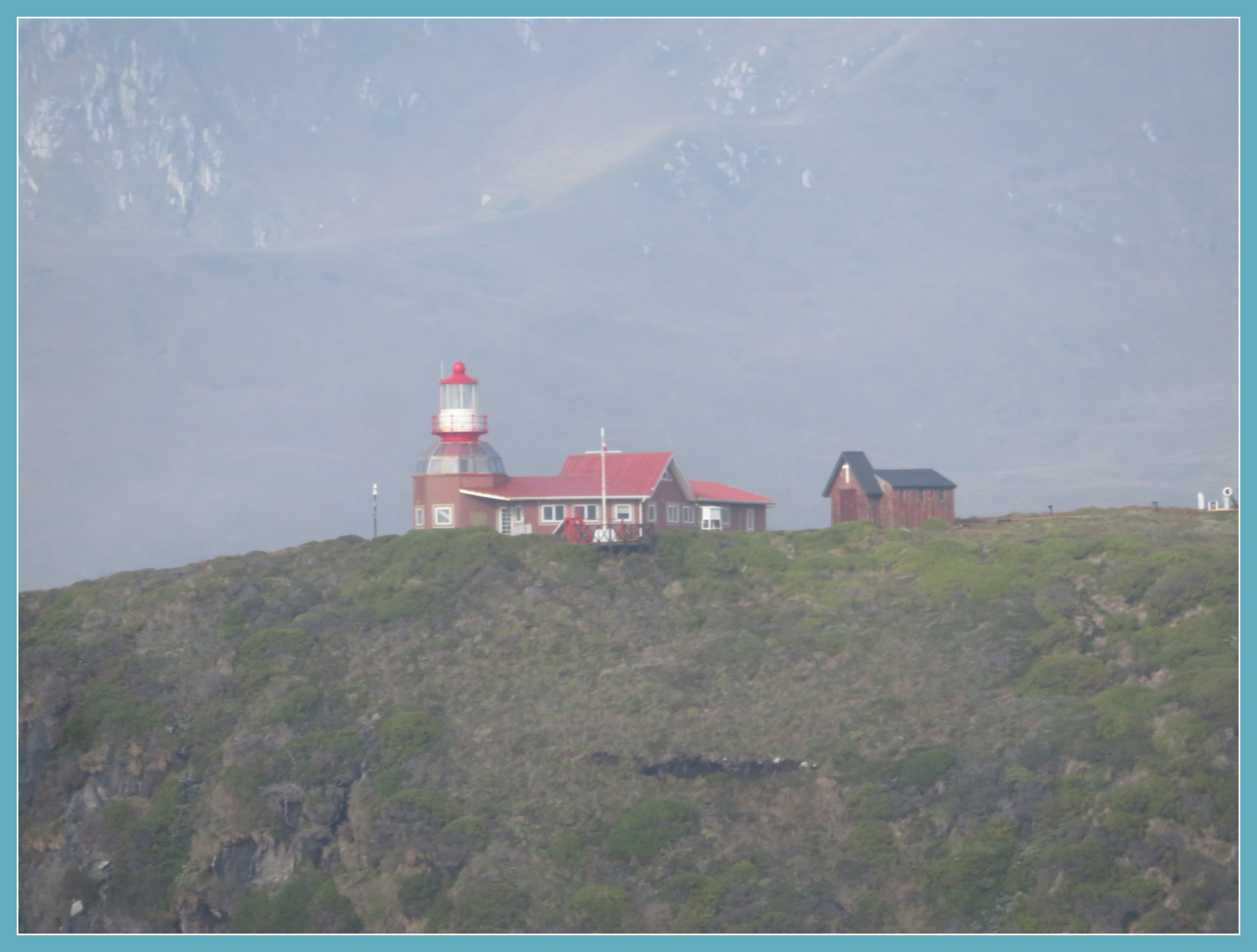
    IMG_6437

    We even got a glimpse of  Faro Cabo de Hornos — the Cape Horn Lighthouse.  Nearby there is a monument to the sailors who have perished rounding the horn, but we were unable to spot it.      This lighthouse is the responsibility of the Chilean Navy.  Because of its remote location, the Navy assigns the position to a married officer with family.  The lighthouse is home to them for a period of (if I remember correctly) two years before the position is rotated.


    IMG_6990

    Needless to say, ships today are much safer than they were in Drake's day.  Still Viking rewarded everyone aboard with a certificate showing we had made the (not-so-dangerous) passage.  It would make a cute page in a travel scrapbook  but I took a picture  because this is my only scrapbook these days.    

    Grateful for these two fascinating days — we visited the end of the earth, set foot in a new-to-us-country, rounded Cape Horn.  And we learned so much … and that is the best part of travel.

     (Still blogging about our winter trip and this post is a little over the halfway point.  The passage around the Horn happened on December 31 and we celebrated New Years Eve on board ship that evening.    In real life we've been home for over two months.  It was quite a long vacation trip, but not as long as it seems here in blogland.)

    LINKING this week to the following sharing opportunities, with thanks to the hosts:

    MOSAIC MONDAY;  THROUGH MY LENS; TUESDAY TREASURES;  MY CORNER OF THE WORLD;  SIGNS SIGNS;  THANKFUL THURSDAY; and  SKYWATCH FRIDAY;    

  • Magdalena Island Chile

    The day after the scenic glacier sailing,  the ship docked at the historic town of Punta Arenas on the Brunswick Peninsula.


    IMG_6413


    Punta Arenas was founded as a Chilean penal colony in 1848, then later was a supply town and port for mariners crossing the Strait of Magellan to take part in Chile's goldrush.  It continued as one of Chile's most important port cities  until the opening of the Panama Canal.   However, we only had one day at this port, so everything we learned about the town itself we learned  only from the on-board briefings the evening before. 

    We chose a different excursion instead    — we went to see Penguins.


    Mag island


    Early in the morning, we boarded a large catamaran right in front of where our ship was docked.  It took about an hour to get to Magdalena Island, which is only accessible by boat.  For us, not having to get on a tour bus was a bonus.  (We like boating.)   The picture above is from a window on the catamaran as we approached the  island.   


    IMG_6265
    We learned that these penguins never want to be the first one to enter the water.  That's why they stand in groups at the shore's edge.  They won't enter as a group, but wait for just one penguin  to dive in– if he or she seems OK, the rest will go in together.  


    IMG_6301


    When we got off the catamaran, we walked over a shoe-sanitizer.   Everyone has to stay  on the roped off trails — the pictures are zoomed, but we could clearly see the burrows and watch the family interactions.  We were able to get about four feet from some of the burrows.  There were hundreds, maybe thousands,  of burrows.


    IMG_6283


     It is estimated that over 60,000 Magellanic Penguin couples make this island their home.  The penguin babies were at different stages — some so tiny we could barely see them at the bottom of the burrow.  I couldn't get pictures of those.  


    IMG_6309


    The whole 782 square mile island is a Penguin Reserve officially named Monumento National Los Pinguinos.  A naturalist on the catamaran told us that the penguins used to be the only bird on the island, but then some gulls moved in and thrived.  He said that it was a worry but might have turned out to be  good thing for the penguins because birds of prey tend to like the eggs of the gulls better than those of the penguins.     


    IMG_6285Skua — a bird of prey 


    G  Magdalena Island Penguin Puenta Arenas dec 29

     Here are some gull babies who survived.  They apparently use shallower burrows than the penguins.  And it was baby-raising season for them too.  We see gulls everywhere we go, but it isn't often that you see baby ones.  I think these are Kelp Gulls.


    IMG_6304

     So so cute!  

    We learned that the penguin parents take turns watching the babies while the other parent goes after dinner.


    IMG_6273

    I followed the walking path to the highest point of the Island, the location of an historical Lighthouse.  It was built in 1902 and is still casts a guiding light on this part of the Strait of Magellan.  Although it is now fully automated, the former keeper's home is now an interpretive center for the Penguin Preserve.  


    IMG_6313

    It was a rush to get back down, because our time on the Island was drawing to a close and I certainly didn't want to miss the boat.   Really, there was no choice but to hurry because the wind had come up while we walked and it felt a little bit like I was being blown down the hill.


    IMG_6265


    We said good-bye to the penguins, who really do seem curious about their visitors.  


    Catamaran magdalena island

    NOT MY Photograph — Borrowed Internet Image

    I did not take a picture of our Catamaran, but this picture borrowed from the Trip Advisor website is what it looked like. 

    The windy day continued and wow did we get our rough-sea experience on the trip back.  We'd had a good place to sit on the top deck on the way to the island that morning, so we headed to the stairs (really more of a ladder) again this time.   But first I needed to make a quick stop at the rest room on the lower deck.     Of course there was a line (when does that not happen?) and the catamaran started off while I was still waiting.  No worries, we had been able to move about on our trip over.  But not this time.  As it turned out, I stayed right there on Deck One until we got to our ship dock over an hour later.  It was really rough!   One of the staff on board fell as he tried to help people find seats, but he wasn't seriously hurt.  All of us still in the lineup to the toilets were sliding around and hanging on to walls and each other.  Thankfully, I did make it in and out of the facility in one piece and a staff member carefully escorted me  to a  booth, where I could laugh about the experience and where the bobbing boat didn't feel nearly as scary.  


    IMG_6270Just one more penguin picture from earlier in the day

     When we  "reunited" Bill said he hadn't even missed me, but I forgave him.  (Actually, I knew that a staff member had  gone up the ladder during a brief lull to report that everyone was safe on the deck below.)    In retrospect,  the rough trip just added to the story of this great day.    

    That night while we slept, our ship  left charming Chile –the next day we would be in Argentina. 


    Thanks  for visiting  and thank you to the hosts of these sharing opportunities: 


    MOSAIC MONDAY;   NATURE NOTES;  THROUGH MY LENS; TUESDAY TREASURES;  MY CORNER OF THE WORLD;  SIGNS SIGNS; THANKFUL THURSDAY;  SKYWATCH FRIDAY; and  SATURDAY CRITTERS  


  • Scenic Sailing – Amalia Glacier

    We've been at home at the Canal Cottage for  nearly two months now but I am determined to complete our winter travel adventure on the blog before starting anything else.   

    Day 6 of our trip was such a magical day I'm tempted to just show the pictures because no words can express the awe.


    IMG_6324

    For that matter, my pictures don't really capture the grandeur either.   You have to imagine seeing the fjords and ice floes completely lining the horizon  as we sailed for miles.  The picture above was taken from our balcony very  early in the morning.  We knew we'd be sailing past the Amalia Glacier but we didn't think about how we'd wake up feeling as if we were right there in the ice fields.  (Admittedly while safe and  warm in our cozy stateroom .)   


    IMG_6351

    The massive Amalia Glacier is slowly eroding the slopes of Mount Reclus, a volcano located directly behind it.  The ice floe arrived here millions of years ago from the heights of the Andes Mountains.  

     
    IMG_6328

    As massive as what we saw seemed to us, this glacier is just a small part of the Southern Patagonian Ice Field, one of the world's largest continuous ice fields.  During the Ice Age, this sheet of ice covered the entirety of southern Chile.


    IMG_6336


    Grateful that 'The Planner" (Bill)  had chosen a room  on the port side of the ship for this perfect view, we watched daybreak from the balcony window and then hurried to the ship's World Cafe (a buffet restaurant)  so that we could get a window table on the same side of the ship.  Because  you can't miss breakfast (if you are like me at any rate). 


    Amal gl

    The morning awesomeness continued as we ate.   (Our table was not only on the good side but was also  close to the door to the walk-around track which is located on that deck of the ship.    I went outside several times to take a picture in the open air.   But not for long — although it was early summer in Chile, it was cold and windy — not outdoor weather at all.

    IMG_6361

    I am never bored on at-sea days, but usually on those days the view is the open ocean.   Ocean-gazing is relaxing for a while in a Zen-like way and there are always other things to do on the boat. (For me, that usually means reading a good book when I tire of the view, but there are many activities available.)   But for almost all of this day it was actually hard to tear our eyes away from the stunning views.  


    IMG_6380

    Later on it turned out to be a good day for sky-watching as well.


    IMG_1838

    Amalia Glacier is part of Bernardo O'Higgins National Park.  The Park is named for Chile's first head-of-state who had been the leader of the revolution that freed Chile from Spanish rule.  His ancestry was Basque-Spanish and (surprise) Irish.  Learning about him explained why on the days before we had seen streets called O'Higgins, something we had thought rather incongruous at the time.   But it's just like most cities in the USA have a Washington Street.


    E  Amalia Glacier Sailing dec 28

    The National Park itself is huge and apparently not very developed for tourism.  It is only accessible by helicopter or boat.  That would be quite the adventure; we were happy to have had this safer and easier view of part of it.  Before we left the glaciers and fjords behind, the Captain stopped the ship quite close to the glacier and everybody watched while  four brave crew members took a skiff out to the glacier.   

    They brought back large chunks of ice which were used for special pre-dinner cocktails served in the lounge while we  listened to the ship's piano/violin duo.   We enjoyed a later than usual dinner in one of the ship's specialty restaurants for a perfect ending to a lovely day.  


    LINKING this week to the following sharing opportunities.  Thank you to the hosts.

    MOSAIC MONDAY;  NATURE NOTES;  THROUGH MY LENS; TUESDAY TREASURES;  MY CORNER OF THE WORLD;   THANKFUL THURSDAY; and  SKYWATCH FRIDAY;    


  • Puerto Varas, Northern Pategonia

    The next day our home-away-from-home was docked at Puerto Montt, which is the major city in  Chile's Northern Patagonia province.


    IMG_6123Mount Osorno seen over Llanquihue Lake 

    The history of this area was interesting — and surprising — to learn.  In the mid-1850s,  the Chilean government wanted to develop this then remote region which had a climate suitable for farming as well as  many many acres of undeveloped land.     They made a plan to sponsor the immigration of people from Germany,  people who were interested in farming and eventual land ownership.  The plan worked and the region thrived.   In 1912 a railroad line was built to link Puerto Montt to Santiago which boosted the economy even further.  

    IMG_6085

    In the morning we took a tour bus past some of those still-thriving farms and orchards to the village of Puerto Varas, located on  Lake Llanquihue.  This large and lovely lake seems to  be guarded by snow-capped volcanoes. The major one is shown in the first picture in this post.  

    Although this wasn't primarily a birding trip, I 'm always happy when it happens accidentally:

    IMG_6140


    So  as we walked along the Lake it was fun to come upon an evergreen tree with three or four of these birds hanging out in the branches.  I  think these were Black-faced Ibis (based on research after the fact).

    IMG_6142


    It is apparently a fairly common bird in Chile, but of course our first time, not so common at all.   We had time to do a bit of exploring along the Lake as well as walking in the charming village.


    D Puerto Montt and P Varas Chile dec 26

    Puerto Varas is known as Chile's "City of Roses".   While it was still rather early in the  summer  here in the Southern Hemisphere,  we  saw a lot of beautiful summer flowers.     This little village felt familiar the minute we stepped foot in it.  Probably because of the  strong Germanic influence in the architecture and, I think, in the general appearance of the carefully tended parks and private yards.   But every once in a while on our travels we have visited a place that feels, for no particular reason, as if  it could have been home in another life — almost a feeling of deja vu.     (It's never a City with a major tourist destination  — apparently even if I really believed in  past lives, I can't imagine myself having lived in a castle…)  


    IMG_6100


    Everything wasn't carefully manicured — and we enjoyed those parts of the area at least as much.  

    The following two days were on-board "sailing" days.  Below is the Pacific Ocean and blue sky from our deck on the next morning and that was pretty much the view for that whole day from any window on the ship.

    IMG_6753

    But it gave us a chance to take part in some of the ship activities (besides sleeping well and eating delicious food, which happened every day no matter how we'd spent the rest of our time).  We kept busy and then the next day on board there was such magnificent scenery that any shore excursion paled in comparison.    That day is future post in itself.

    LINKING this week to the following sharing opportunities.  Thank you to the hosts:

    SATURDAY CRITTERS ; MOSAIC MONDAY;   NATURE NOTES;  THROUGH MY LENS; TUESDAY TREASURES;  MY CORNER OF THE WORLD;   THANKFUL THURSDAY; and  SKYWATCH FRIDAY;    

  • Valparaiso Chile

    It's wonderful what a good night's sleep can do.  After a long and tiring trip from Oregon, we  woke up on our first full morning aboard ship happy to be here and looking forward to the rest of the journey.

    IMG_6010 Valparaiso morning on our first full day on board

     (Zoomed-in shot from our room)

    The ship was docked overnight at Valparaiso, which is known as the gateway to Santiago, Chile's capital.   (And of course since it's also the harbor for the city it is quite  a good choice for docking a boat.)    As a gateway, however, the town is a little far away, since it is located about 80 miles away from Santiago.  Therefore, still a little travel-weary, we were happy we had passed  on the chance to see more of the capital city — an 8-hour land tour which would  have included being driven back over the same route we'd taken the day before to get to the ship from the airport. 


    IMG_6037View of the Jupiter (our ship) from one of the many hills of Valparaiso

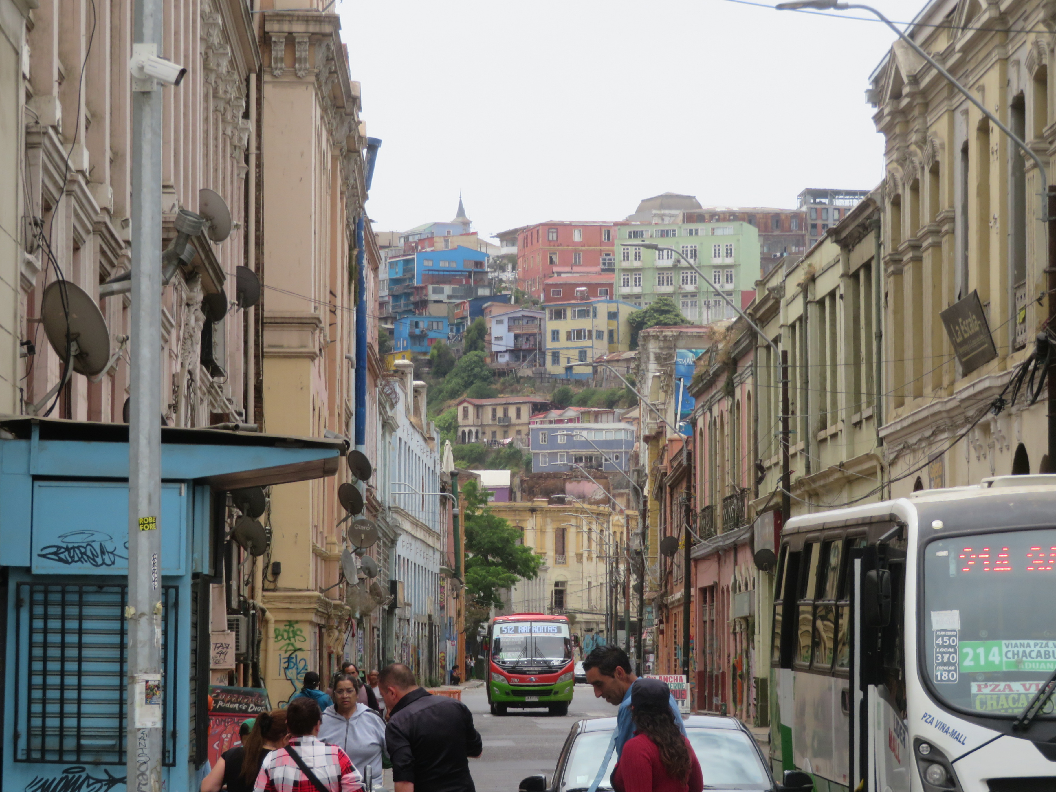
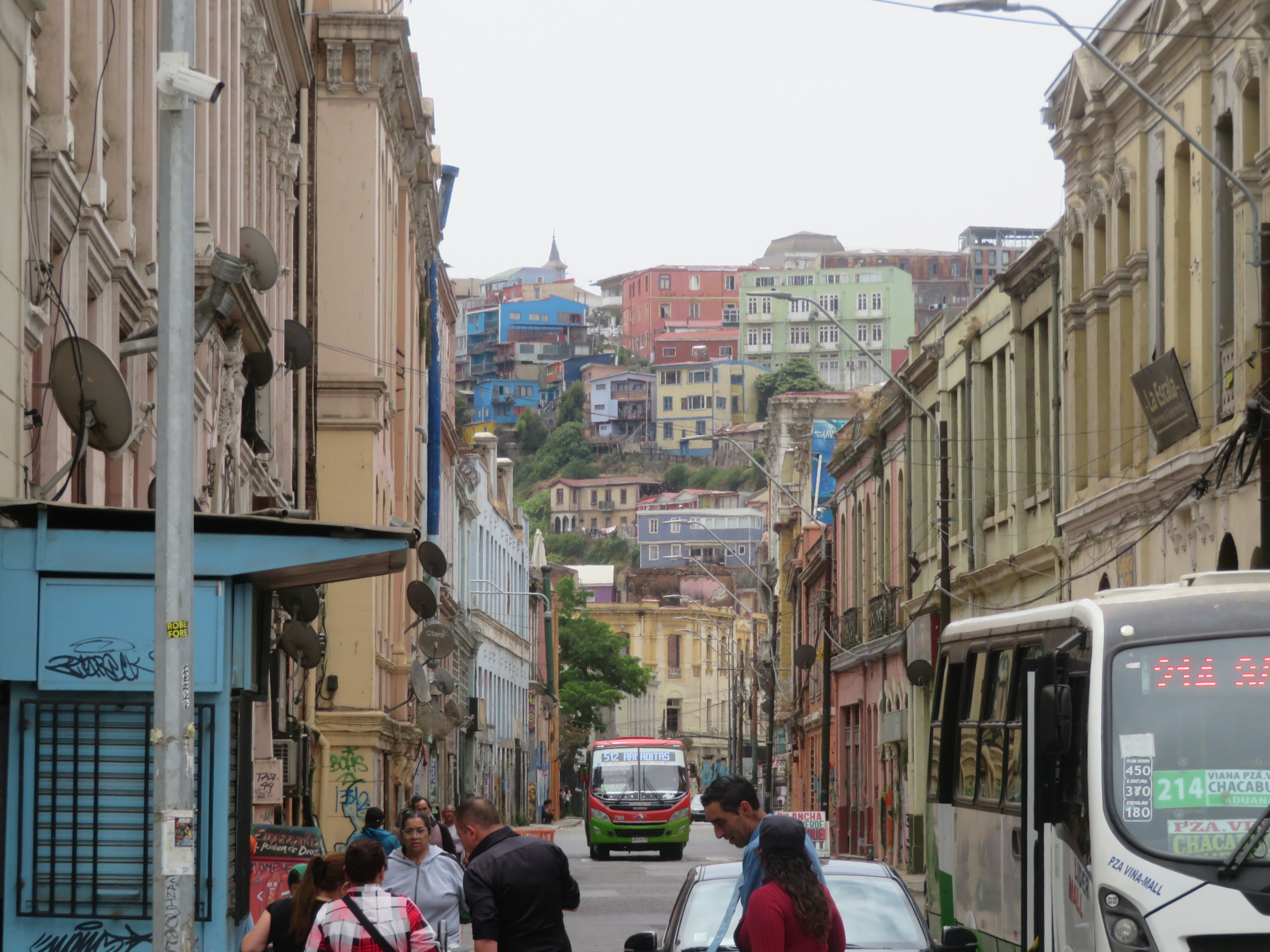
    We opted instead to explore more of Valparaiso which would also give us time for much needed relaxation on board.   Because the Harbor is located right in the center of town, it was a quick trip from the ship.  The Harbor is well-known for its location in the heart of the city.


    IMG_6014-001Plaza Sotomayor

    The Plaza is  practically next door to the harbor.   This side of it  houses the headquarters of the Chilean Navy (Armada de Chile).  


    IMG_6017

    It really is a very hilly city. 

    We saw some of the interesting barrios as well as some lovely views of the harbor from the hilltops (where I didn't take picture).    


    A  Valparaiso Dock dec 23 24
    Ascensor El Peral

    We took this funicular railway to the top of one of the hills.  El Peral was built in 1902 and is one of sixteen remaining funiculars in the city– there used to be at least 30. The remaining ones have been declared Chilean National Monuments.  

    A  Valparaiso Dock dec 23 241-001Fonck Museum

    We visited this museum which is housed in an impressive mansion that used to belong to a wealthy Valparaiso family.  It is now a municipal property.  We especially enjoyed the history and artifacts from  Easter Island, a part of Chile sadly not included on our itinerary (just possibly because the Island is 3000 miles away from Santiago!)    We couldn't take pictures inside but were happy to see all we did.

    And we were happy to be in Chile and looked forward to the rest of the journey.  

    #

    ________________________________________________________________

    Footnote:  One thing about travel is that you have more places you know and remember well, so that when disaster hits there, it has even more meaning to us.  We've had that happen before to places where we've stayed and sadly I'm sure it will happen again.  But this time it happened almost right away.  We'd only been back home a few days when the town of Valparaiso was hit by devastating wildfires that ripped through the country's Pacific Coast.   Over 120 people were killed and more are missing.  Tens of thousands lost homes which were destroyed by flames.   This year, the record summer droughts and high temperatures throughout the continent of South America created conditions ripe  for forest fires.   

    I  won't discuss climate change any further because that's not the purpose of this blog which I try to keep a happy place.  But the reality of what happened  later affects our memories of this lovely town and that can't be ignored. 

      _________________________________________________________________________ 


    Linking this week to the following sharing opportunities:  Thank you to the hosts.

    MOSAIC MONDAY;   THROUGH MY LENS; TUESDAY TREASURES;  MY CORNER OF THE WORLD; and  THANKFUL THURSDAY

  • Ocean to Ocean

    We are at home for the season here at the Canal Cottage.   It was a long trip from Oregon, but not as long as you'd think based on the date of  the last post here on Full Time Life.     I've missed my blogging friends and am happy to be "back home" here in Blogland as well as in real life, here at our winter spot on the canal.

    It was a longer-than-usual trip this time, as we traveled not only from coast to coast, but even from Ocean to Ocean.  We flew from home in Oregon to South America and then by boat clear around Cape Horn on the way to our winter spot in the sun.   What an amazing world it is.  I'm so grateful that we were able to see this part of it!

    We flew to Santiago Chile where we traveled by bus to the port of Valparaiso.  Here we boarded the Jupiter, a Viking Ocean Cruise vessel.  This post is only an overview of the highlights.  (The pictures are not in chronological order.)   

    IMG_1836

    The beautiful view in the picture above is the Pacific Ocean as we traveled through the Chilean Fjords.  This was  the early morning view from our stateroom on an at-sea day.   

    Amal gl

    On another day at sea, we traveled past the Patagonian Glaciers — more glaciers than we could count.  This is one of them.   We watched from our stateroom deck window and from the dining and public deck areas on the same side of the ship.  It was a beautiful moving panorama.

    Grandeur is the best word I can think to describe much of the scenery we saw  on this trip.   And grandeur is hard to  capture with a camera.  All my pictures are really just a tiny taste of the awe inspiring scenic beauty.


    IMG_6479


    The ship rounded Cape Horn on New Year's Eve day.    The peak of this archipelago marks the point where the Pacific and Atlantic Oceans converge and it's well known for rough seas.  It was raining  but the seas were calm.   This was good news for many,  but at least one person I know very well  (!) was actually  hoping for a bit more rocking sea adventure as we "sailed" the passage.  Calm or rough, it was an exceptional way to mark  the end of another interesting year.


    Mag island

    We saw Penguins!  Up close and natural.

    From the dock at Punta Arenas Chile, we traveled by  catamaran to Magdalena Island.  This view is as we approached the island dock.  We were able to get closer after we disembarked by walking along  carefully marked paths. 

    This cruise was a nice mixture of time spent out in nature, sea days with that stunning scenery and shipboard activities of our choice, and  some tours in big cities and small town port towns when the ship was docked for a day or two.  A few of those land sights are in the collage below:  


    Recovered Autosave

    Valparaiso Harbor Chile; Montevideo Uruguay; Puerto Varas Chile

    Port Stanley Falkland Islands (note the British Flag); Buenos Aires Argentina (The "Pink Palace"); Puerto Madryn Argentina

    South America best   temp2

    And here are a couple more penguins who waddled up as we walked along the beach in the Falkland Islands.   

    That's it for this week.  But there will be more details and more pictures  — we learned so much on this trip that we want to remember.  Pictures from winter here in the sun to come too I hope and maybe even some that  I  never did post from our time at home in Oregon.    Thank you to everyone who visits and especially to those who expressed concern about the long gap.  And thanks to the hosts of these sharing opportunities:  

    SATURDAY CRITTERS; MOSAIC MONDAY;   NATURE NOTES; THROUGH MY LENS; TUESDAY TREASURES;  MY CORNER OF THE WORLD;   THANKFUL THURSDAY;  and SKYWATCH FRIDAY