Category: The Whole USA

  • SCENIC IDAHO


    This week's pictures, nearly the end of the road-trip,  are all from the State of Idaho.   We've spent quite a bit of time in that State  over the years (both of us grew up in a tiny town in Washington State that borders  Northern  Idaho) and we have camped in  and traveled through parts of it many times in our life.     But surprisingly on this trip we found several new and interesting places to explore.


    DSCN2971-001


    This is Shoshone Falls on the Snake River near the town of Twin Falls.   I love waterfalls and Shoshone Falls was stunning.  We don't know why we'd never visited  before, as we have driven through that town several times in the past.    The contrast between the swiftly flowing water and the rugged Idaho landscape was fascinating.


    DSCN2966-001


    The Park area above the Falls was donated to the city of Twin Falls by the ranchers who owned the land, for the purpose of public enjoyment — and of course we were not the only members of the public doing just that on this day.


    Shoshone falls idaho 2017


    Among all the other tourists there was also a group of plein-air painters set up at various points around the Falls.  It was fun to sneak a peek over their shoulders to see the various artistic interpretations.   (I'm more than happy to let my camera interpret for me.)


    Roadtrip 2017 wyoming idaho2


    We saw these petroglyphs  in the Snake River canyon near the tiny town of Melba. Humans have lived in this area for at least 10,000 years.   We walked the trail to try to see some of the etchings left on the rocks.  They are quite faded and hard to see and the trail was fairly rugged, so I'm sure we missed a lot.


    Roadtrip 2017 wyoming idaho3


    We visited the World Center for Birds of Prey near Boise.  Naturalists at the Center are among those working to re-introduce California Condors into the wild.  This vulture, the largest flying bird in North America is also the most endangered bird on our continent.  Although ancestors of the bird were alive during prehistoric times, by 1982 only 22 of the species remained.  All of these were placed in captive breeding programs at that time.   Most of the young condors born here in Idaho are released near the Grand Canyon.   

    Today, the greatest danger to the newly wild condors are lead bullets.  Because the condors eat only dead animals, they may ingest particles of lead in animals left by hunters.   There is a push to stop the sale of leaded bullets, but I believe they are still being sold.   In addition to breeding condors for release, this Center also treats sick condors for rehabilitation.


    IMG_1039-001


    This pretty little Kildeer was among several wild birds we saw on the grounds of the Center.   At 9 inches or so, it looked awfully small  after we had just gazed at the Condors which have over a 9-foot wing-span.  
     

    DSCN2989-001


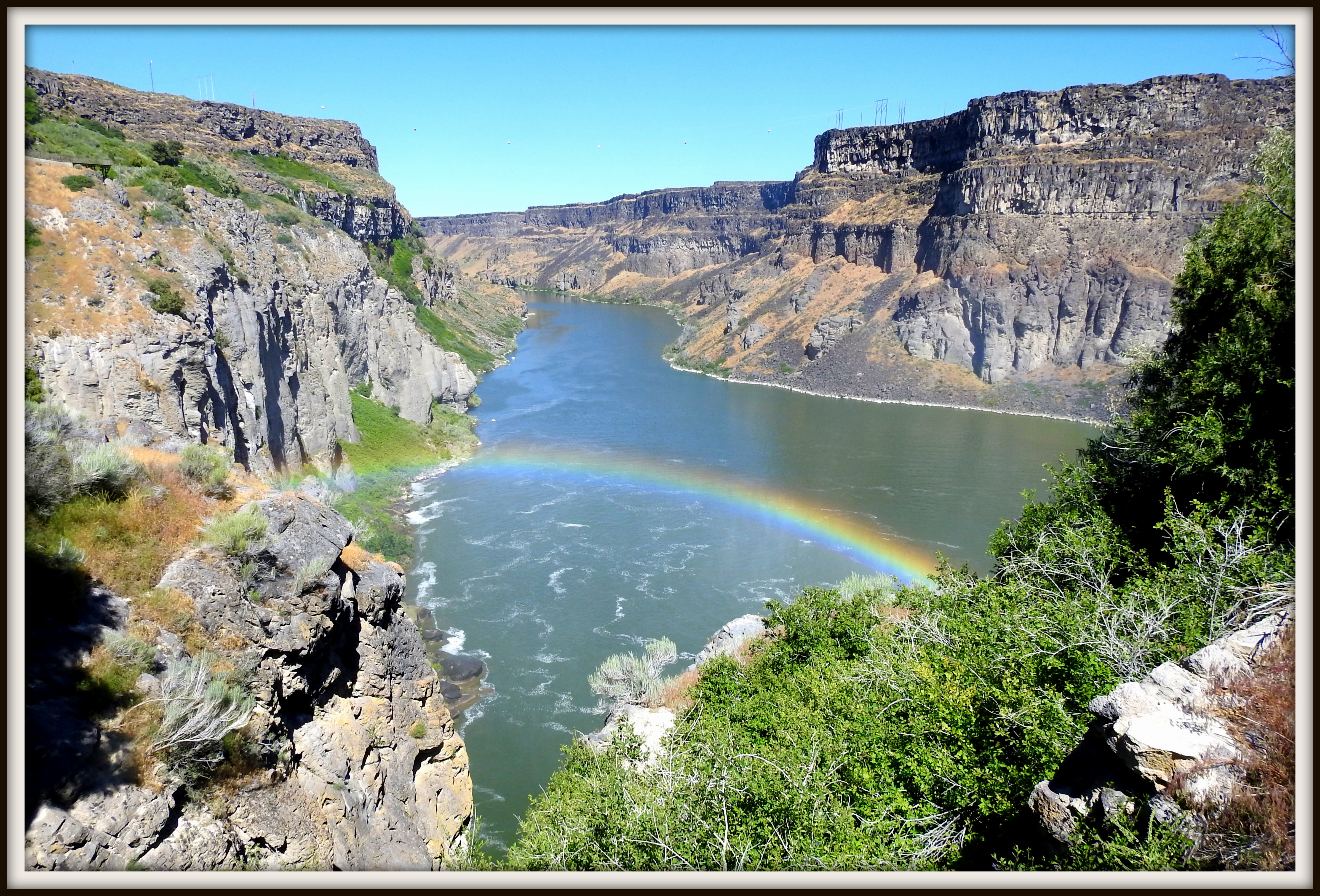
    There were lots of reasons to be glad we spent some time in Idaho on this trip.  And this amazing rainbow upstream from Shoshone Falls was definitely not the least of them.


    LINKING this week to:  OUR WORLD on Tuesday; MOSAIC MONDAY; ALL SEASONS; NATURE NOTES; THROUGH MY LENS; WILD BIRD WEDNESDAY; SIGNS SIGNS; SKYWATCH FRIDAY; SATURDAY CRITTERS; and RATHER B'BIRDING.  


    Thank you to the hosts for making these wonderful sharing opportunities available to all of us.


  • DRIVE-BY WYOMING and a STOP IN UTAH


    We've been happily at home in Oregon for over three weeks, but I'm still road-trip blogging — because there are still  fun pictures and experiences we don't want to forget .  

    After  we left Colorado on our way to the Utah stop I showed last week, our route took us across southern Wyoming.    We don't drive a lot of miles in a day, so we did stay overnight in Rawlins,  but, as it's been on most of our cross-country trips,  Wyoming was pretty much a drive-through State.    


    IMG_0954-001
     

    Blue sky, green grass and red rocks when we first hit the Wyoming border — outside of Laramie — but it wasn't  many more miles before we began to see the landscape that defines this part of the State … endless miles of sagebrush.


    IMG_0970-001


     It gets monotonous, but Sagebrush  is an important part of the ecological system ….


    IMG_0959-001

    (click for easier reading)

    … as the above sign (at a highway rest-stop area)  explains.


    Roadtrip 2017 wyoming idaho


    In the mosaic above, one farm animal behind the fence and some wild animals in the open are browsing that sagebrush.    We always lose count of how many pronghorn we see when driving across Wyoming.  I think there might be more of them than there are people.  

    Among the 50 States, Wyoming ranks 50th  in population but is the 10th largest in area.  According to Wikipedia there are 584,000 people populating just over 97,000 square miles.  (That leaves a lot of room for sagebrush and the wildlife it supports.)    


    IMG_0972-002
     

    We stopped in Kemmerer for lunch.     It is in this tiny town that James Cash Penney founded his first department store in 1902.   This, the "mother store" is still in the same downtown location where it all began.   Nowadays, you would almost always  find this national chain store in malls.   (If you found it at all, the way things are going these days. )  That very morning, we'd read yet another story about how brick and board stores are rapidly declining as more and more of us do our shopping on line.    


    We arrived at Bear Lake  (on the Utah/Idaho border) that afternoon and that was where we took the bird pictures I showed last week.   That State line is one of the few in the country (in our experience)  where you actually notice a difference in terrain and landscape almost as soon as you cross into the next State.   


    Bear lake utah4


      Bear Lake Valley  as seen from Logan Canyon Scenic Byway, Utah


    LINKING THIS WEEK to OUR WORLD on Tuesday; MOSAIC MONDAY; ALL SEASONS;  NATURE NOTES;  THROUGH MY LENS; SIGNS SIGNS;  SKYWATCH FRIDAY; and SATURDAY CRITTERS.

     Thank you to all of the hosts.


  • BIRDS OF BEAR LAKE


      On our way home to Oregon, we spent a couple of nights camping at Bear Lake.  The Lake, which straddles the Utah/Idaho border,  has been a favorite stopover  for years.  


    DSCN2924-001


    It is one of the prettiest, bluest lakes ever — though I never seem to quite capture that technicolor blue in pictures.   We always see birds when we stay there and again we weren't disappointed.    On this hot summer day we didn't see as many as on past visits which were in the Spring or Fall, but we had one sighting that made the stopover oh so worthwhile … 


    DSCN2898-001


    The American Avocet wasn't  a first-timer because in our previous  (pre-retirement)  life, we used to see them sometimes when we went camping in Eastern Oregon.  But that was long before the days of digital cameras (or blogs).   And even though I know these birds hang out sometimes in Florida as well as in Oregon, it had been years since we'd seen one.    So I was delighted with this sighting.   


    Bear lake birds1


    Above are some other birds near where the Avocets were hanging out.   I am guessing that the top birds were Wilson's Phalarope, but am more than willing to be corrected.  And we saw quite a few White Pelicans — it always surprises me to see them on inland waters.   


    DSCN2872-001


    This yellow-headed blackbird watched the water birds from a fence post and sang loudly to let them (or us) know he was claiming the territory.  

    The red-winged blackbird below is from when we were back in Colorado earlier in the trip, but included because it is interesting  to compare the two blackbirds…. 


    DSCN2812-001
     

    …and also because this picture  was taken by Geoff (our son) and it's a much better blackbird picture! 


    Bear lake birds2


    Here are a few more shots of the Avocet  –just because it was so nice to cross this beautiful bird off my photo wish list!  (I'd still love to see them again though — anytime, anywhere!)


    LINKING this week to :  MOSAIC MONDAY; NATURE NOTES; OUR WORLD;  ALL SEASONS; THROUGH MY LENS; WILD BIRD WEDNESDAY; SKYWATCH FRIDAY; SATURDAY CRITTERS; and RATHER B' BIRDING.  


    THANK YOU to all of the hosts.


  • ROYAL GORGE, COLORADO

    Please scroll down for SIGNS SIGNS entry. 

    Happy to be home in Oregon in real life,  but  in blogland remembering and sharing highlights from our recent roadtrip   …

    still in Colorado for this post.

    The incredible Royal Gorge Suspension Bridge hangs 965 feet above the wild Arkansas River.    Built in 1929, for over 70 years, it was the highest suspension bridge in the world.   The picture below was taken near the Royal Gorge Park Visitor Center.  Rather incredible in itself, this is a City Park belonging to the small community of Cañon City Colorado, where we spent one night on our trip. 


    DSCN2758-001


    The bridge cost $350,000 to build —   today that cost would exceed $20 million dollars.  From the Visitor Center there are 360-degree views of the Gorge and the Sangre de Cristo Mountains.


     The night before we reached Cañon City, we purchased tickets to ride the Royal Gorge Railroad through the canyon.  


    DSCN2669-001


    We boarded the train at the historic Santa Fe Depot.   Cars are air-conditioned and comfortable; food and beverages are available.  


    Royal Gorge Colordo


    We had a large picture window at our seat in the dome car, but the most spectacular views and photo ops were from the open observation car.   I spent most of the ride out there — but it was nice to have the air-conditioned space available inside.    


    DSCN2678


    Sometimes, as in the pictures in the collage, the train traveled through canyons so narrow that we could have touched the granite cliffs.  At other times, we looked up to the top of the 1,000 foot cliffs that towered above the track.   Above  is a zoomed-in view of the suspension bridge from way down below it.


    DSCN2697-001


    Most of the time, we could see the wild and winding Arkansas River on one side of the track and steep cliffs on the other.


    DSCN2741-001


    Here's the end of the train coming around a curve in the tracks — and a few other photographers capturing the moment as they leaned out over the railing.

    The next three pictures, like the top one in this post, were taken the  day after our train ride, when we drove up to the (city) Park.   There's a good-sized Visitor Center perched  on the side of the Gorge, 1,230 feet above the River.  Historical photos and information about the area and lots of family activities are available.


    DSCN2764

    DSCN2763-001


    A wildfire destroyed 90 percent of the park in 2013 and the Visitor Center was completely rebuilt.  The Bridge itself was minimally damaged.   I like to walk across bridges and we had heard that you could walk across this one, but we learned at the Visitor Center that it is only open for pedestrians twice a day.  We missed the morning time and didn't plan to hang around for the evening hour.   (Also we learned that you have to pay an admission fee even to walk the bridge.)


    DSCN2761


    We might  have walked the bridge, but here's one of the adventures Cañon City offers that did not tempt me at all.    We've taken trams up and down snowy mountains in at least a couple of places, but thinking about swinging above all those sharp granite rocks was more than a little shivery.


    DSCN2721-001


    We were glad we were able to visit this spectacular natural wonder.    Here is one more view of the bridge from down below (on the train ride) ….  I like  this one because it shows off Colorado's beautiful blue sky, the  subtle colors of the incredible granite cliffs, and the amazing man-made wonder of the bridge all in one quick shot from the open train car. 


    ** My one new thing to learn this week was how to make the tilde mark above the 'n'…. but I had to use Bill's Mac to do it.  (He's Mac, I'm PC)….and so now you know that Cañon City is pronounced in the Spanish way more like Canyon than canon — which makes sense and makes me much happier.


    Sharing this week with the blogging communities at:  OUR WORLD; MOSAIC MONDAY; NATURE NOTES; ALL SEASONS; SIGNS SIGNS;  THROUGH MY LENS; and SKYWATCH FRIDAY.    

    Thank you to all of the hosts.


  • RE-‘OREGON’IZING


    We are home again in Eugene and whipping our summer home back into shape (stocking empty cupboards and refrigerator, working through the big bag of laundry from the last of the roadtrip … and, not least, trying to remember where everything belongs here in the apartment.)    There's a bunch of unsorted  road trip photos, but until there is time for that task, here are a few from our stay in Colorado  (approximately the middle of the trip).   


    IMG_0933-001


    This picture and those in  the mosaic below were taken during evening walks on the greenway behind Geoff's and Lisa's home.  It was easy to put this post together because every picture I took of this lovely area was usable 'as is'  …. you can't go too far wrong with scenery like this. 


    2017-007


    I don't know what's wrong with me that I managed to snap a picture of Cody (their dog) and none of the handsome and charming person on the other end of the leash.  I am so bad at taking pictures of people  – too busy enjoying the good company!  


    2017-06-17


    On our way to enjoy the delights of downtown Boulder one day,  Geoff and Lisa detoured through Loveland so that we could check out Benson Sculpture Park.   I fell in love with this collection of outdoor art years ago when we used to stay at an RV Park near here.   That was when we pulled our home behind us (the 40-foot Fifth-Wheel RV)…. back then, since we lived in the RV full-time, it was easier to stay in it when we visited than it would have been to pack stuff up and stay in the kids' guest room.      

    Above are some old favorites  – most were here the first time we visited the park.    Geoff had the camera and his pictures show what a good job the Park does of placing the statues.  They're not just plunked down in a row, but rather situated so that you can almost believe … those lions are moving stealthily through the savannah … the kids are riding double down the sidewalk … the sweet gardener is thinking about what she'll plant next …  


    2017-06-171


    Benson Park holds a juried selection process annually.    These are some of the newer installations.   We loved the ones on the left and in the middle, disliked the one on the top right and were unsure of the one on the bottom.   But it is a good thing that the judges choose art that appeals to different tastes.     


    SHARING our Colorado family's "backyard" with SKYWATCH FRIDAY; SATURDAY CRITTERS; ALL SEASONS; NATURE NOTES; MOSAIC MONDAY ; THROUGH MY LENS; and OUR WORLD on TUESDAY.


     Thank you to all of the hosts.


  • HALFWAY DOWN THE ROAD


    We've been in Colorado for a week… about halfway to our summertime destination in Oregon.    We enjoyed the journey (most of it anyway) and it's good to be here at what feels like our home away from home (or our halfway house, maybe).    Beautiful scenery here in this gorgeous state, lovely weather, and best of all our very own Colorado family.  
     
     
    IMG_0924-001
     
     
     There's more sky than mountains in this 'through the car window' shot, but it's a tradition to snap a picture of the first mountain range we see after living in flatland Florida for half the year.   This shot is getting close to our Colorado destination and I will probably be blogging about Colorado until well after we're home in Oregon.   


    The rest of today's post however  is about the journey to get this far.   Our first two stops along the Florida Coast were in small cities that Google Map apparently doesn't think deserve more than a dot on the map (and Google is probably right).  

    The third night we stayed in beautiful Gulf Shores State Park in Alabama.   After that, we stayed in Vidalia Louisiana (directly across the Mississippi River from Natches.)    Those were both wonderful stops and Google really should have given them credit.  After that,  over-night stops in Mt. Pleasant and Vernon both in East Texas, Raton in New Mexico, and Canon City on the Colorado border.  And then we were 'home' (at the kids).  

    It was not  the most efficient route nor the fastest, but we like to avoid freeways when we can …it is a better way to see what the country really looks like.  It is slower, but more interesting — and we're fortunate to have lots of time.   And because we do, as is obvious, we also drive short days.


    2017-06-151


    However we  didn't see much beautiful scenery for the first three days of the trip.  It  was pouring when we left our Florida home and that hard rain continued as we made our way along the coast.  

    It would have been churlish to complain, because Florida has been in a drought for some time and the rain was much needed.  (But I must confess to wishing it would stop for a few minutes every so often.) 


    IMG_0877-001


    We were in Alabama before we saw the sun….and here it is setting at Gulf Shores State Park after we stopped for the night.  This beautiful park is near Foley Alabama.  We spent a winter near here back when we were full-time RVers and it was fun to see familiar places (and have an early dinner in a favorite restaurant, which was just as good as we remembered from way back then). 


    2017-06-154


    Evening walks with beautiful sunsets and birds are amenities that freeway motels don't usually offer.    But they are common benefits when camping across the country.  The Purple Martin houses were at Vidalia and the other birds along one of the trails at Gulf Shores.


    IMG_0899

    At Vidalia, this cute little guy (and a few more of his family members) visited our front yard.  The first black squirrels we've ever seen.


    IMG_0894-001


    This picture is taken from in back of our camper van  at Riverview RV Park in Vidalia.   We were settled in to our spot just yards away from the mighty Mississippi River.   The tugboat is pushing a row of barges that must have been a quarter mile long.  It had to go under that bridge and around a curve in the river.  We admired the pilot's skill as we walked along the  lovely walking path between the river and the park.


    LINKING these recent travel memories to:  OUR WORLD on Tuesday; NATURE NOTES; MOSAIC MONDAY; ALL SEASONS; THROUGH MY LENS; WILD BIRD WEDNESDAY;  SKYWATCH FRIDAY; SATURDAY CRITTERS; and RATHER B' BIRDING.    Thank you to all of the hosts.


  • VISIT TO WASHINGTON (STATE)


    Earlier this month we traveled North to spend a few days visiting our son and his family in Tacoma (Washington State).    We like to explore and  so does our son, who guided us on this day drive through pretty farm country (although it is also rapidly growing housing developments).   We saw Mt Rainier from a side we hadn't visited before.  


         DSCN0491-004


    Views of the Mountain from the town of Orting heading towards Rainier National Park.   


    DSCN0485-001


     Mt. Rainier is the tallest peak in the Pacific Northwest and it is an active volcano.  


    2016-11-171
     

    Signs in the Orting City Park remind area residents to be prepared in case of an eruption.  As the sign says, it may not happen in our lifetime, but preparedness is the best defense.

    Just as in Florida where streets and highways are marked with hurricane evacuation routes, here in this part of Washington, there are volcano evacuation routes. 

    (Danger lurks everywhere, but we might as well enjoy the beauty in the meantime.)


    DSCN0495-001


     A few miles outside of town, we crossed the Carbon  River.  It flows from Carbon Glacier on the Mountain and joins the Puyallup River at Orting.  We walked over this bridge for amazing river and forest views.


    A few miles further on, we  stopped to walk in this mini rain forest area barely into the National Park.


    DSCN0515-002


    Bill and Pete — wondering if that rickety boardwalk is safe.


    DSCN0538-001

    Sure, why not.  Let's do it.   

    (I have more problems with city sidewalks as it turns out.)


      2016-11-17


    It was a green and beautiful nature walk — but cold!


    DSCN0547-001


    And no wonder — by the time we headed back to town for dinner,  there was even more snow on the Mountain than there had been in the morning.

    ***

    Linking to:  Our World; Nature Notes; Mosaic Monday; All Seasons ; Wednesday Waters; and Signs Signs.  

    Thank you to all of the hosts. 

  • ITTY BITTY PRETTY TOWN


    On our drive through Washington's rolling farm country,  we stopped for a break in the  town with the same name that the whole area is known by – Palouse.  We found a lot to like in this tiny town with  a population of fewer than a thousand souls. 


    P1040737-002


     This is the Palouse Caboose where we had a good lunch.  They featured local farm products — I had a veggie bean  burger that was pretty darn good — lentils and dried beans are an important secondary crop around here (next to wheat as shown in the previous post).

     Notice the logo for Washington State University on the doorway – –  this University, which began as a Land Grant College, is located in Pullman, less than 20 miles away.     WSU is Billl's alma mater and obviously that of the young guys who  owned and managed the restaurant/bar. 

      After our good lunch, we stretched our legs by walking around town.   It was a pleasant way to break up a long drive.  And of course I took pictures.   

    2016-09-083


    The town park was tiny, but perfect… roses seemed to be at their peak.   I appreciated the chance to take some flower pictures, especially since I haven't yet made it to the Rose Garden at  home in Eugene (there is still hope).


    P1040738-001


    Bill spotted this ghost sign across the street from the restaurant.   We have never seen one with so many ads on one building. 


    2016-09-082


    Because we've  lived in small spaces for quite a few years now, we don't need any more of what this store had to offer.  In fact "Stuff Store" is what we call junk and souvenir shops .. and we save money because we hardly ever need anything they have for sale.  But this is the first time I've seen such a store that actually calls it like it is.  (I'm not sure about the lamps and furniture, but here's a yellow-shirted photographer reflected in the top right photo that is guaranteed to be the  genuine vintage article.)


    P1040733-002


    And just because I've missed linking  to SKYWATCH Friday for way too long,  here's a slightly different view of the blue and gold  vistas just outside of this little town.  (There are more in the previous post.)


    Linking to:  SIGNS SIGNS; GOOD FENCES; TODAY'S FLOWERS; SKYWATCH FRIDAY; and next week's MOSAIC MONDAY.  Thanks to all of the hosts.  

  • PALOUSE COUNTRY

    We drove  the Palouse Country Scenic Drive last week on our way to celebrate a family birthday in Idaho. 


    P1040732-002


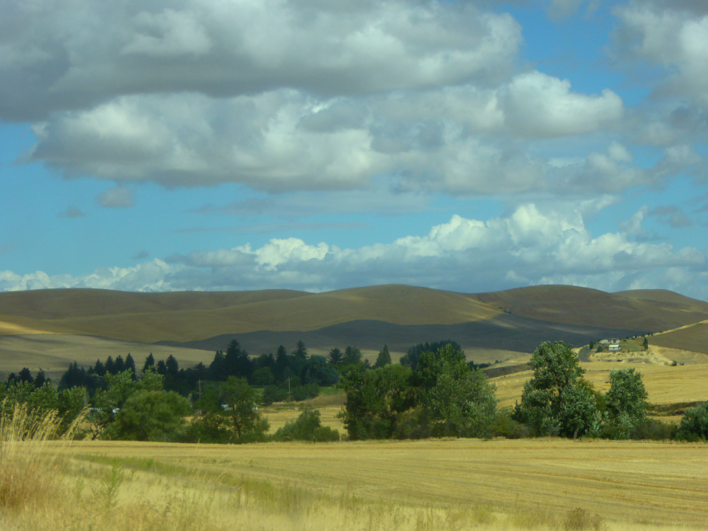
    The Palouse region  is a major agricultural area in Eastern Washington State  – where both sides of our family are from originally from.  We were married there and lived there (except for a couple of years) for the first years of our married life.     And even after we moved our own family to western Oregon we made scores of trips through this area  to visit our parents and other family members who still lived there.   Back in those days  I admit we used to take the beauty of the Palouse for granted. 


    P1040734-001


     But we don't make many trips that way nowadays  – no family members in our old home town any more and the area is quite remote and not usually on the way to any place where we're going.   So it was fun to have a reason to make the drive again – thanks to our (much) younger brother turning 60 and celebrating it in Northern Idaho.


    P1040731-002


    Now that we have more time to enjoy the scenery, we also have more time to indulge our curiosity and we wondered about these unique and beautiful hills — so unlike what we see in our part of the Pacific Northwest.   We not only have the time and the curiosity, but also of course that lovely laptop research tool  we carry with us at all times these days.   Wikipedia tells  us  these rolling  Palouse hills are formed by many layers of loess — a soil formed by fine-grained windblown sediments.  

     At its thickest, the Palouse loess measures 246 feet.   The older layers accumulated between 1 and 2 million years ago.  (Click the link to read more of the interesting history and geology of the area.)


      P1040730-003


    We all have to eat and the rich soil of Palouse makes it one of the prime wheat-growing regions in the country.  However, the intensive farming practiced here – roadbed to roadbed — leaves few fence rows and few small streams — therefore, not very many birds.    In recent years however, some agricultural lands in the region have been converted to large suburban home sites and these large yards have attracted many more birds.    That's a good thing.


    LINKING to OUR WORLD on Tuesday; SEASONS; NATURE NOTES; and THE BARN COLLECTIVE.    Thank you to the hosts.


  • Have a Nice Fall

    Image

    Even though Autumn  doesn't officially begin until September 20, Labor Day Weekend marks the start  of the school year and the end of summer activities for many.  It seems like the end  of summer even for those of us no longer living on a school year calendar.   

    The picture above  is a repeat from my first ever post to this blog … Almost nine years ago. 

     We are spending the long weekend in Idaho and the rest of the pictures are from near where we are staying.

    Image


    This post is my first attempt at blogging from my IPad.   


      Image


     After nine years, it is probably time to learn some new tricks.


    Image
     

     But I think I like the old way  better!


     Linking to:  OUR WORLD on Tuesday; SEASONS; THE BARN COLLECTIVE;and SIGNS SIGNS.  Thank you to the hosts.