Category: The Whole USA

  • FAIRBANKS and CHEENA HOT SPRINGS

    Hope everyone isn't sick and tired of Alaska flowers;  they did so amazingly well up there that I just couldn't stop taking pictures.   The one directly below is from River's Edge RV Resort where we stayed in Fairbanks.  This Park was on the Cheena River and besides having excellent RV facilities, and a  lovely river path to walk, it also had rental cottages, each of which had its own hanging basket.  This is one of them. There was also an excellent restaurant on the grounds.   

     P1010633

    We actually stayed at this RV Park two different times.  There aren't a lot of highways in the State and so it was almost impossible to do circle trips — there was a lot of out-and-back driving.  Which was always fine because there was too much to see on one (or even two) trips.  And of course, when your day ends at a nice stop like this one, it is even better.  

    When we left Fairbanks after one of our stays we were headed to the Dalton Highway — up to Prudhoe Bay and the Arctic Ocean.   We knew that would be kind of a roughing-it trip, without nice RV Parks, so we took advantage of the city facilities at the RV Park and in Fairbanks. 

    While we were there we read about a resort called Cheena Hot Springs that had RV spaces.  Even though it was only about 70 miles from Fairbanks, it sounded intriguing, and it was sort-of on our way toward the Dalton so we decided to stop there for a night.


    P1010670-001

     We found the resort and the attached RV Park, which had spaces out in a woodsy area.   Above is what our "carpet" underfoot looked like after we settled our little camper van into its spot.    

    Then we walked over to check out the resort grounds.  There were beautiful flower gardens.  And we checked out the Hot Springs — there were several spring-fed pools and hot tubs that were absolutely beautiful.  And another wonderful restaurant.  And more.

    It did not take us long to decide that we needed to stay a few more nights.  I guess I had hot-tub brain because I totally forgot to get a picture of the wonderful pools, but really they were amazing!  I did get flower pictures.


    Chena Hot Springs1


     And (before we developed that hot-tub brain from soaking in the mineral springs) we learned that the owners of the resort are working toward becoming a self-sustaining community.   Vegetables are already grown in year-round greenhouses that are heated entirely by geothermal sources.     


    Chena Hot Springs

     We signed up for the very informative tour of the greenhouses and geothermal facilities.  We learned that Cheena, in conjunction with the Department of Energy, is funding a project to use the geothermal reservoir which underlies the area.  They are also working with the University of Alaska on several environmental projects. 

    When there is more produce than the restaurant can use, the resort sells it at the Visitor Center —   we bought some wonderful tomatoes and lettuce to take with us when we left.   


    P1010634

    The Resort also boasts an amazing Ice Museum which we toured.  But that's a whole other post someday.    We really enjoyed our stay at Cheena Hot Springs.   (Here is a link to their website.)  


    LINKING this post to TODAY'S FLOWERS; I HEART MACRO; MOSAIC MONDAY; and NF BLO-MA.   

    Thank you to Denise (TF); Laura (Macro); Judith (MM) and Monica (Nature Fotos).    Each of these lovely hosts have  amazing blogs and it is great of them to take time to host these fun sharing opportunities.  


  • INDEPENDENCE MINE


    Independence Mine is an Alaska State Historical Park.   There is more  information about the gold-mine's history in an  earlier post from while we were on the road (HERE).   This  is more about the structures on the old mine site. 

    Fence
    This pretty chain-link fence bordered the walkway to the Visitor Center, which is in what was the Mine Supervisor's home when this was an active gold mine.  


    P1010389


    As we walked toward the Center, some of the other mine buildings were visible. … housing and offices for the various occupations and professions that it took to run this kind of operation.


    P1010396\

     This is a view from the Visitor Center window…  It would have been the Supervisor's living room window … he and his family could have sat in comfort and seen quite a bit of the site. 

    (From all accounts, he was a good supervisor well-liked by the people who worked there.)

     A few more of the buildings are open to the public and there are great informational posters in the Center and along the pathways.  We also walked up the hill to where the actual mining operations took place.

    P1010408-001


    The fencing here really didn't seem quite adequate to protect visitors.  Notice the people on the left of the picture — no fence at all between them and the mine-shaft ruins. 


    P1010429

    Poignant and almost elegant in decay, not to mention hazardous.  We were surprised (but pleased)  that the State has left these ruins standing for the public to see.   


    LINKING TO OUR WORLD on TUESDAY (thank you to Lady Fi, Arija, Gattina, Sylvia and Sandy) to Roan's RUBBISH TUESDAY and Tex's GOOD FENCES.  Thank you all.


  • A FOREST OF SIGNS

    Signpost Forest is a (free) roadside attraction in the town of Watson Lake BC.  In 1942, when the Alaska Highway was being built, the US Army Engineers put up a directional post at their camp at this location.  The signs pointed to camp facilities and the nearest communities.    A homesick private named Carl Lindley added a sign pointing to his home town of Danville Illinois.  That started a tradition that is now known as the World Famous Signpost Forest.


    P1020661


     According to Watson Lake's website there are now over 72,000 signs.  Anyone can add one — and  obviously many tourists do.


     P1020659


     The tradition is to bring your own home-town sign,  but a few other kinds of signs seem to have snuck in there as well.


    P1020658


    We stayed in Watson Lake on our way back to the lower 48.  And (only partly) because we'd never heard of this tradition we didn't add a sign — we just took the ones that were already there (pictures only).  

    So if  you visit Watson Lake, don't forget your sign.  


    Linking to SIGNS SIGNS (obviously) and GOOD FENCES (stretching a bit, but the meme is about gates too and the top pictures does show the gateway into the Forest.)


    Thank you to Lesley for Signs and Theresa (TexWis Girl) at the RunAroundRanch for Good Fences.  Visit and link up!!


  • AMAZING ALASKA QUICK-STOPS/PHOTO OPS

    There is hardly anyplace in Alaska that isn't a photo-op.   Even when we were just driving from one place to another, we usually had to stop every few yards to take a picture.  These are a few of those quick stops as we drove between Valdez (where we'd stayed for over a week) and our next (several-night) stop in Mt St Elias National Park.  


    P1020201

    We got out to stretch our legs along the Gilahena River. 


    Swans

    An elegant pair of Trumpeter Swans.  We saw them  just after we left Valdez.  


    Swans1

     More scenery as we walked along the lovely Gilahena River.


        LINKING TO:  SCENIC WEEKENDS,  SKYWATCH FRIDAY,  SATURDAY CRITTERS, I'D RATHER B'BIRDING and MOSAIC MONDAY.  

    Thank you to the hosts  for making these sharing opportunities possible. Each of them has a beautiful blog of their own in addition to managing these memes.   

     THANK YOU to Gemma for SW; to Yogi, Sylvia and Sandy for SWF;  to Eileen for SC;  to Ani of the Bird D'Pot; and to Judith for MM.    

    Your generosity is appreciated!

  • ARCTIC OCEAN GEESE

    P1010803The town of Deadhorse (Prudhoe Bay) Alaska is  the biggest industrial area you've ever seen.  There are no homes, no shopping,  not much of anything except machines and shops and trucks associated with oil drilling here at the start of the Alyeska Pipeline.  

    The people who work for the various drilling and trucking companies live in barracks called "Man Camps,"   where they eat, sleep, and, I guess, play if they have any time.   They work for varying lengths of time (three weeks or longer) and when the time they signed up for is over, the company flies them back and forth at no cost to Anchorage or Fairbanks for their equal time off .    There are no parks or outdoor recreation areas or amenities at all.

    So,  you wouldn't usually go birding in the industrial area of town.  But Deadhorse sits smack on the edge of the Arctic tundra,  which is the breeding grounds for several species.  We hadn't really thought of that though and so we didn't really give ourselves the time to really GO birding here.  But, without really trying we saw quite a few wonderful ones anyway.


    P1010828

    There were several families of Greater White Fronted Geese.  This was a first-time sighting for us.

    And tons of Snow Geese — both the blue phase and the white.    We had seen flocks and flocks of the white ones in New Mexico one Fall several years ago.    That might even be where these very ones will end up, since they leave the Arctic sometime in October. 

    P1010844

    The blue ones were new to us.    When we took the security bus to the Arctic Ocean, there was a hand-made sign out on the tundra (near the oil rigs) that said "Slow Please.  Snow Goose Flight-Training Area."  It made me  happy to know that the workers cared.  (I wish I could have gotten a picture of the sign.    But the driver had his timing down to the second, so I couldn't even ask.)  (Here is a link to an earlier post about this area.)


    P1010830

    Another shot of the white-fronted goose family. 


    P1010843


    These look like Snow Geese, but their billls look black.  Maybe it's a trick of the light.  Otherwise, I'm not sure what these guys are.   


    Sharing these Arctic Ocean sightings with  WILD BIRD WEDNESDAY.  Thank you Stewart.

  • VOLUNTEER PARK WATER TOWER


    The Tower in Seattle's Volunteer Park was built as a water reservoir in 1906.   We climbed the 180 steps (!) to the observation deck which put us at the highest point on the City's beautiful Capitol Hill.

      P1020788
     

    Placards on the brick walls tell the history of Volunteer Park.  (We learned that it was named as a tribute to Seattle's volunteers in the Spanish-American War, which was not at all what we'd first assumed.)   Other signs pay tribute to the Olmstead Brothers who designed the Park's Gardens and lawns. (They designed Central Park and the Biltmore Mansion among other places.)  

    A walk around the circular deck gave us a 360 degree view of beautiful Seattle.


    P1020783-001


    From one window we saw the Space Needle and Puget Sound beyond it.  

    Of course you could see the whole City from the top of the Space Needle too.  But it would cost you — at the very least an expensive meal.  The Water Tower is free and not as touristy.  

    We felt like locals because I think everybody else up there was. There was even a small group of four-year-old girls celebrating a Princess birthday in the magic tower!  And of course their mothers (also in costume) were even having more fun.  

    We were lucky to have a very knowledgeable local guide in our brother-in-law, otherwise we'd never have known about this great spot.


    P1020777
      

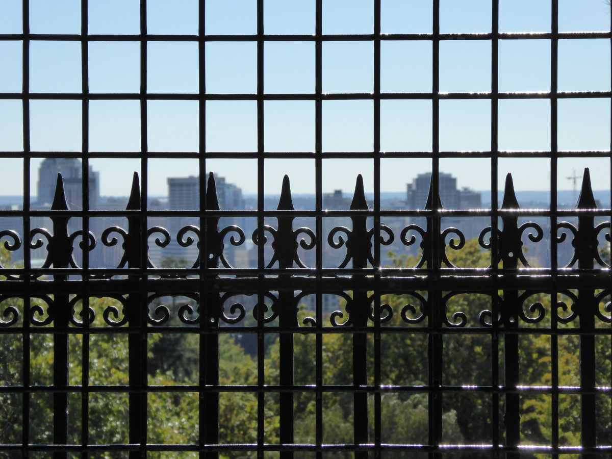
    The window fences are quite an elegant way to keep people safe.   And of course looking through them is the actual way our eyes saw the views.  Sometimes I shot what we saw.

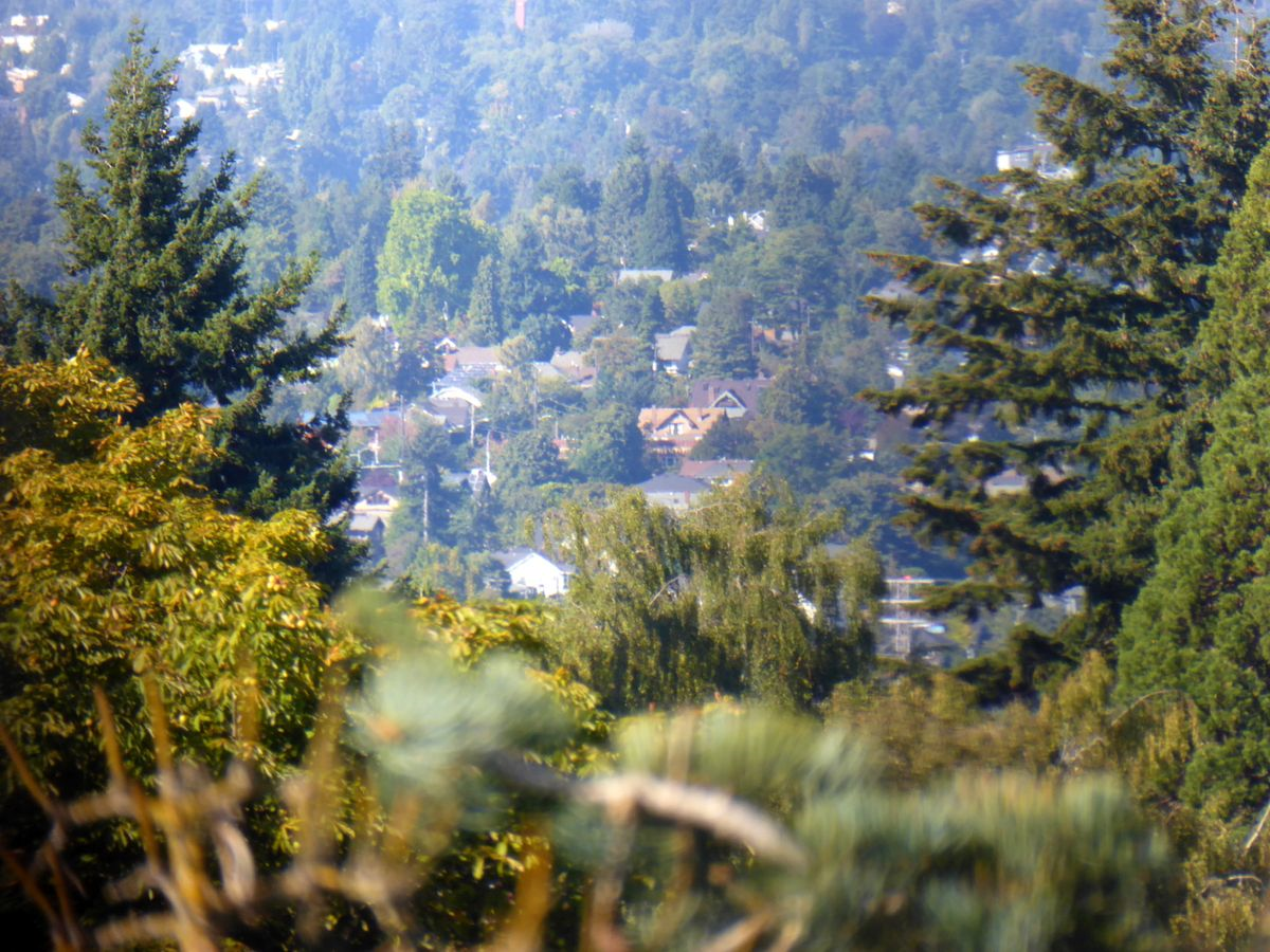
    And sometimes I poked the camera lens through the big spaces above the window fences and just shot away.   


    P1020785

    Below a couple of views of Emerald City green:


    P1020787


    P1020781-001


     There is a lot to see in beautiful Volunteer Park and I hope we can go back on our next visit to Seattle.  (The Arboretum where we saw the beautiful orchids and the stinky corpse plant (HERE) is also in this park.)

     Sharing these views of beautiful Seattle with OUR WORLD TUESDAY and GOOD FENCES.

     Thanks to Lady Fi, Arija, Sandy, Sylvia, Gattina, and Jenn for hosting OWT and to Theresa for GF.


     Seattle Park's  page about the tower is HERE.  


  • MATANUSKA VALLEY GARDENS


     Back in July we visited the Garden at the Palmer Museum.  Palmer is in Alaska's Matanuska-Susitna Valley (South-central part of the state).  This area was settled by homesteaders and farmers and the farming community is still productive.

    P1010315


    I was surprised to learn how well  things grow in this State that we outsiders tend to think of  as the 'great frozen North'.   

     Summer is a short season up there, but the long daylight hours and rich glacial soil (especially in this Valley) contribute to remarkable growth.    Record-setting vegetables are grown here.    Everything in the cabbage family, winter squash, and most root vegetables do especially well and the museum grounds had several demonstration vegetable plots.

    But I mostly took pictures of the beautiful showy flowers. 


    P1010305


     Big cabbages may win blue ribbons for Matanuska Valley farmers, but  the big beautiful showy peonies won my heart.


    P1010296

      The gardens were bursting with color.


    P1010301


    LINKING TO:  TODAY'S FLOWERS  (thank you to Denise) and to I HEART MACRO (thank you to Laura).

  • WE DID IT … BACKWARDS

    The Alaska Highway (formerly known as the AlCan) was built during WWII to connect the United States to its (then) territory of Alaska through Canada.   It opened to the public in 1948, when much of the route was still rough and unpaved.  Quite a few  tourists who braved it bought the bumper sticker that  said "We survived the Alcan." 

    P1020749-001


     Now paved over its entire length, it's fairly smooth driving.    Not the worst road we've ever driven by far.  Not even the worst one in Alaska.  But we honored the history of those who went before by taking the obligatory picture of  the start of the highway — at Dawson Creek BC.    (Only, for us, Dawson Creek was the end rather than the beginning of the road.)


    P1020320-001


    Like just about everywhere in Alaska, the drive-by scenery along the Highway was stupendous.   


    P1020297-001


    But also like everywhere else in the State, there are only two seasons:  Winter and Road Construction.  One time, we followed this pilot car for over 15 miles.   Road crews keep very busy repairing frost heaves and other weather damage.


    P1020321-001


    Of course, the scenery was even better when we could get out of the car to explore and we felt fortunate to be able to do that.


     From the Alaska Milepost guidebook:

    "The Alaska Highway begins (or ends) at Mile 0 in Dawson Creek, BC. The first 613 miles/987 km of the Alaska Highway are in British Columbia, where it is designated BC Highway 97 North.  

    The highway travels in a northwesterly direction to the Yukon  border near Watson Lake, YT (Historical Mile 635). From there it continues as Yukon Highway 1, crossing 577 miles/929 km of Yukon to Port Alcan on the Alaska border.

    The Alaska Highway crosses into Alaska at Historical Mile 1221.8, where it becomes Alaska Route 2. From this international border, it is 200 miles/322 km to Delta Junction, AK (Historical Mile 1422), the official end of the Alaska Highway. " 


    We drove all of it.  Not in one fell swoop  –   parts of it at a time with side jaunts here and there.     We stayed overnight in Delta Junction (the end/beginning of the Highway) on August 2 and we got the other end at Dawson Creek on the 5th of September.  Even covering all those miles, that gave us  some time to explore.

      P1020313-001


    So we  survived the Alcan Highway — even though we did it backwards.  (There might be a metaphor for our life in there somewhere!)


    LINKING with the wonderful sharing opportunity provided by the host team of OUR WORLD on TUESDAY.  Thank you Lady Fi, Sylvia, Sandy, Gattina, Arija, and Jenn.

  • DECORATED FENCES in Seldovia

    Scroll down for the bird!

    Seldovia was the picturesque Kenai Peninsula island village where we spent several hours in the middle of a day cruise  (HERE if you missed it).    The town was full of photo opportunities (which is sort of the definition of picturesque, isn't it))!    And I knew as soon as I took the ones in this post where I'd eventually link them! 


    P1010082-001


     This was one of several sweet pocket parks that border the wooden sidewalks.   Besides the wonderful adornments to the wooden fence, there are forget-me-nots (Alaska's State Flower) and those big leaves are rhubarb, which  thrives in the State.  We saw it often, usually used, like it is here, as a decorative plant.  


    Seldovia-001

     More views of the boots on the fence.  We were there early in June.  Probably by later in the summer,  flowers were blooming in each one.

     Below is another Seldovia wooden fence with a living decoration sitting on it: 

    Seldovia1-001

     We watched the bird as it splashed in a puddle and then flew up to the fence to fluff out its feathers.  At the time, I was sure it was a young magpie, but when I downloaded the pictures I wasn't sure any more, because it looks like its eyes are blue.   I don't know what else it could be though.   Any help as always is welcome!  


    P1010069-001For comparison, here's an adult black-billed magpie, not on a fence but also in Seldovia.  

    (This picture reminds me that we saw more dandelions in Alaska than I've ever seen in my life.  

    We found it rather refreshing that people seemed to enjoy the bright yellow without getting all shook up because they were weeds.) 

    Spring and Summer are pretty short seasons up there so I'm sure they are happy for the color! 

    Linking this post to GOOD FENCES, with thanks to Theresa of the Run-A-Round Ranch and to (Saturday's)  THE BIRD D'POT with thanks to Anni  who would Rather Be Birding.

  • A MUSHROOMING POPULATION


    Nature has reclaimed the abandoned town of Dyea Alaska,  once a major port for Klondike goldrush travel.   Mushrooms and other fungi thrive where storekeepers once sold supplies to stampeders.


    P1020546


    The area is now owned by the National Park Service; some historical artifacts and ruins can be seen on a self-guided walk.  Even better, the reclaimed forest was a quiet and beautiful place for a long nature walk — a perfect day trip to escape from the touristy city of Skagway, where we were staying.


    Dyea drive from skagway


     At the time of the goldrush, this area was a grassland and the forest is not yet mature … the process known as plant succession is underway here.  As it matures, spruce, hemlock, and cottonwood trees will  give way to the shade-tolerant western hemlock.

    At its present stage, the forest-floor provides the perfect home for mushrooms and fungi.  So many varieties that we lost count.   (But I think we got pictures of most of them.)


    P1020593
     

     Magical mushroom, I'm sure.


    Dyea drive from skagway1
     

    Fungi on parade.


      P1020590

     Broken but still beautiful.


    Linking this post to Laura's I HEART MACRO; to Judith's MOSAIC MONDAY; and to Michelle's NATURE NOTES.  

    Thank you to each of these lovely ladies for giving us these opportunities to share and learn.