Category: Exploring Oregon

  • HOW TO COOL DOWN #1

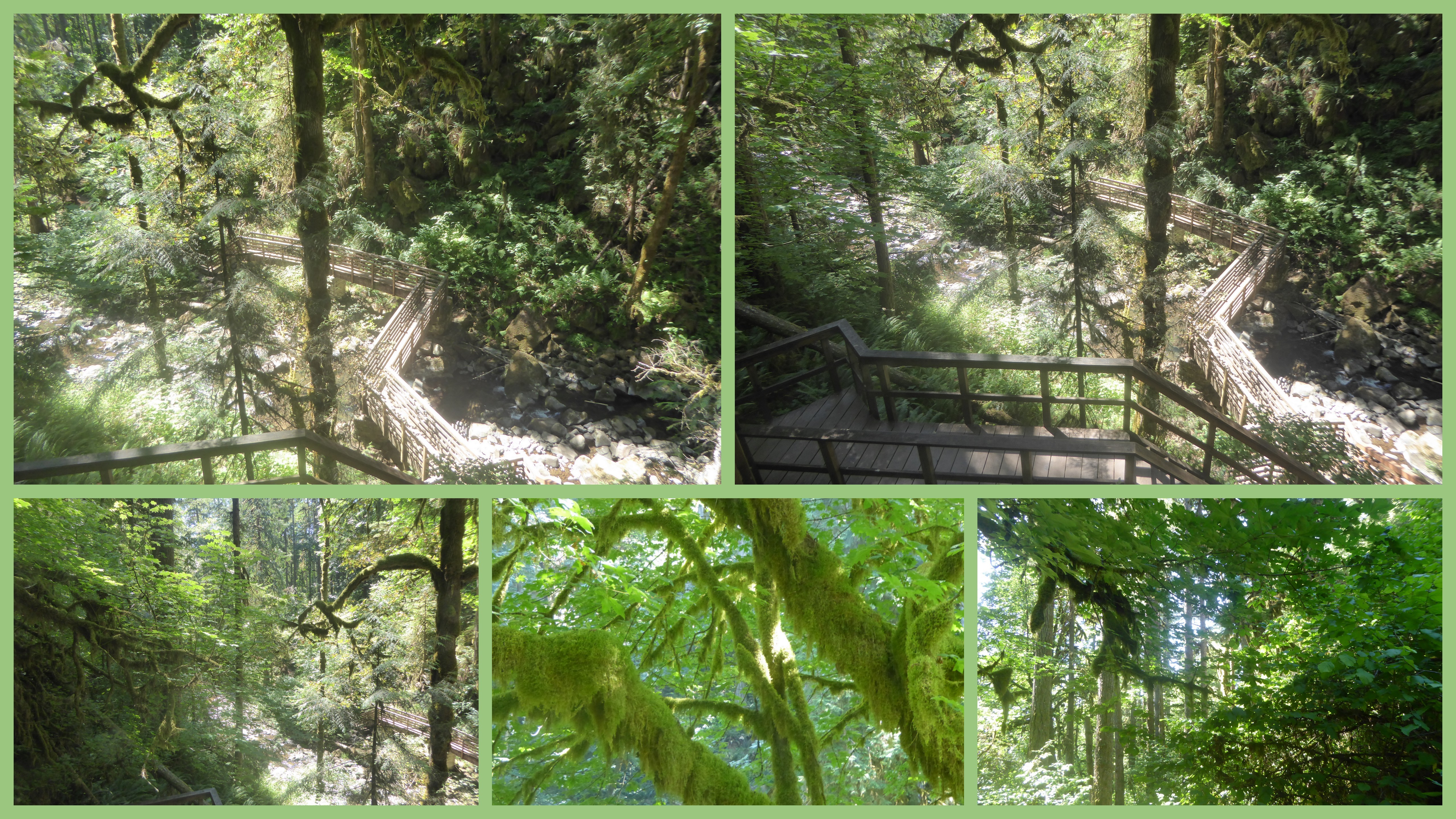
    It has been SO hot!   Friday tied the record for hottest day ever in Eugene — triple digits are almost unheard of here!   Earlier last week, we decided to take a 'Sunday drive' into the woods  (on a Monday  – as retired folks, we try to leave the weekend driving to those who work on the other five days).  We didn't have to go very far.   It was still warmish, but much cooler than in the Valley.


    P1040663-001

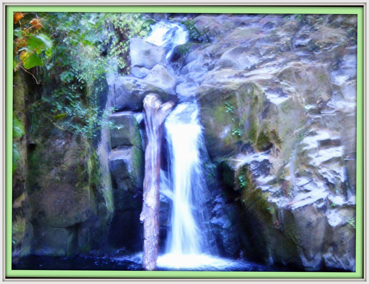
     This is Upper McDowell Falls.  We could hear it as soon as got out of the car at the parking area.

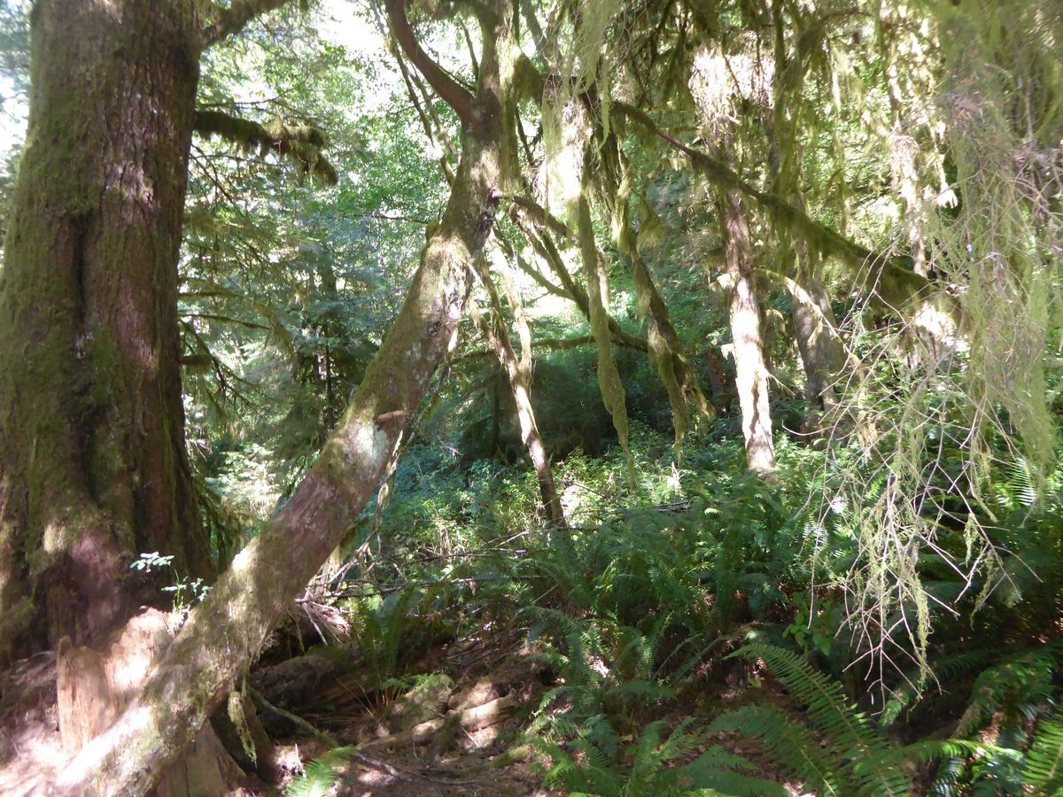
    Here in the City, it's still over 100 outside as I'm writing this post.   But I swear just looking at the pictures of these soft cool greens brings the temperature down!  (Or of course it might be the air conditioner.)    


      2016-08-18


    There are three waterfalls in the area.  The staircases lead to the other two.   We only walked part of the way because it was still kind of warm for all that stair climbing, especially because we had to climb back up to get to the car.  


    P1040661-001


    McDowell Creek is a Linn County Park (the next county to where we live) — it's a very easy day trip and there's a nice restaurant with a  view of Foster Lake for after!  So we would love to go back when the temperatures cool down a little bit and do the whole hike.  


    LINKING this post to:  Jesh's SEASONS; Maggie's MOSAIC MONDAY; Michelle's NATURE NOTES; OUR WORLD ON TUESDAY*;  Gemma's WEDNESDAY WATERS and Gemma's SCENIC WEEKENDS.   Thank you to *Lady Fi, Gattina, Arija, Sandy and Sylvia for OW*  and to each of the other hosts.


  • MALHEUR OCCUPATION

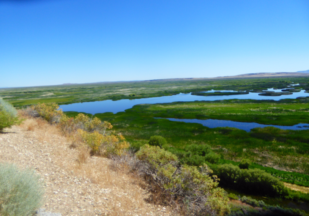
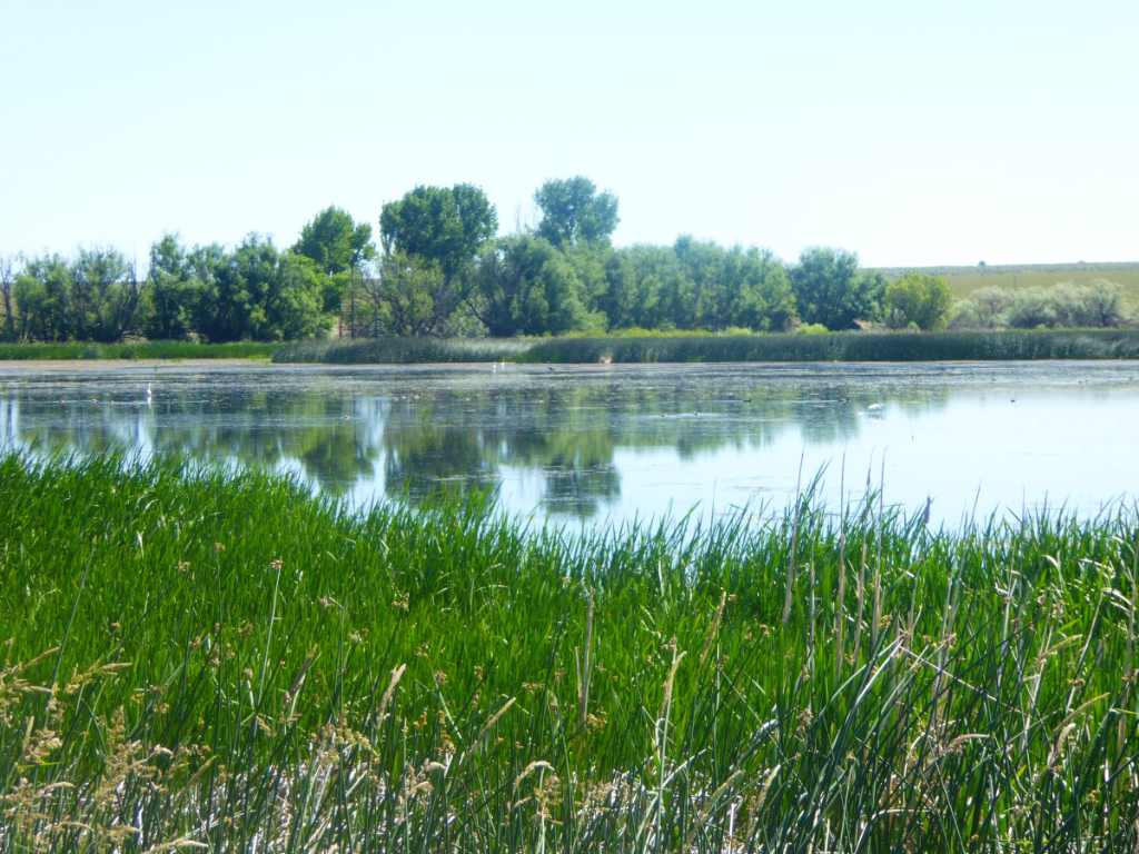
    It is hard to believe that beautiful and peaceful-looking Malheur National Wildlife Refuge was the site of an armed occupation only a few months ago.   And this is a hard post for me to write because I'd rather concentrate on the beauty of our natural world.  (Usually this blog is my 'happy space'.)   But there is important information here that I need to share.  Everyone who loves nature and the public lands that make it possible for more of us ordinary people to enjoy it should know and remember what happened here last winter.  

    P1040502-001


    We used to visit the Malheur and the nearby Steens Mountain when we lived in western Oregon (in our former life) but hadn't been there for years.

    We were in Florida last December when we read the news about an armed militia group seizing the Refuge Headquarters.  The news certainly would have upset any thinking person (in my opinion), but also, because we loved the area, we felt a personal connection (and that was why we decided to go out of our way to visit the area on our way home).   A Google search will show you hundreds of articles and millions of words about the occupation — but here is my summary (and some opinion).  

    The immediate goal of the occupation was to force the federal government to hand over the refuge to ranchers (for cattle grazing) and they said they were willing to engage in armed conflict to accomplish that.    


    P1040511


    None of the occupiers were local — or even from Oregon — the  leaders said they were acting on behalf of two local ranchers, but the ranchers they named said they did not approve of the occupation.    (There are varying opinions about how many local people supported the occupation.)   

    Federal, state, and local law enforcement agencies did not interfere for quite some time – the occupation lasted for 41 days.  

    Law enforcement agencies were trying to avoid an armed confrontation, which  I guess is understandable, but in the meantime, the occupiers  trashed the park headquarters, destroyed some Native American artifacts and other exhibits, kept visitors from the headquarters, and kept the Refuge Staff from doing their jobs.    


      P1040513-001


    In late June when we were there, the Visitor Center was still closed as the extensive clean-up is not yet completed.


    2016-06-276

    Still closed to the public


    The occupation ended during a confrontation in which one of the occupiers was killed.  A total of 27 people were arrested either then or afterwards when they at last surrendered from the headquarters.  They were charged under Federal law with felony conspiracy and most were charged with other felonies and misdemeanors.  It  was a sad story that went on way too long.  (Our Governor announced that the occupation cost the United States about $100,000 per week.) …   And the trials for those arrested have not yet taken place.


    P1040499


    A sad story — but the even more important thing to keep in mind  is that these militias have a bigger agenda than just this one refuge in a remote corner of a a Pacific Northwest State.  They really want to privatize all public lands everywhere.   

    Let your local leaders and favorite candidates for office know that you support keeping public lands public!!  

    LINKING to: SEASONS; NATURE NOTES; OUR WORLD on Tuesday; SIGNS SIGNS; and GOOD FENCES.  

    Thank you to the hosts.


  • REMOTE HISTORY — ROUND BARN AND MEADOWS WITH A ‘NAUGHTY’ NAME

    (In real life, we  are happily at home in Eugene Oregon and pretty much settled in for the summer/fall season.    It is only on the blog that we are still traveling.)


    P1040491

    When we stopped in Southeastern Oregon on our way from Colorado, we stayed in the village of Frenchglen.  The town as well as a wilderness area in the State called French Pete are named for Peter French, who, back in the 1870s, became the first "cattle king" of Oregon.    (There is a long history of cattle ranching and grazing here in the wild wild West.)     The information below about the barn French built is from informational signs placed by the Oregon Historical Society.


    2016-06-278

    "In the spring of 1872, 23-year-old Peter French set off from California headed for Southeastern Oregon with about 1200 head of cattle, 20 horses,a few supply wagons, half a dozen cowhands and a cook.  he eventually established a ranching operation that grew over the next quarter-century to 200,000 acres.

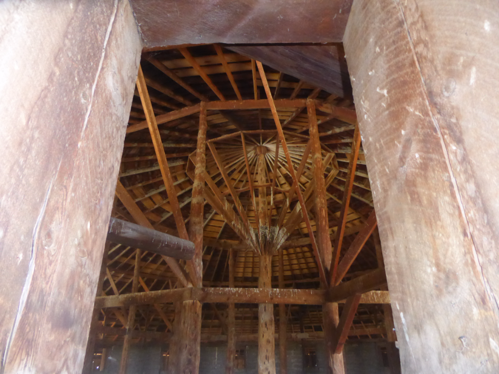
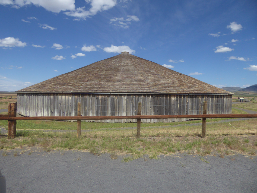
    Peter French built this unusual barn around 1880.   He and his hands used the barn for breaking and exercising horses during the winters.  About 300 head of horse and mule colts were foaled each year.  Most were kept to work on the ranch.  The barn is placed on high ground for better drainage — it encloses a 60 foot diameter stone corral.  The conical roof is supported by a 30 foot juniper center post and 13 other posts.

        P1040374


    'The Round Barn's circular pattern was used to keep the young horses traveling smoothly safely and continuously without corners to stop their progress.  Peter French's innovative Round Barn was ahead of its time. "

    The historic structure including two acres and an access easement was deeded to the Oregon Historical Society in 1969 by the Jenkins family of local ranchers.     It is open the public at no cost.


    Pictures in the collage below are not only part of the natural beauty of this area, but also an interesting part of its history:  


    2016-06-277

    Whorehouse Meadow


    About 17 miles from Frenchglen on  the Steens Mountain Loop Road are some beautiful meadows — they are on private land, but the owners do not try to prevent the public from enjoying this beautiful and historic area.   There is no path — just open meadows with beautiful aspen trees.    We walked in (as we had done on all of our previous visits to the area) and enjoyed the sunshine and relatively flat walking after our time up on the mountain.

    These meadows are known as having one of the more unusual geographic feature names in the United States.   According to Lewis McArthur, the author of "Oregon Place Names":

    'In the early days β€œsin” was considered an unavoidable adjunct of life in the cattle and sheep country. During the summer one or more of the female entrepreneurs from Vale would set up facilities under canvas in this accessible but secluded meadow a mile east of Fish Lake. Houses of this category, wood and canvas, passed with the end of open cattle range and all that remained was the name on the slopes of Steens Mountain: Whorehouse Meadows."

    In the late 1960s, the BLM and the  Bureau of Geographic Names had a fit of prudishness and without public notice changed the name of this geographic feature to "Naughty Girl Meadows".  The ensuing public furor eventually caused the U.S. Board of Geographic Names to find for history and honesty.   Current topographic maps show the original name.'

    A couple of decades ago, when we first visited this area,  you could still see scatalogical  drawings carved into the aspen tree bark.  They were said to have been made by men waiting in lines.  Now (perhaps fortunately)  those aspens either have blown over or grown so tall that the carvings are no longer visible.  

    Happily the meadows have gone back to their natural state — with only the name a reminder of the rough history of the Old West in this remote corner of the world.


    LINKING this post to: OUR WORLD;   SIGNS SIGNS; GOOD FENCES; SKYWATCH FRIDAY; TREES & BUSHES; and THE BARN COLLECTIVE

    Thank you to all of the hosts.

  • KIGER MUSTANGS — WILD HORSES OF THE STEENS


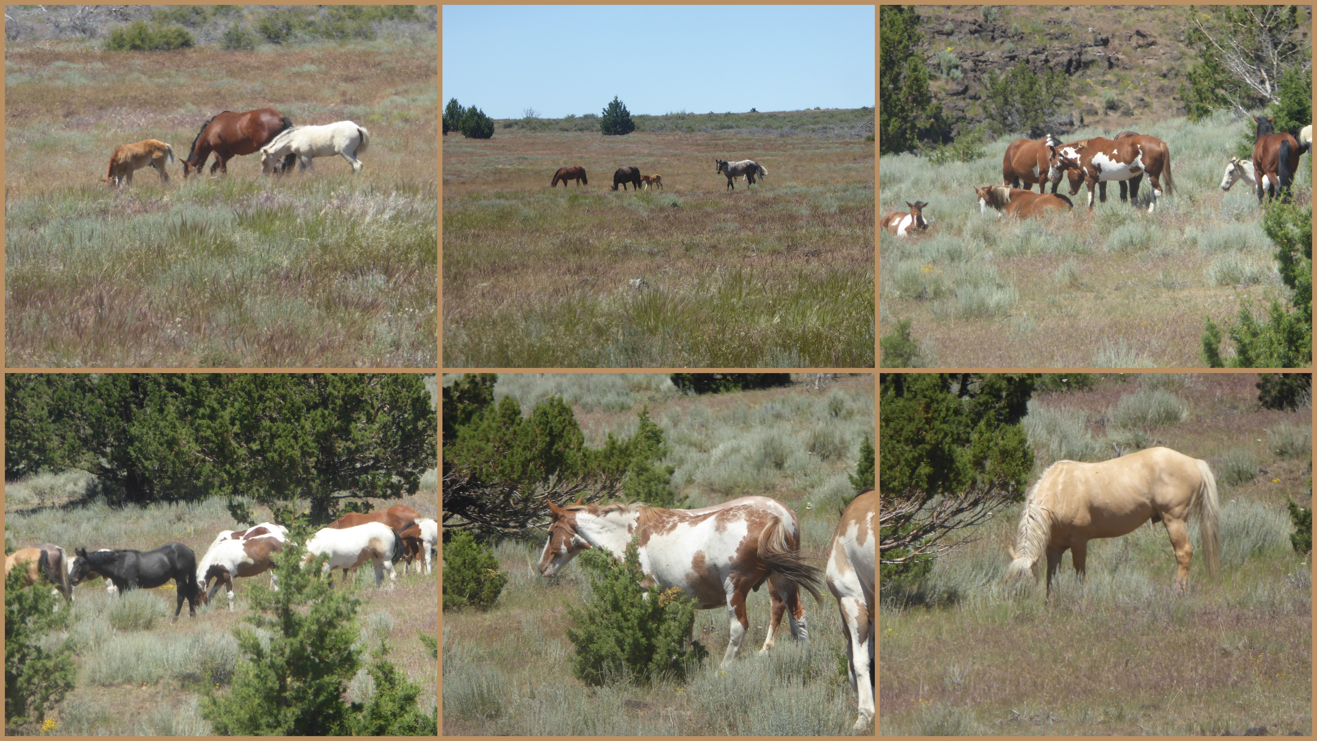
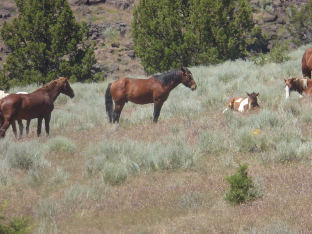
    Steens Mountain is home to a unique type of wild horse, the Kiger Mustang.   We came across several of them on the other side of our loop drive from French Glen to the summit of the Mountain (previous post here).


    P1040485


    Kiger wild horses possess many characteristics of the original Spanish Mustang, the horse that helped settle the American West.  At one time, it was thought to be extinct on the range.  Since the Kiger Mustangs are one of the best remaining examples of the Spanish Mustang, their preservation is extremely important. 


      2016-06-275


     The Steens Mountain herd roams  over 127,000 acres of rugged, high desert country. Pinto, sorrel, bay, palomino, brown, black, red roan, and dun colors may be seen on the 159-304 horses who occupy this territory. They range in size from 14.2-16 hands high, 900-1,000 pounds and rely on a diet of native bunchgrasses within sagebrush and juniper cover. Perennial streams, natural ponds and springs are common water sources.  (Information source:  BLM website).  


       We watched these beautiful animals from the car so that they were not disturbed.  

      P1040475-001


    The Bureau of Land Management  (BLM) is  responsible for wild horse herds throughout the United States (and for balancing their needs with other needs for the public lands).  According to their website:  "Our overall goal is for the range to achieve or maintain a thriving natural ecological balance. Heavy to severe wild horse grazing jeopardizes the health of rangelands, wetlands, wildlife habitats, and ultimately animal health and condition."    

    The BLM holds gathers of wild  horses and one is planned for the South Steens in August of this year.  According to the link above,  they plan to remove 100 horses, which will be offered for sale.    (There is more information about this on the link above.)


    P1040484-002


    I read that the Kiger Mustangs bring the highest sale prices of any wild horses that the BLM rounds up and sells.    As with much of what the BLM does, there is some controversy about these 'gathers'.    The BLM makes some of these public lands available to ranchers for cattle grazing.  Quite a few people believe that if cattle grazing were on public lands were discontinued, there would be enough range land and water to supply the horses without resorting to thinning the herds.

     What  I know for sure is that these are beautiful animals and we were very happy to end our sightseeing day by seeing so many of them in their natural surroundings.


    LINKING THIS POST  to SATURDAY CRITTERS (thank you Eileen);  to SEASONS  (thanks to Jesh); and to NATURE NOTES (thank you Michelle)


  • STEENS MOUNTAIN


    P1040406


    Between Colorado and home we spent a couple of days in the far Eastern corner of Oregon.  Although it is the same state, Harney County  is over 300 miles away and as different as can be  from the Western coastal part of the state, where we live.  Some people call that sparsely settled area "Oregon's Outback."   


    P1040494


    French Glen, a village of two businesses, a post office  and about nine people,  is the gateway to the Steens Mountains … the loop road to the top of the mountain starts right across the street  from the Frenchglen Hotel where we stayed.  Established in 1916,  the historic hotel serves breakfast,  lunch and family-style dinner to hotel guests and by reservation to others  when there is room.   (There is space in the dining room for 28 guests.)   I've never been a huge fan of eating family style with strangers, but everybody at dinner had the shared experience of  a day exploring so dinner became true 'family style' pretty quickly.  (The food was good and plentiful.)    Because of its historical interest, the Hotel itself is now an Oregon State Park, as indicated by the blue sign under the windows on the right.  (Management of the hotel and restaurant is by a concessionaire).


       P1040393


    This area is known for good birding, but as on the whole road trip, we only had time for accidental sightings.  This sweet Mountain Bluebird greeted us as we started our drive to the summit.


      P1040409-001

    Steens Mountain is a part of the Malheur National Wildlife Refuge.  Some of you may recognize that name because it made national news for a sad reason last winter and spring.  (And I will write more about that in the next post.)  When we lived in Oregon  (the first time, before retirement) we  camped several times in the refuge.  It was a great getaway spot when we had a few days off to travel, but it had been years since we'd been there. Because of the news, we'd been talking and reminiscing about the area for months.   I was happy when Bill figured out that we could stay there without going too much out of our way as we traveled home.  


      2016-06-27


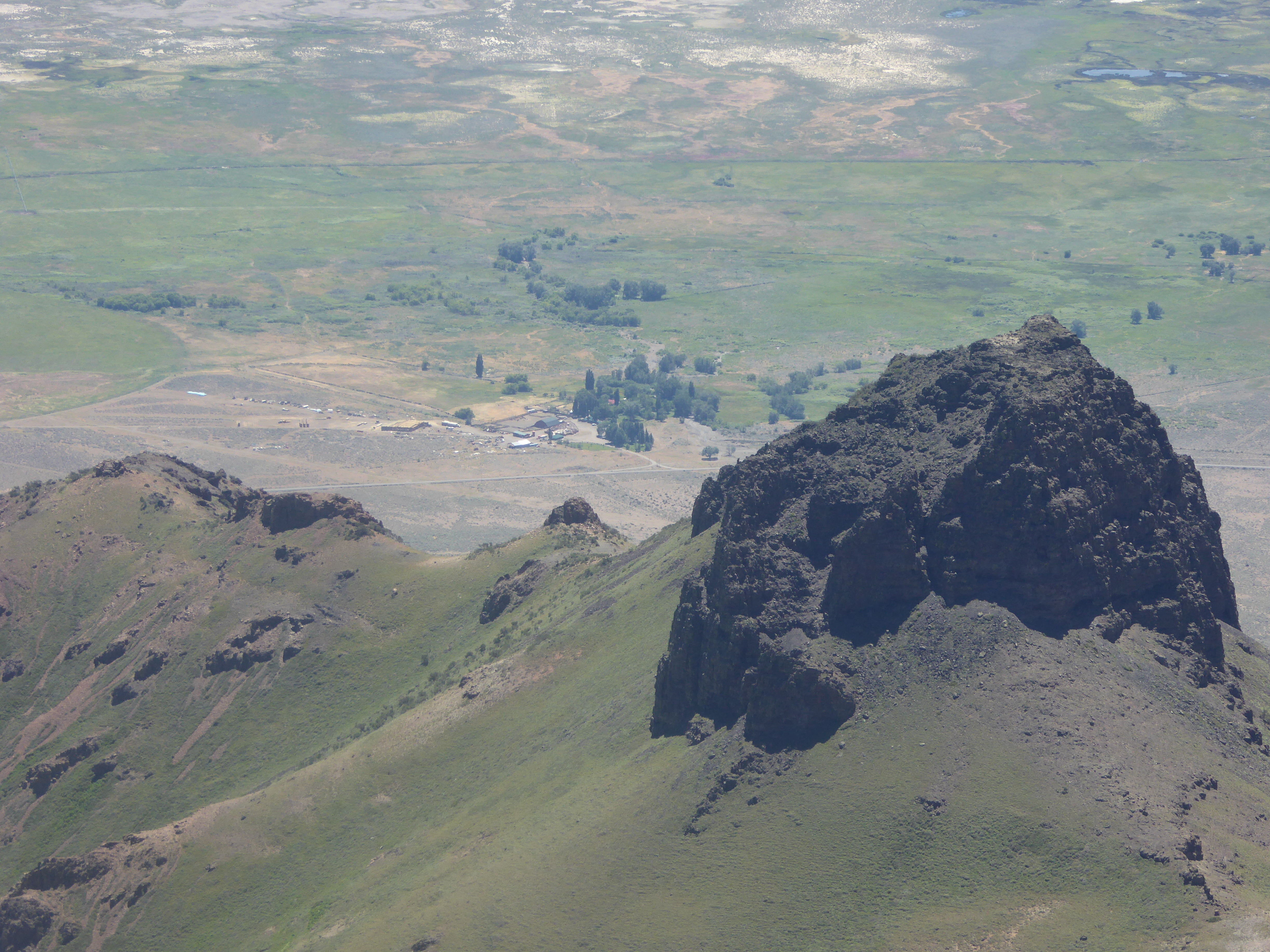
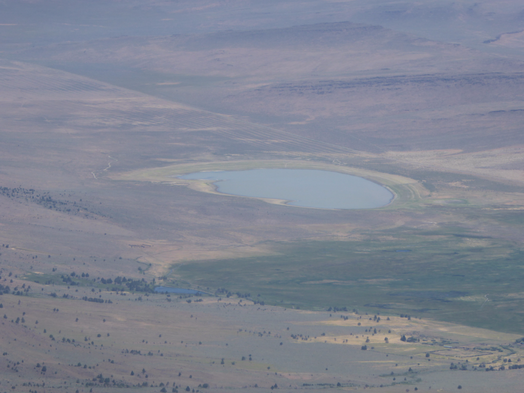
    These ancient mountains were formed when rivers of basalt lava flowed across the area.  Each flow added a new layer of rock.  As the lava slowly cooled, the earth's crust bulged and cracked to form faults.  Over time, huge blocks of basalt moved, tilted, and slid along the faults.  Steens Mountain is a 30-mile long fault block that tilted to the west.  The block east of that one slid downward to form the Alvord Basin.       The top right picture is looking down on the Alvord Desert, the driest place in Oregon.    

      P1040436

    The desert receives only about six inches of rain in a year and sometimes, when winter snows melt, a shallow lake forms on the desert surface.  

     This picture of the Alvord Ranch next to the dry lake, and those in the collage, were taken near the summit of the Mountain Trail (the one you walk up to after you drive the narrow road.)   We decided that things had really changed in the years since the last time we visited the summit.  It didn't used to be nearly as steep or as hard to climb twenty years ago!  (Back in our own version of ancient history, when we were younger and stronger.)


    LINKING to OUR WORLD on Tuesday; NATURE NOTES; SEASONS; and WILD BIRD WEDNESDAY.

    Thank you to all of the hosts for providing these sharing opportunities.    (Click on any of these links and visit  the hosts and other links.)


  • FALLING SKY

    This might be stretching it a bit for a sky picture, but after all, it is November and we are in Oregon!


    P1020447-001


    And it would certainly be a sky shot if we were in a plane flying through those clouds.   Instead, we were driving along the McKenzie River on a rainy, misty Sunday afternoon.   It looked like the sky was falling into the water. 


    LINKING to SKYWATCH FRIDAY (with thanks to Yogi, Sylvia, and Sandy) and also to

    SCENIC WEEKENDS (thank you to Gemma).  


  • GeT OUT OF TOWN!


     Last weekend …

    P1020414-001

    Dexter Covered Bridge and Dam

    … because we finally felt at home in our new City digs, we celebrated  by getting away to the country.  (A little illogical maybe … but a fun break from selling the RV and shopping for the new apartment.)


    2015-11-15


    It was just a day trip to the Mountains.  We thought we might be able to catch the last of the Fall color — but most of the leaves were already on the ground.   However, the drive along the Willamette River to the tiny town of Westfir is always beautiful.  It's mostly Forest Service land — we used to camp along there pretty often  (back in our previous life).    


    2015-11-151


    What started out as a beautiful day suddenly turned dark and wet — everything we saw for a while was through the rainy windshield.    We'd thought about doing a little hiking, but rain erased  all desires for that activity.    


    2015-11-152

    Above  Westridge, we turned away from the Willamette River and drove  along  the McKenzie.  This route, from River to River, is called the Aufderheide Drive.     We dropped down to a lower altitude and had a little bit more dry weather (and almost sunshine)  just as the day was ending.  (Too soon, this time of year.)

    One of the best parts of living in Eugene is that you can travel to the Mountains or to the Coast in less than two hours.    We didn't do enough of either one of those things this time here  (and you know why if you've been reading earlier posts).   We look forward to less busy-ness and more exploration next year.


    Linking to:  OUR WORLD on Tuesday; MOSAIC MONDAY; NATURE NOTES; TREES and BUSHES; and WEDNESDAY WATERS.


    Thank you to the hosts:  Lady Fi, Sylvia, Sandy, Gattina, Arija, and Jenn for OW; Judith for MM; Michelle for NN; Monica for Trees; and Gemma for WW.  

  • TRAIL THROUGH THE WOODS


    A friend and I did a 5K Volkswalk Saturday.   The walk was along the trail through the Whilamut Natural Area of Alton Baker Park in Eugene.  


    P1020218-001


     It was a lovely Autumn day and a treat to be outdoors.  I've been mostly City walking lately, so it was fun to get out into this more natural area.


    P1020211-001


    Etched stones along the trail are there to reintroduce words from the Kalapuya language.  The Kalapuya were the first people to live along  the Willamette River.


    P1020207-001


     There are good trails throughout the park.


    P1020216-001


    This stone says that 'Gaw-Ni' is the word for "trail through the woods".  I 'm pretty sure that the trails weren't this good when the Kalapuya walked here.


    2015-10-111


    We saw some beautiful homes and yards across the river as we walked.    It is still between-season, with roses and other late summer flowers still blooming in some yards, but trees showing red leaves in others.


     2015-10-112


    When we got back to the Willamalane Park and Recreation District (the starting and ending point) the Volkswalk people had Halloween refreshments waiting.    Some even good for you!  


    LINKING to: Judith's MOSAIC MONDAY; Michelle's NATURE NOTES;  to OUR WORLD ON TUESDAY (Lady Fi,  Sylvia, Sandy, Gattina, and Arija); to Monica's TREES and BUSHES; and to Gemma's WEDNESDAY WATERS.   Thank you to all of the hosts.


  • WATERCOLOR?


    Because it reminds me of an oil painting, I'm posting this shot of a waterfall I've showed you before to the NF DIGITAL ART meme.  


    P1010865


    I didn't really do any post-download manipulation though (except to add the frame) — the "painting" is simply a result of forgetting to change the setting when I was trying to get a close-up view of Sweet Creek Falls.  Somehow, the combination of the light and the setting created an unreal photo. 
    (So it's mistake I fell in love with.  Thank you for indulging me!)


      P1010867


     I  wrote about hiking into the Falls last week, but this is a slightly different view from the one I showed there — and the closest one I could find to my 'painting' (or mistake).    

    I will also link this to the  next SCENIC WEEKENDS because every scenery junkie everywhere loves a waterfall. 


    Thank you to Monica (Nature Footsteps) for Digital Art and to Gemma for Scenic Weekends. 

  • SWEET CREEK FALLS

    A cool pool and a small waterfall were the reward at the end of a short hike to Sweet Creek Falls.

    P1010872-001


    It's been so dry, we weren't sure there would be any falls at all at the end of the hike.  It's not as glorious as it would be if we'd had rain, but on a hot summer day, I'll take any waterfall at all! 


    P1010879


    There was still some green, but lots of dry stuff underfoot.


    P1010896


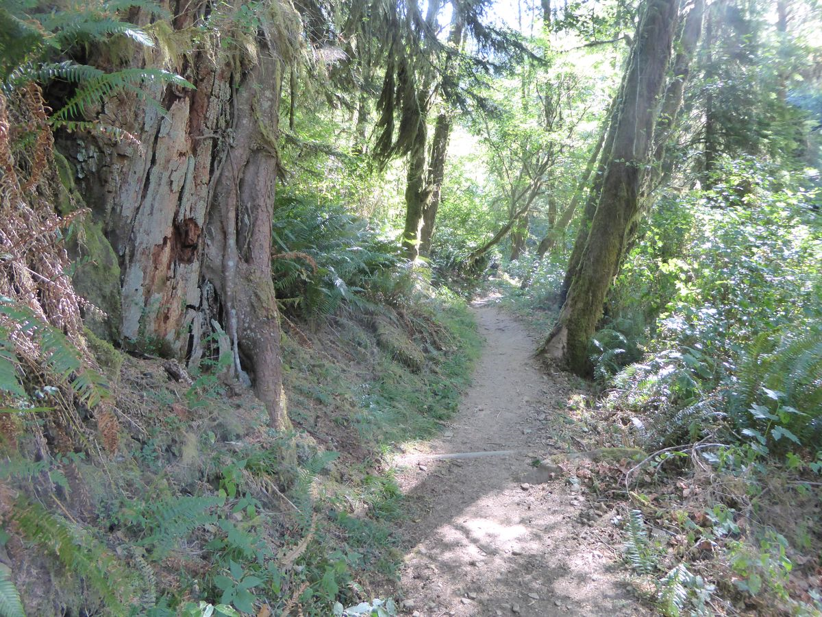
    The trail was kind of gnarly and dusty — but it was worth it.   

    P1010887
     

     I like gazing at the tall trees  but it is good to stop when you look up (especially if, like me, you have trouble walking and chewing gum  taking pictures at the same time).  


    Sweet Creek Falls is near Mapleton, Oregon.  


    LINKING to NATURE NOTES; OUR WORLD; NF TREES ; and WEDNESDAY WATERS.

     THANK YOU to the hosts of each of these wonderful sharing opportunities!