Category: NATIONAL PARKS

  • MESA VERDE

    This post is about the  ancient part of  OUR WORLD that we visited in June.   Thank you to the Our World  hosts  (Click on the links for the best virtual traveling of the week.)

     P1060315-001

    Spruce Tree House


    In 1906, President Theodore Roosevelt made Mesa Verde a National Park  "to  preserve the works of man".   It is the only National Park with the specific purpose of preserving our archeological heritage.   

    P1060293

    Kiva Spruce Tree

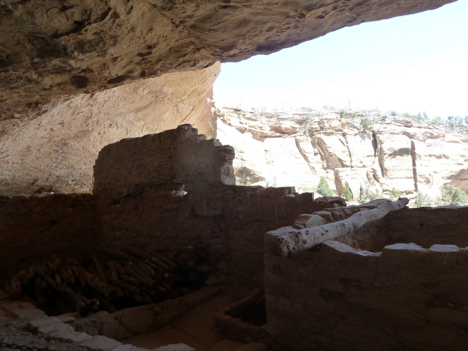
    We visited several cliff dwellings.  Spruce Tree House was constructed between 1200 and 1276.  It contains 114 rooms and eight kivas.  (Kivas are ceremonial chambers.)    


    Spruce Tree House is built into a natural cave that measures 216 feet.

     Archeologists think it was home for around 100 people.   Because the natural overhanging cliff protected the dwelling there was very little deterioration. 

    P1060291

    Windows, Spruce Tree

    The keyhole windows in this dwelling are interesting — there is no known reason for them to be that shape — maybe the people were just adding a decorative touch to their homes.   


     The low wall in front of the courtyard set the dwelling apart from a refuse dump.   The small rooms were mostly used as bedrooms.  The families lived and worked in the courtyards, on the rooftops and on balconies, which used to extend from the front of the bulding.  The poles near the top row of windows are original wooden supports of a balcony. 


    W ladders

    Long House

    Long House is a larger dwelling.  The Park brochure lists access as strenuous — But we made it!    It's only accessible by ranger-led tour.  After a tram ride to the trailhead, there's a half-mile walk to the dwelling with a 130-foot gain in elevation. There are two 15-foot ladders to be climbed inside the dwelling. 

    P1060256
    It's worth the climb because at the end of it, here you are  – sitting in the same place where these Ancient Puebloans lived and worked.  

    As with all of our wonderful National Parks, access for everyone is the best part.  It's amazing to walk right into these dwellings.    

    Mesa Verde isn't the easiest park  to negotiate.   The Visitor Center is a 15 mile drive from the Park Entrance over a winding road.  (And the Park Entrance is several miles from the nearest town, where we were staying.)    It's a huge park.  Scattered about over  its 52,000 acres are over 5,000 archeological sites, including 600 cliff dwellings….   

    Cliff roof

    …. So it goes without saying that we didn't get to visit everything.  And it's yet another place on our "we'd go back again someday if we could" list. 


  • PICTOGRAPHS – ANCIENT SIGNS?

     FOR OUR WORLD, because we were fortunate to visit and learn a little bit about the world of the Navajo recently.  There are many guesses about the meaning of the earliest of these signs left by long-ago civilizations, but because they must have been meant as some kind of message to others, I am also linking this post to SIGNS SIGNS.  Thanks to the hosts of both memes. 

    P1060147 pict kokapelli hands etc

    The pictographs and petroglyphs are maybe the most amazing thing about Canyon DeChelly because they show how long the Canyon has been occupied and give us a chance to see (and try to interpret) these messages left by the different civilizations who made it their home. 

    P1060212 men and circle picto
    Anthropologists have learned that ancient people lived here for about 600 years beginning in the 700s.  They lived in rock caves which provided warmth in the winter and then probably moved when the weather got hot. Nobody knows what happened to these people.

    P1060151 pictograph2
    Anasazi people lived here in beginning in 1296 and built the homes whose stone ruins we saw.

    P1060194 anasazi and nav pictog

    The area had again been abandoned by the time the Navajo people arrived in the 1500s.   Some of these pictographs were done by Anasazis and some later by the Navajos.    This pictograph is near the ruin called the Antelope House.

    P1060150 petrog deer and hunt horses-001

    This is a later work, because there were no horses in the Canyons until the Spaniards arrived in the late 1700s.   

    P1060211 mission picto

    This pictograph depicts the arrival of the Spanish, the first non-native people to arrive in the area (you can see the black-robed missionary) .  Then a tragic era for the Navajo began.  The mural is drawn near the cave where an 1805 battle took place and many Navajo were killed.  Fighting continued  and in 1864,  an Army contingent led by Kit Carson decimated the lands.  Many Navajo were killed and many more were burned out.   Survivors who surrendered were forcibly marched to Fort Sumner New Mexico (the Long Walk).   After four years in exile, survivors were  freed and allowed to return to their homeland.   It is poignant to hear this tragic tale told by their descendents.

  • SAND AND SKY

    For SKYWATCH FRIDAY.    Thanks to the host team.


    Sand and sky

    Great Sand Dunes National Park June 2012


    Let your mind wander as you gaze at these, the tallest sand dunes in North America and soon it becomes difficult to know where the sand ends and the clouds begin.    Or is it the other way round?

       White sand clsup

      P1060108


    Information provided by the park tells us:    While patterns in the sand may be temporarily changed by raindrops, breezes, melting snow and human footsteps, forces that affect the dunes system as a whole — winds, mountain watershed, and locally shallow groundwater levels keep it remarkably stable.  One Park ranger says he loves this Park because  "..the Great Sand Dunes provide consistency in a changing world."

    Great Sand Dunes National Park and Preserve, Colorado

  • FOUR CORNERS AND (more from) CANYON DE CHELLY

    For Our World - thank you to the hosting team.

    P1060132white house from walk in
    Ruins, Canyon De Chelly


    Earlier this month in OUR WORLD, we explored parts of the FOUR CORNERS area that we'd missed on earlier trips.  We spent time in four states — Colorado, Arizona, Utah, and  New Mexico —  and much of the time we were in a (sort-of)  different country — the semi-autonomous Native American-governed territory of the Navajo Nation.   

     Canyon De Chelly is the only National Monument that isn't actually federally owned.  All of the land belongs to the Navajo…it is jointly administered by the Tribe and the National Park Service.     Ancient Pueblan people farmed in these canyons and Navajo families still do.  

    P1060215 cow picto and dwellingl


    Right now though it's very dry and hot in the canyons and invasive cottonwoods and other species are drinking up a lot of what water there is.  Farming can't be easy.

    Because of traditions handed down through their mythology, Navajo people do not usually enter buildings of the ancients.  The Standing Cow ruin (above) is an exception.  The foundation of this ancient round building was excavated years ago and used to construct a stone hogan.  One couple lived in it while they looked after their fields.  Our guide told us that the woman lived there until she died.      (I will do another post later with more pictures of the Canyon's pictographs and petroglyphs.)


      P1060131 invasive green The Canyon with invasive Cottonwoods along the creek bed


     Here are two more  links with information about the Canyon.

     NATIONAL PARK SERVICE LINK

     NATIONAL PARK SERVICE GEOLOGY


    WIKI LINK

  • THE LEGEND OF SPIDER WOMAN

    These pictures are from Canyon De Chelly National Monument, part of our recent roadtrip to the Four Corners area.   (Shared with the blogging community at SKYWATCH FRIDAY.)


    P1060173 spider rock
    Spider Rock, Canyon De Chelly, Navajo Nation 

     Geologists say that formation of this 800 foot tall red sandstone monolith began 230 million years ago.  Dine' (Navajo) legend says that it was the home of Spider Woman, one of their Deities.    

    Spider Woman possessed supernatural powers and protected the people.  She also taught them the art of weaving.   Her web stretched between these spires.


    P1060177 spider woman spires

    For many years, ancestors of today's Navajo people lived in caves and sandstone dwellings within the canyons that now comprise this national monument.

    P1060155 dwelling2

    This is the White House, one of the ruins that we visited.

  • ONE REASON….


    We've been on a mini-roadtrip through parts of the Four Corners area.   One reason that posts were few-and-far-between is that exploring at this altitude was hard on these tourists from the flatlands.   I didn't have much energy at the end of the day!


      Vista f pk pt

     view from Park Point, Mesa Verde National Park

    Our home in Florida is about seven feet (7) above sea-level.  Walking at seven thousand feet (7,000) plus takes a little more work.   


      Park Point Sign-001

      (OK, I admit it, breathing at this altitude takes more work!)


    FOR:  SIGNS SIGNS.  (It's nice to be back.)

  • MOUNTAINS! ONCE AGAIN

    For SKYWATCH FRIDAY

    ROCKY MT NAT'L PARK 6 7 12

    Rocky Mountain National Park, June 2012


    There is nothing in the world like seeing MOUNTAINS again after you've spent months in the flatlands.  It's great to be in Colorado.


    P1050984

    Front-range view from Rabbit Hill, near Lyons


  • PLANET WATER

    FOR MICHELLE'S NATURE NOTES and NATURE FOOTSTEPS-WATER  (Thank you!)

    Visiting the Everglades during the dry and then the beginning of the wet season provided a quick and obvious lesson on the importance of water to the health of our environment.   On our most recent visit, we noted one sign reminding us that our planet is seventy-five percent water — it suggested that this third rock from the sun might better be named "Water" instead of "Earth."  

    P1050776-001

    The Everglades is all about water, in seasonal cycles of rain and drought.   

    Edge lake o

     The above picture  and the next one are from an earlier trip we took by boat.  This one is the edge of Lake Okechobee, the major source of water for the Everglades.  The next picture is a lock on Lake O.

    The information in italics under each of our pictures is taken from National Park Service explanatory signs in the Everglades.  

      Lock lake okechobee

    Historically Lake Okechobee overflowed with rain each spring.  But today, humans have engineered nature, disrupting the flow that nourishes the Everglades and its wildlife.  

      sawgrass

    The entire Everglades food web has evolved in pure low-nutrient water. Changes in water quality due to nutrient contamination (the introduction of phosphates and nitrates) threaten the natural glades.  (Sawgrass, seen above, is a sedge-like plant  that grows naturally in low-nutrient water.  Stands of cattails seen elsewhere in the park are not natural, they are growing as a result of nutrient contamination.)

      everglades

    Increased public awareness and support offer the hope of restoring natural conditions.  Park managers, working with other agencies, are restoring portions of the ecosystem that will help protect this "River of Grass"  – from its headwaters in Lake Okechobee to its exit into the Gulf of Mexico and Florida Bay.  

      gator Shark Valley Everglades

    "Here is land, quiet in its tranquil beauty, serving not as the source of water, but the last receiver of it.  To its natural abundance, we owe the spectacular plant and animal life that distinguishes this place from all others in this country." President Harry S Truman, dedicating Everglades National Park, December 6, 1947 .


  • BLACK IN BLACK


    FOR WEEKENDS IN BLACK AND WHITE

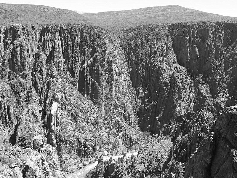
    Pegamite 

    White wildflower gunnison-2 These pictures are from the Black Canyon of the Gunnison National Park.  It was a stop on our summer roadtrip that I posted about here. 

    But because it fits this meme so well, here are couple more pictures from this magnificent place.

    These dainty white wildflowers are plucky! 

    Not everything could bloom in this rocky environment. 


  • GREAT BASIN NATIONAL PARK — part two

    This post is linked to WATERY WEDNESDAY.  It is a continuation of the previous post about our visit to Great Basin National Park.

    Creek campsite Upper Lehman Creek campground, where we stayed, is a meadow area, on this lovely creek.  The snow only recently melted and there were lots of spring wildflowers.  

     Starting near the campground, Wheeler Peak Scenic Drive climbs along the shoulder of the Mountain, ending near the treeline.

     In 12 miles, the drive gains 3,400 feet in elevation,passing through several enviromental zones to its bristlecone pine forest and view of Mt Wheeler.  The picture below is Aspen woodlands part way up the drive.

      Aspens 

    The Great Basin is actually a series of basins between ranges of mountains from California's Sierra Nevada to Utah's Wasatch Mountains.  Water in these basins have no outlet to the sea and so it collects in shallow lakes and marshes that dry out in the dry desert air. 

    You know you're in the Basin area (not necessarily in the National Park) when you drive through what seems like oceans of sagebrush …and then look up to see beautiful mountain ranges at the skyline. Plants and animals that couldn't survive on the lower desert live up there.

    Congress created the National Park in 1986 to protect part of the Basin.  The Park encompasses the South Snake Range, a desert mountain island  on the Utah-Nevada border.

    This is Mt Wheeler.  The road was still closed to traffic just behind where these people are walking. 

    Cold sky and mt 

    There are several good hiking trails in the park, including a trail up Wheeler Peak.  We walked at lower elevations — it was COLD up here on top of the Drive!