Category: NATIONAL PARKS

  • GREAT BASIN NATIONAL PARK, part one


    For THAT'S MY WORLD –  Our visit to Great Basin National Park was part of our world during our just-completed summer roadtrip… and  is still part of it as memories (almost the best thing about travel) remain!

          Bristleconepine 2 

    Bristlecone pines are an icon in this cold high-desert area.   We learned at the Visitor Center that the trees grow at altitudes between 9,500 and 11,000 feet.  The information says that they endure bitter cold and winds that twist and mold their shapes and still they live up to 3,000 years.  They grow slowly, a branch at a time and the  oldest ones grow near the treeline, where survival is most difficult.   In lower, less extreme altitudes the trees die at younger ages, at only 300 or 400 years.

    We camped in this park many years ago before it actually became a National Park.  (It was named one in 1986).  But I don't really remember the bristlecones.  Probably their survival story means more the older one gets!

    MT AND BRISTLECONE PINE 

        (More about Great Basin tomorrow). 

  • BLACK CANYON OF THE GUNNISON NATIONAL PARK

     A summer roadtrip stop for SCENIC SUNDAY.    Beautiful places there … click the links! 

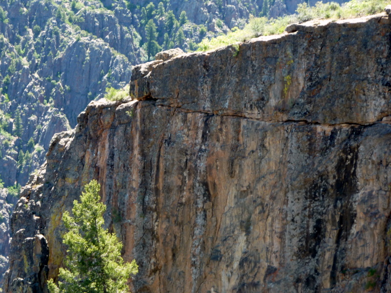
    Canyon wall-1 

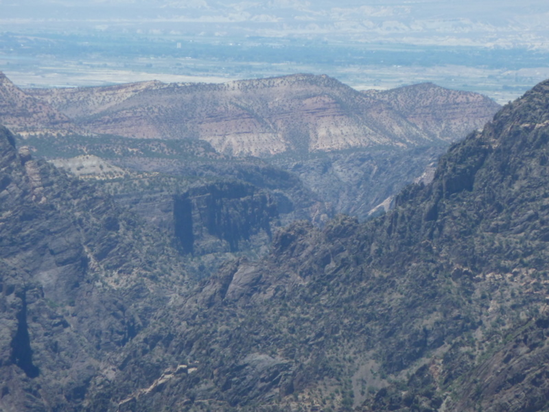
    Canyon view bill Usually the scenery in Colorado involves looking UP!  But at the Black Canyon of the Gunnison the breathtaking view is definitely DOWN.    This was the 37th National Park we've visited.  It's small  as National Parks go but the geologic history and beauty are well worth a visit. 

     ______

    _______________

    Chasm view 

    The Gunnison River has an average fall of 95 feet per mile.  This gives the river the energy to cut downward faster than other kids of erosion can widen it.  

    Tomichi point 2 The view from Tomichi Point welcomed us to the South Rim. 

     There are eleven viewpoints from here to the end of the six-mile South Rim Road. 

    Most involve a short walk to the viewpoint.   


    Pegamite2 The sand-castle-like shapes are called Pegamite Dikes.


    Molten rock was squeezed into these shapes and colors over a billion years ago. 


    Cyn side w shadow Each layer of the rock cliff marks a span of geologic time.   The thin brown layer is called entrada and it is young rock — only about 165 million years old!  It rests directly on rock that is almost 2 billion years old.  This marks a gap in geological history (somehow the rock that should be between these layers eroded).  It is called an unconformity.  

    There is no evidence of human occupation in the depths of the canyon, although the Ute Indians have lived in this area since written history began.  The lands below the canyon rims have been designated as National Wilderness to preserve the ecological conditions.   


  • ACADIA NATIONAL PARK

     This post is linked to Skywatch Friday.  We had beautiful blue skies and beautiful blue water in Maine!  Enjoy other skies all over the world by clicking on the Skywatch links.

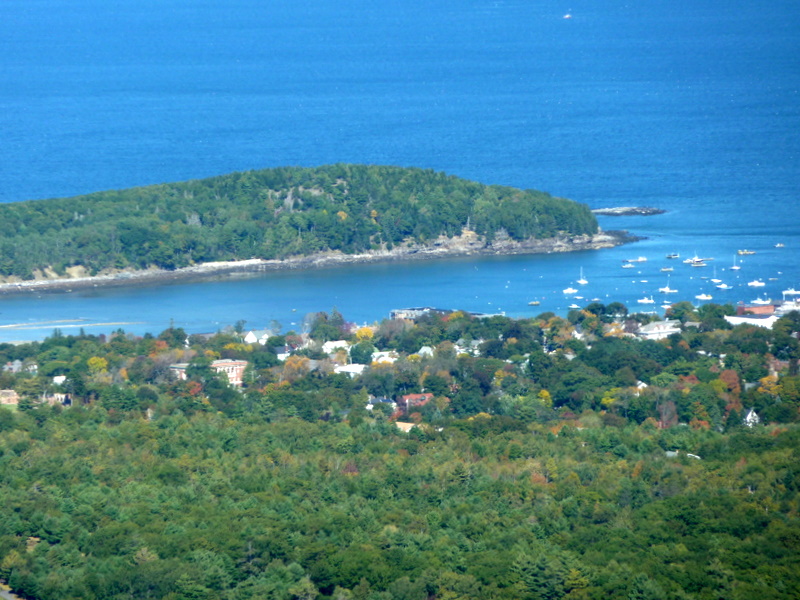
    Cad mt view 2 

    This is Cadillac Mountain in Acadia National Park.  It's the park's highest elevation and provides a lovely viewpoint.  At 1500 feet, it is also the highest point on the United States Atlantic Coast.  If you stood here at dawn, you might be the first person in the Country to see the sun's first rays.  (The sun had been up several hours when we were there.)

    Fjord fb 

    The views WERE lovely and it was fun being up there.  (But we just have to add that in the Western part of the US, we would call 1500 feet a hill.)

    Bayview-1 

    Cadillac Mountain was named for Antoine Cadillac, the Frenchman who was granted possession of this land in the late 1600s by King Louis XIV.  He later founded Detroit — where we had a car named after him!

    Island view3 

    From the Mountain you can see Frenchman's Bay with it's many islands, Schoodic Penninsula, Seal Harbor, and beyond that the open sea.


  • JOSHUA TREE NATIONAL PARK – ROADTRIP FEBRUARY 2010

    Josh tree npU 2 10 THAT'S MY WORLD for beautiful photos from all over our world. 

    One of the great advantages of the RoadTrek over the truck and Fifth-Wheel is that we can take little side trips if there is something we'd like to see — or visit scenic attractions off the main road — without finding out in advance whether there is adequate parking or turn-around space. 

    Between Redlands and our next overnight stop (which was Quartzsite Arizona)  we exited the freeway to spend a short while at  the Cottonwood Springs area of Joshua Tree National Park.  We've visited JOSHUA TREE several times in the past and neither of us quite understands why we love this Park so much since we're usually drawn to watery places.  There's just a peacefulness to the place and something about those trees growing in this unlikeliest of places that appeals to us. 

    JUt37 Josh2U feb rt

    We thought there might be more water than usual in Cottonwood Spring because of the recent rains on the desert, but it was almost completely dry.  Bill spied a little trickle of water after looking very hard.  Still, the sky was blue and clear and it was a very pleasant place to take a break from the freeway. 

    Joshua treesi

  • CHACO CANYON REVISITED (Sunday Favorites)


    Click here for more Sunday Favorites.  Thank you to Chari for providing this sharing site. 


    Chaco Canyon 1278
    This is a re-run for Sunday favorites.  It's about our 2006 trip to the ancient Pueblo culture center of Chaco Canyon.  This National Monument is in New Mexico, near the beautiful Four Corners area.  Since most of our recent posts have been about watery places, I thought it would be fun to see something from the dry part of the country, with its very different beauty and history.  We still hope, just as we stated in the original post, that we can spend some more time in this area sometime.  


    Chaco Canyon was the first place to be made a National Monument (not a National Park).  We just learned about that from the PBS series.  I'm sure that bit of history was mentioned in the Monument's visitor center.    But there is so much to look at and so much to learn in these beautiful places that it takes more than one exposure to get it all.  Here's the original post:

      
    Chaco Canyon 1273 
    The Four Corners area is high on our list of places to go back to, because we didn’t see nearly enough of the area during our first visit.    We did get to explore Chaco Canyon, a National Cultural-Historical Park. 

    ________________

    The Chaco buildings were a center for Pueblo cultures  about 850 to 1250 A.D.  It was during that time that the Anasazi (ancient ones) began to settle into a more urban culture after what had been a nomadic existence.  Tree-ring dating establishes that there was a severe drought in the area beginning in 1150; by 1250 the buildings and area were abandoned.  Nobody knows for sure what happened to the Chacoan people, but Pueblo Indian people of today trace part of their ancestry to Chaco.  The area is a spiritual center for Hopi, Zuni, Acoma, Zia, and other Rio Grande Pueblo people.

    ________________________________

    In the visitor center, we learned that archaeologists working in the Chaco buildings have uncovered evidence of advanced engineering and astronomy projects as well as artistic and architectural achievements. 

    Chaco_canyon_1278 We toured Pueblo Bonito, a 600 room Kiva (ceremonial structure).   All of the rooms were for public use.  It was built over the course of 300 years.  Nobody really knows where their homes were or where the people went when the area was abandoned. 

    Chacoa_1279

    __________________________________

    Some of the doorways that we went through were very small, so exploring the Kiva can be a little bit daunting.


    ____________________________________

    Here are some close-ups of the Kiva construction.Chaco_canyon_construction_1274 Chaco_construction_1275

  • OUR NATIONAL PARKS

    We're looking forward to seeing the Ken Burns series on the National Parks which starts tonight on PBS.   So I wanted to post something on one of our National Park visits for Sunday Favorites.  But then I couldn't decide which one to re-post, so I made this collage of favorite pictures from all of them that we've visited.  (  click here for the link to the PBS series webpage.)

    TEMP NEXT POST


    You can click on the National Parks category on the sidebar to see our posts about some of the National Parks we've visited.  Some of these Parks we visited years ago — before blogging, before digital cameras — we'd especially love to re-visit those.  And we look forward to seeing the ones we haven't visited.  

    Meantime, we'll watch the series to learn more about the history of "America's Best Idea"  and to look for familiar views and new ones to plan on seeing someday. 

    The Parks really are something for America to be proud of and we love visiting them.

  • JOSHUA TREE NATIONAL PARK (Friday Flashback)


    Joshua Trees 1189 We've visited Joshua Tree several times over the years.  It isn't one of those National Parks that is universally loved.  To some, the rocky soil and twisty trees seem bleak and lonely.   One friend, from the Northwest, said "you know those Joshua Trees aren't even real trees at all."  Well, they definitely aren't the same as, say, a Redwood or a Douglas Fir.  But the trees are real survivors.  Each one is unique, bending in the wind and growing in the scant soil.  We admire them.

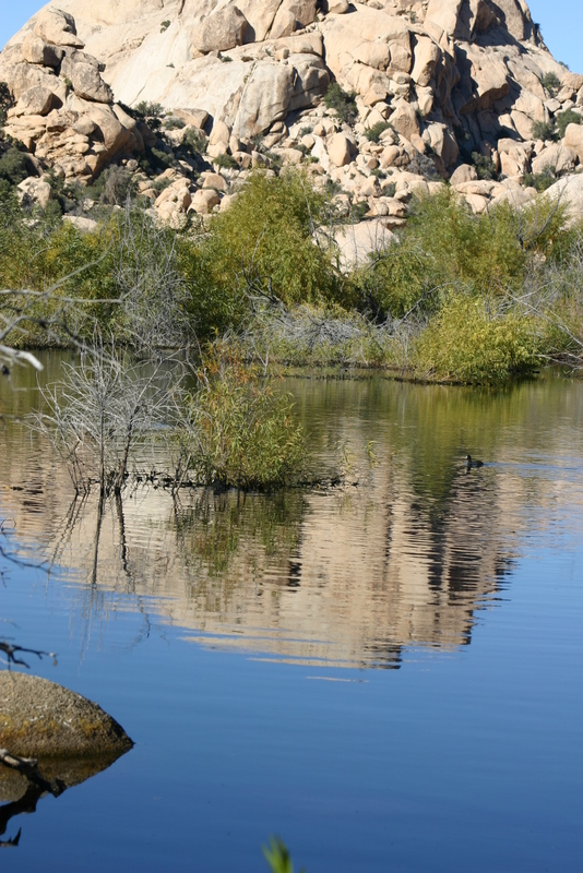
    Barker Dam 1176 These pictures were taken on a November 2005 visit; even in this desert terrain you could get a glimpse of Fall color. 

    Barker Lake is one of the few places in the Park where there is water.  It is unexpected and so it is even more appreciated.Barker Dam 1174


    The Park preserves the Keys Ranch, where pioneer settlers lived before the area was made a National Park.  It must have been hard to make a living here, but they stayed for years. 

    Key's Ranch Buildings 1186


    We stayed at Twenty-Nine Palms CA the first time we visited this Park and on other visits we have driven there from the Desert Hot Springs or the Salton Sea area. 

    The picture below is from the top of Key's View.  It illustrates the one major problem with Joshua Tree NP — it is too close to Los Angeles.  The rangers said that there used to be a clear view from this viewpoint every day.  Now it is very rare to be able to see at all.    There is actually some danger that the smog will destroy parts of the park. 

    Key's view at top, Joshua Tree 1167

    None of the pictures on this post are color-adjusted.  When we go back next time, I hope the colors are more like the first pictures and not like this one.   Even more, I hope that our grandchildren will be able to enjoy the beauty of this Park when they're our age. 

    Here's what the National Park Service says about the Park. 

  • DEVIL’S TOWER WYOMING (FRIDAY FLASHBACK)

    Devil's Tower 0414 Except for the beautiful Yellowstone/Grand Teton corner, Wyoming has never really been near the top of our favorite-places list.   We just haven't found much of the rest of it to be our kind of place.  But we kind of forgot about the national monument called Devil's Tower.  To be more accurate, we didn't actually forget, we just forgot it was in Wyoming.  Because when we went to see it, we were staying in Sturgis South Dakota.  It was an easy day-trip from our RV Park, through farmlands and plains and across the pioneer Bismark Trail.

    The Tower rises 1600+ feet above the Belle Fourche River, and so we were reminded about our 2004 visit just this past spring, when we stayed one night in the town of Belle Fourche, South Dakota.  We remembered that we'd stopped there before on our way to the tower.  We'd wondered then how to pronounce the name. ( Click here to see how and to read about our adventure there.)

    President Theodore Roosevelt named Devil's Tower the first National Monument in 1906.  The Park covers over 1300 acres of pine forests, woodlands (a rarity in this part of the country) and grasslands.  As you can imagine, it is a prime location for rock climbers. We don't climb, but we hiked the 2-mile trail around the base, admiring how the Tower view changes on every side.   Devil's Tower _0412

    Devil's Tower 0413

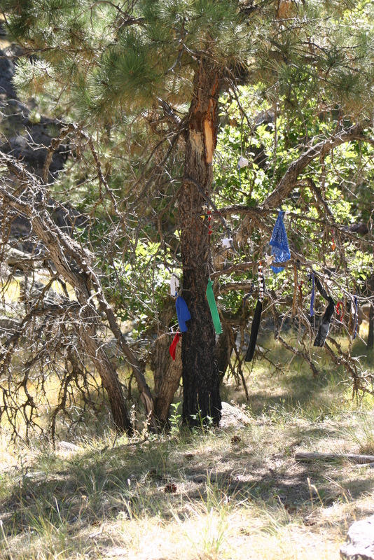
    Devil's Tower prayer cloths B 0405

    The Tower is a sacred site for regional American Indian tribes and it is closed during the month of June when there are ceremonial tribal gatherings.  We were there in August  and saw remnants of the prayer cloths used in these ceremonies.

    Devil's Tower was an interesting and educational place to visit and a perfect day trip from Sturgis. 

    And I really feel bad that we've never given Wyoming credit for this scenic corner until until now.


  • BIG BEND NATIONAL PARK REDUX – SUNDAY FAVORITES


    Recently I came across this nice post-sharing site called  Sunday Favorites.  A blogger, Chari,  created it to share old favorite posts that might otherwise be forgotten.  Seems like a great idea.  So I'm reposting this one to remind myself and everyone else to watch the Ken Burns series "The National Parks" which starts on PBS the end of September.  And because we loved our 2006 visit to Big Bend, one of the more remote places we've stayed.  Click on National Parks in the the right-hand Category column to see posts on some of the other National Parks we've been lucky to visit.  These are all some of our favorite places and we can't wait to watch the PBS series.

    View_of_mexico_from_big_bend_1256

    It would be fun someday to say we'd visited all of our National Parks.   Even if we don't ever get to all of them, we are glad to have spent time in the most remote and least visited one in the lower 48 states.  This is Big Bend in southwest Texas.   There are 800,000 acres within the Park's boundaries.  The scenery provides wonderful contrasts.  It is in the Chihuahuan Desert, surrounded by the Chisos Mountains. 

    Rio_grand_texas_and_mexico_1253 The Rio Grande River forms an international boundary along the south edge of the park (for 118 miles).  The River is narrow and you can see Mexico on the other side.  We really hope that by the time our grandchildren get to visit the park they will still be able to see this view instead of a fence or wall.

    We hiked down the spectacular Boquillas Canyon.  It's a narrow section formed by the River when it meandered through the desert eons ago. 

    Boquillos_canyon_1251 The river level was low when we were there and we easily explored the bottom of the canyon by foot. 

    Before 9/11 there was a soft crossing here into the Mexican village of Boquillos Del Carmen.    Tourists could be ferried across the river and experience a bit of what was like to live in a remote village in Mexico.  That's no longer possible because of security concerns.  By road, the village is 100 miles from the nearest legal crossing to the US, so these changes have almost completely cut off the village's source of income other than subsistance farming.  While security is certainly a problem at some more metropolitan border cities (such as El Paso), it is hard to imagine how it could really be so serious way out here. 

    Boquillos_canyon_walking_stick_stan Vendors still wade across when they can get away with it, keeping an eye out for Border Patrol.  The stand shown here is on the Mexican side of the river. We purchased these walking sticks.  Made from stalks of the sotol plant which grows wild everywhere, they are light and quite strong. Boquillos_canyon_contraband_salli_2

    Humans have lived in the park area since prehistoric times.  The little dwelling in the picture below is called Luna's Jacal.  It is a rare remaining example of a building from the region's early settlement period.  Luna was a Mexican sheepherder and he and his wife raised a large family (10 or 11 children) in this house.  A jacal is a type of dwelling with upright posts chinked with mud.  It had a thick mud roof that kept it cool in the desert heat.  You can see that the roof is disintegrating.  This points out a major problem with all national parks and especially this one, I suppose because it is so remote.  There isn't enough funding and staff to keep up the archeological sites in the park or even to properly catalog all of the historic sites and structures.

    Lunas_jacal_1266

    Big Bend Park is in Brewster County which is one of the most sparsely populated areas of our whole country.  Only about 13,000 people live within its 6,000 plus square miles.  We stayed in Alpine, which is 100 miles northwest of the park headquarters and then moved to the tiny village of Terlingua which is a gateway community to the park.  These are both remote, quirky communities.  We had fun exploring around the towns as well as within the park.

  • BEAUTIFUL CRATER LAKE

    Oregon may not have 10,000 Lakes like another state we visited on this road trip, but it has this one.  Lake view w trees str 66 It's deep, it's beautiful, it's blue, it's Oregon's only National Park.  It's Crater Lake. 

    We hadn't been here for years and years.   We are happy we took the time to see it this time.

    Enjoy our pictures and  CLICK HERE to read all about the geology and history.   I can't explain it better than the National Park Service can.

    Go see it!


    Lake wiz island 37 Wizard Island

    Phantom ship59

    Phantom Ship – still a trace of snow, even though it was quite warm and sunny the day we were there.


    Pinnacles77 The Pinnacles (on the East Rim Drive around the Lake)

    Pumice castle 54

    Pumice Castle


    The Lake 17 Another Lake View.  Who needs Kodachrome?

    Vidae Falls78

    Vidae Falls — another one for the Waterfall collection.

    What a beautiful day.  I'm so glad that our route from Colorado to Fern Ridge Shores took us through this area.